You also want an ePaper? Increase the reach of your titles
YUMPU automatically turns print PDFs into web optimized ePapers that Google loves.
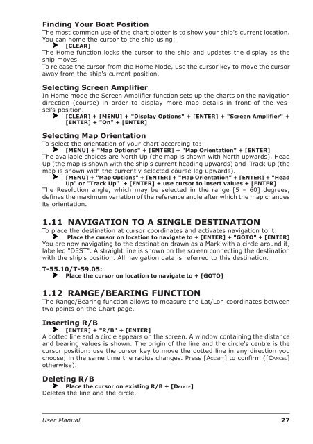
Finding Your Boat PositionThe most common use of the chart plotter is to show your ship's current location.You can home the cursor to the ship using:[CLEAR]The Home function locks the cursor to the ship and updates the display as theship moves.To release the cursor from the Home Mode, use the cursor key to move the cursoraway from the ship's current position.Selecting Screen AmplifierIn Home mode the Screen Amplifier function sets up the charts on the navigationdirection (course) in order to display more map details in front of the vessel’sposition.[CLEAR] + [MENU] + "Display Options" + [ENTER] + "Screen Amplifier" +[ENTER] + "On" + [ENTER]Selecting Map OrientationTo select the orientation of your chart according to:[MENU] + "Map Options" + [ENTER] + "Map Orientation" + [ENTER]The available choices are North Up (the map is shown with North upwards), HeadUp (the map is shown with the ship's current heading upwards) and Track Up (themap is shown with the currently selected course leg upwards).[MENU] + "Map Options" + [ENTER] + "Map Orientation" + [ENTER] + "HeadUp" or "Track Up" + [ENTER] + use cursor to insert values + [ENTER]The Resolution angle, which may be selected in the range [5 – 60] degrees,defines the maximum variation of the reference angle after which the map changesits orientation.1.11 NAVIGATION TO A SINGLE DESTINATIONTo place the destination at cursor coordinates and activates navigation to it:Place the cursor on location to navigate to + [ENTER] + "GOTO" + [ENTER]You are now navigating to the destination drawn as a Mark with a circle around it,labelled "DEST". A straight line is shown on the screen connecting the destinationwith the ship's position. All navigation data is referred to this destination.T-55.10/T-59.05:Place the cursor on location to navigate to + [GOTO]1.12 RANGE/BEARING FUNCTIONThe Range/Bearing function allows to measure the Lat/Lon coordinates betweentwo points on the Chart page.Inserting R/B[ENTER] + "R/B" + [ENTER]A dotted line and a circle appears on the screen. A window containing the distanceand bearing values is shown. The origin of the line and the circle's centre is thecursor position: use the cursor key to move the dotted line in any direction youchoose; in the same time the radius changes. Press [ACCEPT] to confirm ([CANCEL]otherwise).Deleting R/BPlace the cursor on existing R/B + [DELETE]Deletes the line and the circle.<strong>User</strong> <strong>Manual</strong>27


