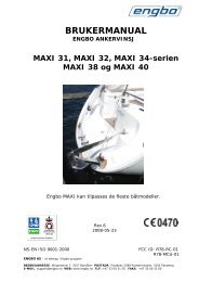

Create successful ePaper yourself
Turn your PDF publications into a flip-book with our unique Google optimized e-Paper software.
♦♦♦♦♦♦♦♦♦♦♦♦♦♦(Course Over Ground) and its length is proportional to the SOG (Speed OverGround).CTS = Course To SteerOptimum direction the boat should be steered in order to efficiently makeheadway back to the courseline while also proceeding toward the destinationWaypoint.Cultural FeaturesAny man-made topographic feature as built-up area, buildings, roads.DatumThe Latitude and Longitude lines printed on any map are based on certainmodels of the shape of the earth: these models are called Datum or CoordinateSystems. There are many different Datum in use, each one gives differentLat/Lon positions for an identical point on the surface of the earth (seealso Map Datum and Fix Datum).Dead ReckoningProcedure to determine the current position of a vessel by applying to the lastknown position the way that has been made (since the last known positionwas received). This procedure is normally based on the last received GPSposition, Speed and Course or to the last received GPS position, Log Speedand Heading.DefaultOriginal factory setting for any menu selection. The default values are setafter a Master Reset (RAM Clear).Depth AreaSea areas included in the user selectable range of minimum and maximumdepth limits. The sea area that is beyond the selected range is filled by anuniform white color, the sea area that is inside the selected range is filled byordinary multicolor shading. The Spot Soundings and Depth Contours are displayedon the range only.Depth Line(Also called Bathymetric Line) Imaginary line connecting points of equal waterdepth.DestinationIn order to tag on the chart the point, towards which the ship is Heading, youcan use a special mark, called destination. When the destination is placed, allnavigation data referred to this point.DGPS = Differential GPSProvides even greater positioning accuracy than standard GPS.DPT = Depth from TransducerWater Depth below the Transducer. The Distance from the Depth Transducer tothe ground.DST = DistanceGeographical distance between two points on the map. It is possible to selectthe unit among Nm, Sm and Km.ETA = Estimated Time of ArrivalPredicted time of reaching a destination or WaypointFileCollection of information (of the same type) stored on a USER MEDIA. Eachfile must have a unique name, ideally one that describes its contents. Filenamesare kept in a directory on each USER MEDIA.FixCurrent position of the vessel provided by the GPS (connected to the chartplotter or built-in) or other positioning systems.90 <strong>User</strong> <strong>Manual</strong>