
You also want an ePaper? Increase the reach of your titles
YUMPU automatically turns print PDFs into web optimized ePapers that Google loves.
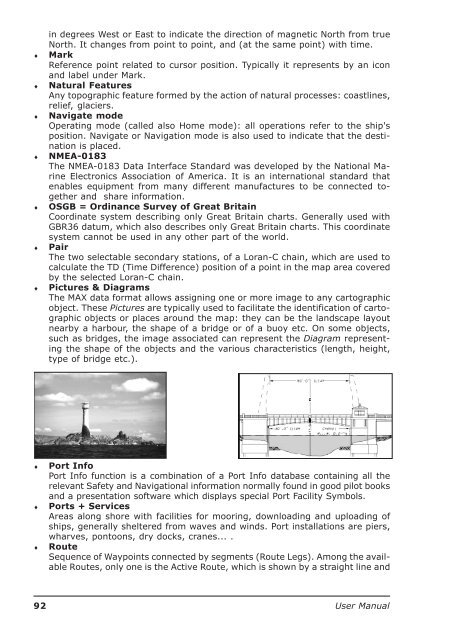
♦♦♦♦♦♦♦in degrees West or East to indicate the direction of magnetic North from trueNorth. It changes from point to point, and (at the same point) with time.MarkReference point related to cursor position. Typically it represents by an iconand label under Mark.Natural FeaturesAny topographic feature formed by the action of natural processes: coastlines,relief, glaciers.Navigate modeOperating mode (called also Home mode): all operations refer to the ship'sposition. Navigate or Navigation mode is also used to indicate that the destinationis placed.NMEA-0183The NMEA-0183 Data Interface Standard was developed by the National MarineElectronics Association of America. It is an international standard thatenables equipment from many different manufactures to be connected togetherand share information.OSGB = Ordinance Survey of Great BritainCoordinate system describing only Great Britain charts. Generally used withGBR36 datum, which also describes only Great Britain charts. This coordinatesystem cannot be used in any other part of the world.PairThe two selectable secondary stations, of a Loran-C chain, which are used tocalculate the TD (Time Difference) position of a point in the map area coveredby the selected Loran-C chain.Pictures & DiagramsThe MAX data format allows assigning one or more image to any cartographicobject. These Pictures are typically used to facilitate the identification of cartographicobjects or places around the map: they can be the landscape layoutnearby a harbour, the shape of a bridge or of a buoy etc. On some objects,such as bridges, the image associated can represent the Diagram representingthe shape of the objects and the various characteristics (length, height,type of bridge etc.).♦♦♦Port InfoPort Info function is a combination of a Port Info database containing all therelevant Safety and Navigational information normally found in good pilot booksand a presentation software which displays special Port Facility Symbols.Ports + ServicesAreas along shore with facilities for mooring, downloading and uploading ofships, generally sheltered from waves and winds. Port installations are piers,wharves, pontoons, dry docks, cranes... .RouteSequence of Waypoints connected by segments (Route Legs). Among the availableRoutes, only one is the Active Route, which is shown by a straight line and92 <strong>User</strong> <strong>Manual</strong>