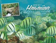
Hawaii FEP - Western Pacific Fishery Council
Hawaii FEP - Western Pacific Fishery Council
Hawaii FEP - Western Pacific Fishery Council

You also want an ePaper? Increase the reach of your titles
YUMPU automatically turns print PDFs into web optimized ePapers that Google loves.
(~436 square miles) and Savai`i (~660 square miles). Upolu and Savai`i and its surroundingislets and small islands are governed by the Independent State of Samoa with a population ofapproximately 178,000 people. Tutuila (~55 square miles), the Manua Islands (a group of threevolcanic islands with a total land area of less than 20 square miles), and two coral atolls (RoseAtoll and Swains Island) are governed by the U.S. Territory of American Samoa. More than 90percent of American Samoa’s population (~68,000 people) live on Tutuila. The total land massof American Samoa is about 200 square kilometers, surrounded by an EEZ of approximately390,000 square kilometers.Approximately 600 miles northwest of the Samoa Islands is Tuvalu (~10 square miles), anindependent nation made up of nine low-lying coral atolls. None of the islands have elevationhigher than 14 feet, and the total population of the country is around 11,000 people. Tuvalu’scoral island chain extends for nearly 360 miles, and the country has an EEZ of 350,000 squaremiles.East of Tuvalu and north of Samoa are the Tokelau Islands (~4 square miles). Three coral atollsmake up this territory of New Zealand, and a fourth atoll (Swains Island) is of the same group,but is controlled by the U.S Territory of American Samoa.To the east of the Samoa archipelago are the Cook Islands (~90 square miles), which areseparated into the Northern Group and Southern Group. The Northern Group consists of sixsparsely populated coral atolls, and the Southern Group consists of seven volcanic islands andtwo coral atolls. Rorotonga (~26 square miles), located in the Southern Group, is the largestisland in the Cook Islands and also serves as the capitol of this independent island nation. Fromnorth to south, the Cook Islands spread nearly 900 miles, and the width between the most distantislands is nearly 450 miles. The Cook Islands EEZ is approximately 850,000 square miles.The 32 volcanic islands and 180 coral atolls of the Territory of French Polynesia (~ 1,622 squaremiles) are made up of the following six groups: the Austral Islands, Bass Islands, GambierIslands, Marquesas Islands, Society Islands, and the Tuamotu Islands. The Austral Islands are agroup of six volcanic islands in the southern portion of the territory. The Bass Islands are a groupof two islands in the southern-most part of the territory, with their vulcanism appearing to bemuch more recent than that of the Austral Islands. The Gambier Islands are a small group ofvolcanic islands in a southeastern portion of the Territory and are often associated with theTuamotu Islands because of their relative proximity; however, they are a distinct group becausethey are of volcanic origin rather than being coral atolls. The Tuamotu Islands, of which there are78, are located in the central portion of the Territory and are the world’s largest chain of coralatolls. The Society Islands are group of several volcanic islands that include the island of Tahiti.The island of Tahiti is home to nearly 70 percent of French Polynesia’s population ofapproximately 170,000 people. The Marquesa Islands are an isolated group of islands located inthe northeast portion of the territory, and are approximately 1,000 miles northeast of Tahiti. Allbut one of the 17 Marquesas Islands are volcanic in origin. French Polynesia has one of thelargest EEZs in the <strong>Pacific</strong> Ocean at nearly two million square miles.The Pitcairn Islands are a group of five islands thought to be an extension of the Tuamotuarchipelago. Pitcairn Island is the only volcanic island, with the others being coral atolls or48