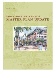
Master Plan Development - City of Boca Raton
Master Plan Development - City of Boca Raton
Master Plan Development - City of Boca Raton

You also want an ePaper? Increase the reach of your titles
YUMPU automatically turns print PDFs into web optimized ePapers that Google loves.
<strong>City</strong> <strong>of</strong> <strong>Boca</strong> <strong>Raton</strong> Stormwater Management <strong>Master</strong> <strong>Plan</strong>Inventory <strong>of</strong> Stormwater System2. Inventory <strong>of</strong> Stormwater SystemAs outlined in the Scope <strong>of</strong> Services, an inventory <strong>of</strong> the <strong>City</strong>’s stormwater management systemwas completed. In order to compile relevant information, several sources were researched.Below is a summary <strong>of</strong> the inventory effort.A. SFWMD Permit InformationTo begin the research on the areas within the <strong>City</strong> that are permitted by SFWMD, GIS coveragesand/or shapefiles <strong>of</strong> the Surface Water Management and Environmental Resource Permits weredownloaded from the SFWMD website (http://spatial1.sfwmd.gov/sfwmdxwebdc/dataview.asp).Figure 2 depicts the areas <strong>of</strong> the <strong>City</strong> for which SFWMD permits have been issued as <strong>of</strong> the May23, 2007 download date. Approximately forty-seven percent <strong>of</strong> the land area in the <strong>City</strong> ispermitted with SFWMD. Other areas <strong>of</strong> the <strong>City</strong> were developed prior to the permittingrequirement.Additional data fields were added to the downloaded database associated with the permitshapefile and populated with information available from SFWMD permit records.Permit file review included research at SFWMD Headquarters in West Palm Beach, as well ason-line at the SFWMD website. The permit files contain all the modification applications, inaddition to the original permit. Modifications to a permit may cover the same, overlapping, orcompletely new geographic areas as the original permit. Subsequent applications may modify thevalues in the original permit by: extending or reducing the project area; raising or lowering theminimum finished floor, minimum roadway, and control elevations; and/or creating, removing ormodifying connections, control structures, points <strong>of</strong> discharge and receiving waters. Somepermits include more than 50 modifications. Extracting accurate representative information fromthese files was time-consuming. In some cases, where information was not found, assumptionswere made, and this is noted in the “notes” field <strong>of</strong> the database.The records researched include several types <strong>of</strong> documentation in addition to the actual permits,including but not limited to:Staff ReportsPermit SummariesConstruction Completion CertificationsRecord DrawingsReviewer CommentsPermit ApplicationsDesign CalculationsDesign DrawingsCorrespondence between permittee and SFWMDNotices <strong>of</strong> NoncomplianceL/bocaswmp/a6016.01/InterimReport 11-27-07/r02Page 5MOCK•ROOS