- Page 3 and 4:
INSTITUTUL DE STUDII SUD-EST EUROPE
- Page 5 and 6:
NOTA EDITORULUIVolumul III al lucr
- Page 7:
MĂRTURII ROMÂNEŞTI PESTE HOTARE
- Page 10 and 11:
X VIRGIL CÂNDEA(Jordan, Lebanon,
- Page 13 and 14:
ABREVIERIA. Cărţi, articole, cole
- Page 15 and 16:
MĂRTURII ROMÂNEŞTI PESTE HOTARE
- Page 17 and 18:
MĂRTURII ROMÂNEŞTI PESTE HOTARE
- Page 19 and 20:
MĂRTURII ROMÂNEŞTI PESTE HOTARE
- Page 21 and 22:
MĂRTURII ROMÂNEŞTI PESTE HOTARE
- Page 23 and 24:
MĂRTURII ROMÂNEŞTI PESTE HOTARE
- Page 25 and 26:
MĂRTURII ROMÂNEŞTI PESTE HOTARE
- Page 27:
MĂRTURII ROMÂNEŞTI PESTE HOTARE
- Page 30 and 31:
2 IORDANIAIORDANIAAL-KERAKAM1 - Ş
- Page 32 and 33:
4 ISRAELISRAEL 1BETHLEHEM 2 (ar. B
- Page 34 and 35:
6 ISRAELmanuscrise, afişe, foi vo
- Page 36 and 37:
8 ISRAELBEIT HASFARIM HALEUMI VE H
- Page 38 and 39:
10 ISRAELMUZ28 - Documente şi pie
- Page 42:
14 ISRAELdin Iaşi. Traducere în
- Page 45 and 46:
ISRAEL 17Reprod.: Beza, Urme, p. 3
- Page 47 and 48:
ISRAEL 1997 - Poruncă, din 12 mai
- Page 49 and 50:
ISRAEL 21partea lor din moşia Bă
- Page 51 and 52:
ISRAEL 23astfel dispoziţiile otom
- Page 53 and 54:
ISRAEL 25154 - Katagrafī tōn kon
- Page 55 and 56:
ISRAEL 27Makariōtatou īmōn desp
- Page 58 and 59:
30 ISRAELMS190 - Psaltire, sec. XI
- Page 60 and 61:
32 ISRAELReprod.: Beza, Urme, p. 1
- Page 62 and 63:
34 ISRAEL1933, p. 296-297); Beza,
- Page 64 and 65:
36 ISRAEL(datat greşit: 1643); Po
- Page 66 and 67:
38 ISRAEL231 - Miscelaneu, s.l., s
- Page 68 and 69:
40 ISRAEL246 - Miscelaneu, s.l., 1
- Page 70 and 71:
42 ISRAELînsemnare din aprilie 18
- Page 72 and 73:
44 ISRAELRef.: Beza, Urme, p. 193.
- Page 74 and 75:
46 ISRAELMĀR SĀBĀMONĪ AGIOU SA
- Page 76 and 77:
48 ISRAELRef.: Nicolae Timuş, Sta
- Page 78 and 79:
50 ISRAELafişe, foi volante, foto
- Page 80 and 81:
52 ITALIAinformaţii referitoare l
- Page 82 and 83:
54 ITALIAdin Viena, asupra Imperiu
- Page 84 and 85:
56 ITALIA31 - Luigi Ferdinando Mar
- Page 86 and 87:
58 ITALIAp. 226); Antonio Rusconi,
- Page 88 and 89:
60 ITALIAFERRARABIBLIOTECA COMUNAL
- Page 90:
62 ITALIAcommisaria, Reg. nr.4, f.
- Page 93 and 94:
ITALIA 65Ref. şi publ.: Veress, D
- Page 95 and 96:
ITALIA 67104 - Raport din Constant
- Page 97 and 98:
ITALIA 69120 - G. Russo, [Hartă n
- Page 99 and 100:
ITALIA 71138 - Giovanni Martines d
- Page 101 and 102:
ITALIA 73153 - Angelo da Marsiglia
- Page 103 and 104:
ITALIA 75SOCIETÀ COLOMBARIAH167 -
- Page 105 and 106:
ITALIA 77176 - Document din 18 feb
- Page 107 and 108:
ITALIA 79190 - Giovanni Battista C
- Page 109 and 110:
ITALIA 81201 - Anonim grec, Atlant
- Page 111 and 112:
ITALIA 83212 - Documente (9), dat
- Page 113 and 114:
ITALIA 85în Moldova (1576), acţi
- Page 115 and 116:
ITALIA 87circa 1588, cu informaţi
- Page 117 and 118:
ITALIA 89H253 - Francesco Pizigani
- Page 119 and 120:
ITALIA 91Românească, intervenţi
- Page 121 and 122:
ITALIA 93MONTECORVINO ROVELLAAM283
- Page 123 and 124:
ITALIA 95295 - Scrisori italiene (
- Page 125 and 126:
ITALIA 97Ref.: Dumitru Zaharia, Ce
- Page 127 and 128:
ITALIA 99325 - Notizia generale de
- Page 129 and 130:
ITALIA 101Hertelius din Transilvan
- Page 131 and 132:
ITALIA 103351 - Hrisant Notara, Om
- Page 133 and 134:
ITALIA 105PALERMOARCHIVIO DI STATO
- Page 135 and 136:
ITALIA 107LOCANDA „ALLA TRINACRI
- Page 137 and 138:
ITALIA 109Ref.: Szögi Laszló, St
- Page 139 and 140:
ITALIA 111Ref. şi publ.: G. Bavin
- Page 141 and 142:
ITALIA 113ARCHIVIO CAETANIDOC406 -
- Page 145 and 146:
ITALIA 117429 - Catehism, 1719, al
- Page 147 and 148:
ITALIA 119440 - Rapoarte diplomati
- Page 149 and 150:
ITALIA 121Battori Prencipe di Tran
- Page 151 and 152:
ITALIA 123BIBLIOTECA BORGHESEDOC47
- Page 153 and 154:
ITALIA 125490 - Nicolae Mavrocorda
- Page 155 and 156:
ITALIA 127Publ.: N. Buta, I Paesi
- Page 157 and 158:
ITALIA 129519 - Ioannis Lucii Dalm
- Page 159 and 160:
ITALIA 131536 - Avvisi nuovi di Vi
- Page 161 and 162:
ITALIA 133MS553 - [Neagoe Basarab,
- Page 163 and 164:
ITALIA 135571 - Avviso della gran
- Page 165 and 166:
ITALIA 137CHIESA SANTO STEFANO ROT
- Page 167 and 168:
ITALIA 1391848-1877, Buc., 1930, p
- Page 169 and 170:
ITALIA 141611 - Diplomă militară
- Page 171 and 172:
ITALIA 143Ferigo, ataşat militar
- Page 173 and 174:
ITALIA 145s.l., 1678, menţionând
- Page 175 and 176:
ITALIA 147Ref.: D. Bodin, I consol
- Page 177 and 178:
ITALIA 149CR658 - Gazzetta Piemont
- Page 179 and 180:
ITALIA 151Ref.: A. Sacerdoţeanu,
- Page 181 and 182:
ITALIA 153Ref.: Legrand, XVIII/2,
- Page 183 and 184:
ITALIA 155trimis din Cerneţi de c
- Page 185 and 186:
ITALIA 157Românească a lui Musta
- Page 187 and 188:
ITALIA 159domnilor din Ţara Româ
- Page 189 and 190:
ITALIA 161730 - Scrisori (2) din C
- Page 191 and 192:
ITALIA 163Ştefan Tomşa, Gaspar G
- Page 193 and 194:
ITALIA 165reg. III, f. 52 v -53 r
- Page 195 and 196:
ITALIA 167otomane în 1595 (ASV, M
- Page 197 and 198:
ITALIA 169Ref. şi publ.: Fl. Ciur
- Page 199 and 200:
ITALIA 171790 - Document, din 1648
- Page 201 and 202:
ITALIA 173803 - Documente greceşt
- Page 203 and 204:
ITALIA 175817 - Document din 1711
- Page 205 and 206:
ITALIA 177universelle dans l’his
- Page 207 and 208:
ITALIA 179BIBLIOTECA DELLA CONGREG
- Page 209 and 210:
ITALIA 181Ştefan cel Mare, docume
- Page 211 and 212:
ITALIA 18388, 411, 432; Delib. sen
- Page 213 and 214:
ITALIA 185Ref. şi publ.: Nagy Iv
- Page 215 and 216:
ITALIA 187903 - Descriere, sec. XV
- Page 217 and 218:
ITALIA 189921 - Maiolino Bisaccion
- Page 219 and 220:
ITALIA 191940 - Petru Movilă, Ort
- Page 221 and 222:
ITALIA 193cultură renăscut - Pal
- Page 223 and 224:
ITALIA 195CR970 - Ī perigrafī t
- Page 225 and 226:
ITALIA 197Ref.: N. Iorga, Foaia de
- Page 227 and 228:
ITALIA 199PALAZZO CHIERICATIA994 -
- Page 229 and 230:
LETONIA 201LETONIARIGALATVIJAS ZIN
- Page 231 and 232:
LIBAN 2031949, p. 46; I. Feodorov,
- Page 233 and 234:
LIBAN 205Edition and Translation o
- Page 235 and 236:
LIBAN 207de l’oeuvre de Dimitrie
- Page 237 and 238:
LIBAN 209ZAHLEBIBLIOTECA ĪSĀ ISK
- Page 239 and 240:
LITUANIA 2115 - Syl’vestr Kosov,
- Page 241 and 242:
LUXEMBURG 2137 - Rapoarte diplomat
- Page 243 and 244:
MACEDONIA 215MACEDONIABITOLA (Bito
- Page 245 and 246:
MACEDONIA 217BJELO POLJECRKVA NIKO
- Page 247 and 248:
MACEDONIA 219Ref.: Cordescu, Istor
- Page 249 and 250:
MACEDONIA 22137 - Cimitir românes
- Page 251 and 252:
MACEDONIA 223CRKVA SV. KLIMENT(Bis
- Page 253 and 254:
MACEDONIA 22559 - Hărţi ale Unga
- Page 255 and 256:
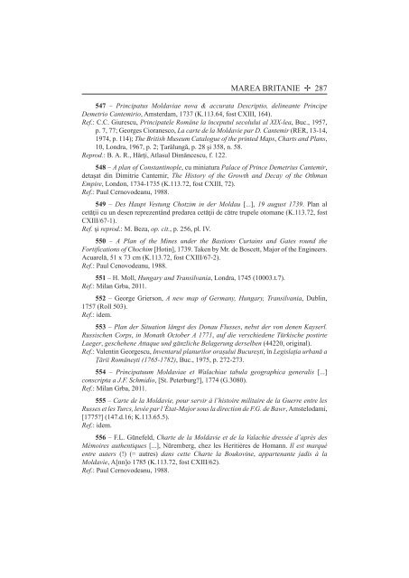
MAREA BRITANIE 227MAREA BRITANIEAL
- Page 257 and 258:
MAREA BRITANIE 229Copie. 29 p. Cup
- Page 259 and 260:
MAREA BRITANIE 23121 - Însemnări
- Page 261 and 262:
MAREA BRITANIE 233Istituto d’arc
- Page 263 and 264: MAREA BRITANIE 235ROYAL MUSEUM OF
- Page 265 and 266: MAREA BRITANIE 237tribun al cohort
- Page 267 and 268: MAREA BRITANIE 239War (ibidem, 46,
- Page 269 and 270: MAREA BRITANIE 241şi Moldova, pol
- Page 271 and 272: MAREA BRITANIE 243the Elder, Septe
- Page 273 and 274: MAREA BRITANIE 245108 - Raport din
- Page 275 and 276: MAREA BRITANIE 247Mihail Sturdza
- Page 277 and 278: MAREA BRITANIE 249şi date despre
- Page 279 and 280: MAREA BRITANIE 251Reprod.: B. A. R
- Page 281 and 282: MAREA BRITANIE 253153 - Sir Willia
- Page 283 and 284: MAREA BRITANIE 255după o versiune
- Page 285 and 286: MAREA BRITANIE 257Ferrara, 1595, i
- Page 287 and 288: MAREA BRITANIE 259Ref.: Legrand, X
- Page 289 and 290: MAREA BRITANIE 261Proche Orient (R
- Page 291 and 292: MAREA BRITANIE 263and Provinces ad
- Page 293 and 294: MAREA BRITANIE 265267 - Dimitrie C
- Page 295 and 296: MAREA BRITANIE 267289 - Scriptores
- Page 297 and 298: MAREA BRITANIE 269314 - Charles Pe
- Page 299 and 300: MAREA BRITANIE 271338 - J.A. Vaill
- Page 301 and 302: MAREA BRITANIE 273363 - Baron Gyö
- Page 303 and 304: MAREA BRITANIE 275391 - O povestir
- Page 305 and 306: 416 - Quelques mots sur la Valachie
- Page 307 and 308: MAREA BRITANIE 279441 - Dionusios
- Page 309 and 310: MAREA BRITANIE 281468 - Note sur l
- Page 311 and 312: MAREA BRITANIE 283494 - Eugen Cara
- Page 313: MAREA BRITANIE 285519 - Alvise Cex
- Page 317 and 318: MAREA BRITANIE 289565 - Pridianum
- Page 319 and 320: MAREA BRITANIE 291COLECŢIA BRIGAD
- Page 321 and 322: MAREA BRITANIE 293generalii Prezan
- Page 323 and 324: MAREA BRITANIE 295principele Trans
- Page 325 and 326: MAREA BRITANIE 297arhivele engleze
- Page 327 and 328: MAREA BRITANIE 299617 - Rapoarte d
- Page 329 and 330: MAREA BRITANIE 301628 - Rapoarte d
- Page 331 and 332: MAREA BRITANIE 303and Sanitary Sit
- Page 333 and 334: MAREA BRITANIE 305Bretagne dans le
- Page 335 and 336: MAREA BRITANIE 307Ionel Gal, Infor
- Page 337 and 338: MAREA BRITANIE 309izvoarele docume
- Page 339 and 340: MAREA BRITANIE 311din Transilvania
- Page 341 and 342: MAREA BRITANIE 313Publ.: Vasile Ar
- Page 343 and 344: MAREA BRITANIE 315Microfilms); M.
- Page 345 and 346: MAREA BRITANIE 317706 - Telegramă
- Page 347 and 348: MAREA BRITANIE 319cronică tratân
- Page 349 and 350: MAREA BRITANIE 321MS731 - Jurnalul
- Page 351 and 352: MAREA BRITANIE 323Jérémie en rou
- Page 353 and 354: MAREA BRITANIE 325viu, Buc., 1963,
- Page 355 and 356: MAREA BRITANIE 327786 - Scrisori (
- Page 357 and 358: MAREA BRITANIE 329Ref.: Ran Aarons
- Page 359 and 360: MAREA BRITANIE 331autobiografice f
- Page 361 and 362: MAREA BRITANIE 333818 - Memed bin
- Page 363 and 364: MAREA BRITANIE 335Publ.: E.D. Tapp
- Page 365 and 366:
MAREA BRITANIE 337849 - Scrisoare
- Page 367 and 368:
MAREA BRITANIE 339villes, por[t]s
- Page 369 and 370:
MAREA BRITANIE 341876 - Elia ben E
- Page 371 and 372:
MAREA BRITANIE 343Publ.: E.D. Tapp
- Page 373 and 374:
MAREA BRITANIE 345RICHMOND(Surrey)
- Page 375 and 376:
MEXIC 347MEXICCIUDAD DE MEXICOMUSE
- Page 377 and 378:
MUNTENEGRU 349MUNTENEGRUBOKA KOTOR
- Page 379 and 380:
MUNTENEGRU 351Ref.: B. Radojković
- Page 381 and 382:
NORVEGIA 353NORVEGIABERGENCOLECŢI
- Page 383 and 384:
NORVEGIA 355„Fulgerul” (de fap
- Page 385 and 386:
NOUA ZEELANDĂ 357NOUA ZEELANDĂWE
- Page 387 and 388:
OLANDA 359Ref.: Wim P. van Meurs,
- Page 389 and 390:
OLANDA 361de principele Transilvan
- Page 391 and 392:
OLANDA 363Ref. şi reprod.: The Ne
- Page 393 and 394:
OLANDA 365Ref.: Eugen Glück, Cât
- Page 395 and 396:
OLANDA 367Porţii şi Costache Car
- Page 397 and 398:
OLANDA 369„de la începutul lumi
- Page 399:
OLANDA 371UTRECHTUNIVERSITEITSBIBL
- Page 402 and 403:
374 VIRGIL CÂNDEAItalia 51Alessan
- Page 404 and 405:
376 VIRGIL CÂNDEAMacedonia 215Bit
- Page 406:
378 VIRGIL CÂNDEATrondheim 356Vad


