- Page 2:
e-copy fey Aft
- Page 6:
PLATE I. Precipice of Purbeckian an
- Page 10:
FIRST PUBLISHED . . APRIL I PRINTED
- Page 14:
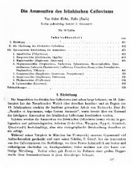
PREFACE The comprehensive Treatise
- Page 18:
PREFACE Nepal (Spiti Shales). While
- Page 22:
CONTENTS PREFACE . . . . . . . . .
- Page 26:
LIST OF PLATES PLATE FACING PAGE I.
- Page 30:
LIST OF TABLES TABLE PAGE 1. Standa
- Page 34:
PART I INTRODUCTION http://jurassic
- Page 38:
CHAPTER I CLASSIFICATION AND CORREL
- Page 42:
CLASSIFICATION AND CORRELATION 5 fr
- Page 46:
CLASSIFICATION AND CORRELATION 7 co
- Page 50:
CLASSIFICATION AND CORRELATION INTE
- Page 54:
LOWER JURASSIC— CLASSIFICATION AN
- Page 58:
CLASSIFICATION AND CORRELATION J 3
- Page 62:
PART II WESTERN AND SOUTHERN EUROPE
- Page 66:
CHAPTER 2 THE BRITISH ISLES The Bri
- Page 70:
THE BRITISH ISLES 19 PURBECKIAN (Pu
- Page 74:
PLATE za.—Portland Stone cliffs a
- Page 78:
THE BRITISH ISLES 21 at the base of
- Page 82:
THE BRITISH ISLES 23 Stanton fauna)
- Page 86:
THE BRITISH ISLES 2$ and that of th
- Page 90:
THE BRITISH ISLES 27 by clay, and i
- Page 94:
OOLITE) CLAY AND MARL COM PACT MUOS
- Page 98:
THE BRITISH ISLES 31 BAJOCIAN (Infe
- Page 102:
THE BRITISH ISLES 33 Zone of Stepha
- Page 106:
THE BRITISH ISLES 35 TOARCIAN (Uppe
- Page 110:
THE BRITISH ISLES 37 unconformity w
- Page 114:
CHAPTER 3 THE PARIS BASIN AND BORDE
- Page 118:
THE BOULONNAIS 41 the thickness of
- Page 122:
THE BOULONNAIS 43 de Lor., P. chlor
- Page 126:
NORMANDY AND SARTHE 45 A conspectus
- Page 130:
NORMANDY AND SARTHE 47 Cardiocerati
- Page 134:
LOWER BATHONIAN (up to c. 60 m.) NO
- Page 138:
NORMANDY AND SARTHE 51 lower with H
- Page 142:
SOUTH-WEST OF THE PARIS BASIN 53 an
- Page 146:
EAST OF THE PARIS BASIN 55 collecti
- Page 150:
MIDDLE KIMERIDGIAN (60-70 m.) EAST
- Page 154:
EAST OF THE PARIS BASIN Since most
- Page 158:
EAST OF THE PARIS BASIN 61 that in
- Page 162:
EAST OF THE PARIS BASIN 63 Zone, in
- Page 166:
EAST OF THE PARIS BASIN 65 recogniz
- Page 170:
EAST OF THE PARIS BASIN 6 7 known a
- Page 174:
BORDERS OF THE MASSIF CENTRAL 6 9 E
- Page 178:
PLATE 46.—The Chateau de Crussol
- Page 182:
[BERRIASIAN (LOWER CRETACEOUS) BORD
- Page 186:
BORDERS OF THE MASSIF CENTRAL 73 MI
- Page 190:
BORDERS OF THE MASSIF CENTRAL 75 of
- Page 194:
BORDERS OF THE MASSIF CENTRAL 77 pa
- Page 198:
BORDERS OF THE MASSIF CENTRAL 79 Th
- Page 202:
THE JURA MOUNTAINS 8l of ruckles wa
- Page 206:
THE JURA MOUNTAINS miles, while the
- Page 210:
Photos W.J. A. PLATE 50.—Mont Sal
- Page 214:
THE JURA MOUNTAINS THE SOUTHERLY AN
- Page 218:
THE JURA MOUNTAINS 8 7 1939, p. 263
- Page 222:
THE JURA MOUNTAINS 8 9 on the range
- Page 226:
Stages BERRIASIAN ARDESCIAN or PURB
- Page 230:
Stages and Zones now adopted LOWER
- Page 234:
THE JURA MOUNTAINS 95 Geissberg Bed
- Page 238:
THE JURA MOUNTAINS Paris basin. The
- Page 242:
THE JURA MOUNTAINS 99 These ammonit
- Page 246:
BATHONIAN— TABLE 7.—THE BATHONI
- Page 250:
THE JURA MOUNTAINS the lower part o
- Page 254:
CHAPTER 5 WESTERN GERMANY THE SWABI
- Page 258:
SWABIAN AND FRANCONIAN ALB IO7 gene
- Page 262: Photo through the kirdress of Er. H
- Page 266: SWABIAN AND FRANCONIAN ALB with man
- Page 270: TABLE 9.—THE KIMERIDGIAN OF THE S
- Page 274: SWABIAN AND FRANCONIAN ALB 113 Subz
- Page 278: SWABIAN AND FRANCONIAN ALB 115 The
- Page 282: SWABIAN AND FRANCONIAN ALB 117 Amoe
- Page 286: SWABIAN AND FRANCONIAN ALB 119 The
- Page 290: SWABIAN AND FRANCONIAN ALB 121 corr
- Page 294: Oppelia aspidoides Zigzagiceras zig
- Page 298: SWABIAN AND FRANCONIAN ALB (figures
- Page 302: LOWER TOARCIAN (C. 4-12-5 m.) SWABI
- Page 306: SWABIAN AND FRANCONIAN ALB 129 by H
- Page 310: LOWER SAXONY farther south and east
- Page 316: !34 WESTERN GERMANY form elongated
- Page 320: 136 WESTERN GERMANY their limitatio
- Page 324: 138 WESTERN GERMANY coralline oolit
- Page 328: 140 WESTERN GERMANY at Porta Westfa
- Page 332: 142 WESTERN GERMANY P. neuffensis (
- Page 336: 144 WESTERN GERMANY Zone of Ludwigi
- Page 340: CHAPTER 6 THE ALPS AND NORTHERN CAR
- Page 344: 148 THE ALPS AND NORTHERN CARPATHIA
- Page 348: 150 THE ALPS AND NORTHERN CARPATHIA
- Page 352: 152 THE ALPS AND NORTHERN CARPATHIA
- Page 356: 154 THE ALPS AND NORTHERN CARPATHIA
- Page 360: THE ALPS AND NORTHERN CARPATHIANS P
- Page 364:
158 THE ALPS AND NORTHERN CARPATHIA
- Page 368:
i6o THE ALPS AND NORTHERN CARPATHIA
- Page 372:
THE ALPS AND NORTHERN CARPATHIANS I
- Page 376:
http://jurassic.ru/
- Page 380:
164 THE ALPS AND NORTHERN CARPATHIA
- Page 384:
i66 THE ALPS AND NORTHERN CARPATHIA
- Page 388:
i68 THE ALPS AND NORTHERN CARPATHIA
- Page 392:
THE ALPS AND NORTHERN CARPATHIANS T
- Page 396:
172 THE ALPS AND NORTHERN CARPATHIA
- Page 400:
174 THE ALPS AND NORTHERN CARPATHIA
- Page 404:
176 THE ALPS AND NORTHERN CARPATHIA
- Page 408:
i 78 THE ALPS AND NORTHERN CARPATHI
- Page 412:
FIG. I 8.—Jurassic outcrops of th
- Page 416:
l82 THE BALKAN PENINSULA The lower
- Page 420:
i8 4 THE BALKAN PENINSULA From Moun
- Page 424:
i86 THE BALKAN PENINSULA Numerous d
- Page 428:
i88 THE BALKAN PENINSULA DOBROGEA M
- Page 432:
190 THE BALKAN PENINSULA Aulacosphi
- Page 436:
THE BALKAN PENINSULA Greece suggest
- Page 440:
i94 THE BALKAN PENINSULA flysch, wh
- Page 444:
196 THE BALKAN PENINSULA (Renz, 191
- Page 448:
198 THE BALKAN PENINSULA bronni sha
- Page 452:
200 ITALY AND CORSICA The supposed
- Page 456:
202 ITALY AND CORSICA in the west e
- Page 460:
204 ITALY AND CORSICA Middle Jurass
- Page 464:
206 ITALY AND CORSICA fossil in col
- Page 468:
208 ITALY AND CORSICA BATHONIAN Acc
- Page 472:
2 10 ITALY AND CORSICA figured in a
- Page 476:
212 ITALY AND CORSICA Calabria and
- Page 480:
214 ITALY AND CORSICA Staub, in a c
- Page 484:
2l6 ITALY AND CORSICA The Aptychus
- Page 488:
2l8 ITALY AND CORSICA undoubted Low
- Page 492:
CHAPTER 9 THE IBERIAN PENINSULA AND
- Page 496:
222 THE IBERIAN PENINSULA flank (Ar
- Page 500:
224 THE IBERIAN PENINSULA ib. Beds
- Page 504:
226 THE IBERIAN PENINSULA that over
- Page 508:
228 THE IBERIAN PENINSULA judging b
- Page 512:
23° THE IBERIAN PENINSULA P. tarra
- Page 516:
232 THE IBERIAN PENINSULA brachiopo
- Page 520:
234 THE IBERIAN PENINSULA (Dunker),
- Page 524:
236 THE IBERIAN PENINSULA Lower Kim
- Page 528:
2 38 THE IBERIAN PENINSULA comprise
- Page 532:
240 THE IBERIAN PENINSULA from over
- Page 536:
242 THE IBERIAN PENINSULA In Portug
- Page 540:
244 THE IBERIAN PENINSULA one unbro
- Page 544:
246 THE IBERIAN PENINSULA Blumentha
- Page 548:
http://jurassic.ru/
- Page 552:
248 THE IBERIAN PENINSULA present,
- Page 556:
250 THE IBERIAN PENINSULA 1933). Fr
- Page 560:
http://jurassic.ru/
- Page 564:
http://jurassic.ru/
- Page 568:
256 NORTH AFRICA gently tilted over
- Page 572:
258 NORTH AFRICA and although movem
- Page 576:
260 NORTH AFRICA foreshadowed the T
- Page 580:
262 NORTH AFRICA Tertiary, with sum
- Page 584:
264 NORTH AFRICA dominant ammonites
- Page 588:
266 NORTH AFRICA practically devoid
- Page 592:
268 NORTH AFRICA TITHONIAN Red and
- Page 596:
270 NORTH AFRICA HETTANGIAN No ammo
- Page 600:
Photo W.J. A. PLATE 12.—Collectin
- Page 604:
272 NORTH AFRICA of regional monogr
- Page 608:
274 NORTH AFRICA is thickly develop
- Page 612:
276 NORTH AFRICA MIDDLE CALLOVIAN R
- Page 616:
278 NORTH AFRICA UPPER BAJOCIAN In
- Page 620:
28o NORTH AFRICA ? SINEMURIAN AND ?
- Page 624:
282 NORTH AFRICA to western Algeria
- Page 628:
CHAPTER II THE MIDDLE EAST THE FRIN
- Page 632:
286 THE MIDDLE EAST date (Seward, 1
- Page 636:
PLATE 14.—Dark Bathonian beds cro
- Page 640:
288 THE MIDDLE EAST English Forest
- Page 644:
290 THE MIDDLE EAST The structure o
- Page 648:
292 THE MIDDLE EAST PALESTINE AND T
- Page 652:
2Q4 T H E MIDDLE EAST (1905), which
- Page 656:
Photo C. I.. Dubertret PLATE 16.—
- Page 660:
296 THE MIDDLE EAST hopkinsi McCoy,
- Page 664:
298 THE MIDDLE EAST interest in the
- Page 668:
PLATE I8
- Page 672:
3°° THE MIDDLE EAST UPPER BAJOCIA
- Page 676:
3° 2 THE MIDDLE EAST Makalla Near
- Page 680:
3°4 EAST AFRICA main central outcr
- Page 684:
3°6 EAST AFRICA BATHONIAN AND CALL
- Page 688:
3o8 EAST AFRICA imperceptible grada
- Page 692:
TITHONIAN AND UPPER KIMERIDGIAN BRI
- Page 696:
312 EAST AFRICA prohexagonum Spath
- Page 700:
3*4 EAST AFRICA parts of this area.
- Page 704:
316 EAST AFRICA 1914, pi. iii, fig.
- Page 708:
3i8 EAST AFRICA Am.Engl. Corallian
- Page 712:
320 EAST AFRICA middle part, and re
- Page 716:
322 EAST AFRICA Posidonia alpina (=
- Page 720:
324 EAST AFRICA and prove the prese
- Page 724:
326 EAST AFRICA interrupted in at l
- Page 728:
328 EAST AFRICA shales with septari
- Page 732:
330 EAST AFRICA oolite crops out. T
- Page 736:
332 EAST AFRICA KIMERIDGIAN The upp
- Page 740:
334 EAST AFRICA Janensch, 1914; Par
- Page 744:
336 EAST AFRICA MADAGASCAR Although
- Page 748:
338 EAST AFRICA (Basse, 1934) and s
- Page 752:
34° EAST AFRICA Ankazoabo in the s
- Page 756:
34 2 EAST AFRICA (1953) has found i
- Page 760:
http://jurassic.ru/
- Page 764:
http://jurassic.ru/
- Page 768:
348 RANGES OF SOUTH-WEST ASIA Senon
- Page 772:
35° RANGES OF SOUTH-WEST ASIA (Jam
- Page 776:
352 RANGES OF SOUTH-WEST ASIA in a
- Page 780:
354 RANGES OF SOUTH-WEST ASIA and y
- Page 784:
FIG. 52.—Jurassic outcrops of the
- Page 788:
358 RANGES OF SOUTH-WEST ASIA 1000-
- Page 792:
36o RANGES OF SOUTH-WEST ASIA the K
- Page 796:
362 RANGES OF SOUTH-WEST ASIA In th
- Page 800:
364 RANGES OF SOUTH-WEST ASIA there
- Page 804:
366 RANGES OF SOUTH-WEST ASIA medit
- Page 808:
368 RANGES OF SOUTH-WEST ASIA of Ju
- Page 812:
370 RANGES OF SOUTH-WEST ASIA fig.
- Page 816:
372 RANGES OF SOUTH-WEST ASIA 3. Bl
- Page 820:
374 RANGES OF SOUTH-WEST ASIA THE Z
- Page 824:
37» RANGES OF SOUTH-WEST ASIA TITH
- Page 828:
378 RANGES OF SOUTH-WEST ASIA On th
- Page 832:
http://jurassic.ru/
- Page 836:
38o RANGES OF SOUTH-WEST ASIA shale
- Page 840:
CHAPTER 14 THE INDIAN PENINSULA, WI
- Page 844:
384 THE INDIAN PENINSULA Jurassic a
- Page 848:
THE INDIAN PENINSULA (without ammon
- Page 852:
388 THE INDIAN PENINSULA Plant Beds
- Page 856:
39° THE INDIAN PENINSULA UPPER CAL
- Page 860:
392 THE INDIAN PENINSULA and there
- Page 864:
CHAPTER 15 THE RANGES OF SOUTH-EAST
- Page 868:
396 RANGES OF SOUTH-EAST ASIA BALUC
- Page 872:
398 RANGES OF SOUTH-EAST ASIA Dacty
- Page 876:
400 RANGES OF SOUTH-EAST ASIA the s
- Page 880:
402 RANGES OF SOUTH-EAST ASIA recog
- Page 884:
404 RANGES OF SOUTH-EAST ASIA KARAK
- Page 888:
406 RANGES OF SOUTH-EAST ASIA SPITI
- Page 892:
Photo A. von Krafft, Geol. Surv. In
- Page 896:
408 RANGES OF SOUTH-EAST ASIA the p
- Page 900:
410 RANGES OF SOUTH-EAST ASIA areas
- Page 904:
412 RANGES OF SOUTH-EAST ASIA The o
- Page 908:
4H RANGES OF SOUTH-EAST ASIA Humphr
- Page 912:
RANGES OF SOUTH-EAST ASIA Farther w
- Page 916:
CHAPTER l6 JAPAN AND KOREA The thre
- Page 920:
420 JAPAN AND KOREA radiolarites of
- Page 924:
422 JAPAN AND KOREA species of tric
- Page 928:
424 JAPAN AND KOREA 1936). The stra
- Page 932:
426 JAPAN AND KOREA Measurements in
- Page 936:
428 JAPAN AND KOREA comprises the g
- Page 940:
43° JAPAN AND KOREA (b) Soma Area,
- Page 944:
432 INDOCHINA AND INDONESIA of Meso
- Page 948:
434 INDOCHINA AND INDONESIA SUMATRA
- Page 952:
436 INDO-CHINA AND INDONESIA assemb
- Page 956:
43§ INDO-CHINA AND INDONESIA in a
- Page 960:
44° INDO-CHINA AND INDONESIA and (
- Page 964:
4 4 2 INDO-CHINA AND INDONESIA PHIL
- Page 968:
http://jurassic.ru/
- Page 972:
446 AUSTRALASIA chains of island ar
- Page 976:
448 AUSTRALASIA fig. 4), which seve
- Page 980:
FIG. 68.—Map of the Jurassic outc
- Page 984:
452 AUSTRALASIA The structure is co
- Page 988:
454 AUSTRALASIA Contemporaneous ign
- Page 992:
Photo Dr P. E. Playford PLATE 236.
- Page 996:
456 AUSTRALASIA collected by Mr A.
- Page 1000:
458 AUSTRALASIA close affinity with
- Page 1004:
460 AUSTRALASIA the coastal plain a
- Page 1008:
462 AUSTRALASIA Queensland the tota
- Page 1012:
http://jurassic.ru/
- Page 1016:
466 BALTIC REGION AND POLAND is of
- Page 1020:
468 BALTIC REGION AND POLAND have b
- Page 1024:
470 BALTIC REGION AND POLAND Englan
- Page 1028:
472 BALTIC REGION AND POLAND Dichot
- Page 1032:
474 UPPER BAJOCIAN BALTIC REGION AN
- Page 1036:
476 BALTIC REGION AND POLAND basin
- Page 1040:
478 BALTIC REGION AND POLAND pi. vi
- Page 1044:
480 BALTIC REGION AND POLAND Zone).
- Page 1048:
482 BALTIC REGION AND POLAND are fo
- Page 1052:
CHAPTER 20 RUSSIA AND THE EUROPEAN
- Page 1056:
FIG. 76.—Jurassic outcrops of Rus
- Page 1060:
488 RUSSIA AND THE EUROPEAN ARCTIC
- Page 1064:
49° RUSSIA AND THE EUROPEAN ARCTIC
- Page 1068:
492 RUSSIA AND THE EUROPEAN ARCTIC
- Page 1072:
494 RUSSIA AND THE EUROPEAN ARCTIC
- Page 1076:
496 RUSSIA AND THE EUROPEAN ARCTIC
- Page 1080:
498 RUSSIA AND THE EUROPEAN ARCTIC
- Page 1084:
5°o RUSSIA AND THE EUROPEAN ARCTIC
- Page 1088:
502 RUSSIA AND THE EUROPEAN ARCTIC
- Page 1092:
5°4 RUSSIA AND THE EUROPEAN ARCTIC
- Page 1096:
RUSSIA AND THE EUROPEAN ARCTIC frag
- Page 1100:
CHAPTER 21 NORTHERN ASIA THE CONTIN
- Page 1104:
NORTHERN ASIA of Asia. In the west
- Page 1108:
NORTHERN ASIA sea never linked up w
- Page 1112:
NORTHERN ASIA North-Eastern Siberia
- Page 1116:
UNDATED (LOWER LIAS) NORTHERN ASIA
- Page 1120:
http://jurassic.ru/
- Page 1124:
http://jurassic.ru/
- Page 1128:
522 GREENLAND movements occurred co
- Page 1132:
524 GREENLAND Micaceous shale with
- Page 1136:
526 GREENLAND UPPER OXFORDIAN (270
- Page 1140:
528 GREENLAND including P. compacti
- Page 1144:
PLATE 25.—Jurassic section, Princ
- Page 1148:
53° ARCTIC SLOPE UPPER OXFORDIAN S
- Page 1152:
532 CORDILLERAS OF NORTH AMERICA zo
- Page 1156:
534 CORDILLERAS OF NORTH AMERICA Al
- Page 1160:
536 CORDILLERAS OF NORTH AMERICA KI
- Page 1164:
538 CORDILLERAS OF NORTH AMERICA So
- Page 1168:
54° CORDILLERAS OF NORTH AMERICA o
- Page 1172:
Photos Dr. TT. Frehnld, Geo!. Rmv.
- Page 1176:
542 BATHONIAN CORDILLERAS OF NORTH
- Page 1180:
544 CORDILLERAS OF NORTH AMERICA Su
- Page 1184:
PLATE 29.—Jurassic sandstone coun
- Page 1188:
546 CORDILLERAS OF NORTH AMERICA of
- Page 1192:
548 CORDILLERAS OF NORTH AMERICA Ca
- Page 1196:
55° CORDILLERAS OF NORTH AMERICA c
- Page 1200:
552 CORDILLERAS OF NORTH AMERICA an
- Page 1204:
554 CORDILLERAS OF NORTH AMERICA ca
- Page 1208:
556 CORDILLERAS OF NORTH AMERICA LO
- Page 1212:
558 MEXICO AND THE GULF REGION and
- Page 1216:
560 MEXICO AND THE GULF REGION way
- Page 1220:
502 MEXICO AND THE GULF REGION taxo
- Page 1224:
564 MEXICO AND THE GULF REGION Pala
- Page 1228:
566 MEXICO AND THE GULF REGION sand
- Page 1232:
568 MEXICO AND THE GULF REGION Jura
- Page 1236:
57° MEXICO AND THE GULF REGION oro
- Page 1240:
572 MEXICO AND THE GULF REGION repr
- Page 1244:
574 MEXICO AND THE GULF REGION Nort
- Page 1248:
576 THE ANDES OF SOUTH AMERICA The
- Page 1252:
http://jurassic.ru/
- Page 1256:
578 THE ANDES OF SOUTH AMERICA trou
- Page 1260:
58o THE ANDES OF SOUTH AMERICA Jura
- Page 1264:
582 THE ANDES OF SOUTH AMERICA UPPE
- Page 1268:
584 THE ANDES OF SOUTH AMERICA UPPE
- Page 1272:
586 THE ANDES OF SOUTH AMERICA . At
- Page 1276:
588 THE ANDES OF SOUTH AMERICA Arie
- Page 1280:
59° ANTARCTICA in the Edsel Ford R
- Page 1284:
592 ANTARCTICA Japan, Natal, India
- Page 1288:
http://jurassic.ru/
- Page 1292:
596 GENERAL SURVEY feet of birds, e
- Page 1296:
598 GENERAL SURVEY When in the ligh
- Page 1300:
6oo GENERAL SURVEY INDIAN OCEAN Con
- Page 1304:
602 GENERAL SURVEY submerged. If su
- Page 1308:
GENERAL SURVEY faunas in Europe cha
- Page 1312:
CHAPTER 28 MARINE REALMS AND CLIMAT
- Page 1316:
6o8 GENERAL SURVEY FIG. 97.—Map s
- Page 1320:
6io GENERAL SURVEY It is with the b
- Page 1324:
6l2 GENERAL SURVEY Europe, but in t
- Page 1328:
614 GENERAL SURVEY Subneumayria inv
- Page 1332:
6i6 GENERAL SURVEY especially in Eu
- Page 1336:
6i8 GENERAL SURVEY the air; this ma
- Page 1340:
620 GENERAL SURVEY seldom that we y
- Page 1344:
622 GENERAL SURVEY whole area has b
- Page 1348:
624 GENERAL SURVEY that of the pres
- Page 1352:
626 GENERAL SURVEY and of mountain-
- Page 1356:
CHAPTER 30 VOLCANICITY The Jurassic
- Page 1360:
630 GENERAL SURVEY Sikhota Alin and
- Page 1364:
CHAPTER 31 DIASTROPHISM OROGENIC PH
- Page 1368:
634 GENERAL SURVEY The principal ma
- Page 1372:
6 36 GENERAL SURVEY In the Tethys,
- Page 1376:
6 38 GENERAL SURVEY and Lower Kimer
- Page 1380:
640 GENERAL SURVEY Certainly the Ba
- Page 1384:
642 GENERAL SURVEY UPPER VALANGINIA
- Page 1388:
6 44 BRITISH ISLES ANDERSON, F. W.,
- Page 1392:
6 46 BRITISH ISLES BAILEY, E. B., &
- Page 1396:
6 48 BRITISH ISLES HOLLINGWORTH, S.
- Page 1400:
650 BRITISH ISLES SPATH, L. F. 1942
- Page 1404:
652 PARIS BASIN, WEST PRUVOST, P. 1
- Page 1408:
654 PARIS BASIN, WEST GLANGEAUD, P.
- Page 1412:
6 56 PARIS BASIN, EAST PARIS BASIN,
- Page 1416:
PARIS BASIN, EAST GROSSOUVRE, A. DE
- Page 1420:
660 PARIS BASIN, EAST MAUBEUGE, P.
- Page 1424:
662 BORDERS OF THE MASSIF CENTRAL C
- Page 1428:
664 JURA MOUNTAINS THE JURA MOUNTAI
- Page 1432:
666 JURA MOUNTAINS LIEB, F. 1946. D
- Page 1436:
668 SWABIAN AND FRANCONIAN ALB STRU
- Page 1440:
670 SWABIAN AND FRANCONIAN ALB FRAN
- Page 1444:
672 SWABIAN AND FRANCONIAN ALB OPPE
- Page 1448:
674 LOWER SAXONY WAAGEN, W. 1867. U
- Page 1452:
676 LOWER SAXONY HOFFMANN, K. 1950.
- Page 1456:
678 LOWER SAXONY SCHOTT, W. 1949. Z
- Page 1460:
68o ALPS AND NORTHERN CARPATHIANS A
- Page 1464:
68z ALPS AND NORTHERN CARPATHIANS G
- Page 1468:
684 ALPS AND NORTHERN CARPATHIANS M
- Page 1472:
686 ALPS AND NORTHERN CARPATHIANS S
- Page 1476:
688 BALKAN PENINSULA VECCHIA, O. 19
- Page 1480:
690 BALKAN PENINSULA NEUMAYR, M. 18
- Page 1484:
692 BALKAN PENINSULA SIMIONESCU, J.
- Page 1488:
694 ITALY AND CORSICA Di STEFANO, G
- Page 1492:
6 96 ITALY AND CORSICA MENEGHINI, G
- Page 1496:
6 98 IBERIAN PENINSULA ASHAUER, H.,
- Page 1500:
JOO IBERIAN PENINSULA FALLOT, P. 19
- Page 1504:
702 IBERIAN PENINSULA RICHTER, G.,
- Page 1508:
704 NORTH AFRICA DELEAU, P. 1938. E
- Page 1512:
706 NORTH AFRICA LACOSTE, J. 1934.
- Page 1516:
708 THE MIDDLE EAST SCHOELLER, H. 1
- Page 1520:
710 THE MIDDLE EAST HUDSON, R. G. S
- Page 1524:
712 EAST AFRICA BESAIRIE, H. 1932.
- Page 1528:
7H EAST AFRICA HENNIG, E. 1924. Der
- Page 1532:
716 ANATOLIA THEVENIN, A. 1908. Pal
- Page 1536:
7i8 CRIMEA AND CAUCASUS DouviLui, R
- Page 1540:
720 PERSIA BONNET, P. 1947. Descrip
- Page 1544:
722 INDIA AND SOUTH-EAST ASIA FILIP
- Page 1548:
INDIA AND SOUTH-EAST ASIA STEFANINI
- Page 1552:
726 JAPAN AND KOREA KOBAYASHI, T.,
- Page 1556:
728 INDONESIA AND INDO-CHINA BOEHM,
- Page 1560:
73° AUSTRALASIA WANNER, J., & JAWO
- Page 1564:
732 AUSTRALASIA MARWICK, J. 1953. D
- Page 1568:
734 BALTIC REGION AND POLAND HUCKE,
- Page 1572:
736 EUROPEAN RUSSIA AND TRANS-CASPI
- Page 1576:
738 EUROPEAN RUSSIA AND TRANS-CASPI
- Page 1580:
74© EUROPEAN ARCTIC NEWTON, E. T.,
- Page 1584:
742 NORTHERN ASIA LEE, J. S. 1936.
- Page 1588:
744 NORTH AMERICA ROSENKRANTZ, A. 1
- Page 1592:
746 NORTH AMERICA IMLAY, R. W. 1948
- Page 1596:
748 NORTH AMERICA TALIAFERRO, N. L.
- Page 1600:
75° MEXICO AND GULF REGION IMLAY,
- Page 1604:
752 SOUTH AMERICA HARRISON, J. V. 1
- Page 1608:
754 ANTARCTICA TRUMPY, D. 1943. Pre
- Page 1612:
756 REFERENCES FOR CHAPTERS 27-31 G
- Page 1616:
i http://jurassic.ru/
- Page 1620:
PLATE 31 HETTANGIAN AND SINEMURIAN
- Page 1624:
PLATE 32 SINEMURIAN AND PLIENSBACHI
- Page 1628:
PLATE 33 TOARCIAN 1. Pleydellia aal
- Page 1632:
PLATE 34 LOWER AND MIDDLE BAJOCIAN
- Page 1636:
PLATE 35 MIDDLE AND UPPER BAJOCIAN
- Page 1640:
PLATE 36 BATHONIAN 1. Oppelia (Oxyc
- Page 1644:
PLATE 37 LOWER AND MIDDLE CALLOVIAN
- Page 1648:
PLATE 38 UPPER CALLOVIAN AND LOWER
- Page 1652:
PLATE 39 UPPER OXFORDIAN 1. Perisph
- Page 1656:
PLATE 40 KIMERIDGIAN Subplanites (V
- Page 1660:
PLATE 41 KIMERIDGIAN AND PORTLANDIA
- Page 1664:
PLATE 42 TETHYAN OXFORDIAN AND KIME
- Page 1668:
PLATE 43 LOWER AND MIDDLE TITHONIAN
- Page 1672:
PLATE 44 UPPER TITHONIAN 1. Berrias
- Page 1676:
PLATE 45 LOWER VOLGIAN 1. Virgatite
- Page 1680:
PLATE 46 LOWER AND UPPER VOLGIAN 1.
- Page 1684:
http://jurassic.ru/
- Page 1688:
794 INDEX Apennines, 212-18, map 20
- Page 1692:
796 INDEX Coast Ranges, 53J>5. 538,
- Page 1696:
798 Harrar, 303, 313-16 Harrison La
- Page 1700:
8oo INDEX Ligurian Apennines, 213,
- Page 1704:
802 INDEX Papuan geosyncline, 445,
- Page 1708:
Spiti Shales, 393, 399, 400, 406-8,
- Page 1712:
8o6 INDEX Zacatecas, 563, map 560 Z