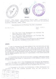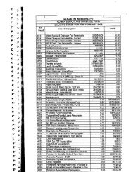
Tamil Nadu Urban Infrastructure Financial Services ... - Municipal
Tamil Nadu Urban Infrastructure Financial Services ... - Municipal
Tamil Nadu Urban Infrastructure Financial Services ... - Municipal

Create successful ePaper yourself
Turn your PDF publications into a flip-book with our unique Google optimized e-Paper software.
2. Town profile and city demographics<br />
2.1 City profile<br />
2.1.1 District overview & Historical Significance<br />
Krishnagiri town functions as the district headquarters. Krishnagiri is a town with historical<br />
significance - the town was ruled by several prominent South Indian dynasties. Archeological surveys<br />
reveal the prehistoric existence of mankind in this place during the Paleolithic, Neolithic and<br />
Mesolithic Ages. The region was popularly known as “Nigarili Chola Mandlam” and<br />
'Vidhugadhazhagi Nallur' during the Chola dynasty. According to historical sources during<br />
“Nulamba” rule, people, as Nulambadi knew the region'.<br />
Adhiyaman once ruled Krishnagiri and hence the place is also known as 'Adhiayaman <strong>Nadu</strong>'. This<br />
region was ruled by Pallavas, Gangas, Nulambas, Cholas, Hoysalas, Vijaya Nagar Emperors, Bijapur<br />
Sultans, Wudayars of Mysore and Nayaks of Madurai. The fort at Syed Padasha Mountain is note<br />
worthy. Haider Ali and Tipu Sultan built this picturesque fort. During the mutiny the forts and<br />
reservoirs were dismantled. The growth of Krishnagiri town has been restricted due to mountain fort<br />
and tank on the western side.<br />
2.1.2 Location and Connectivity<br />
The district is surrounded by Andhra Pradesh on the north, Palcode, and Uthangaraj Taluks of<br />
Dharampuri District at the south; Tiruppattur taluk of Vellore district at the east and Denkanikotta<br />
taluk of Krishnagiri district at the west.<br />
It is located at a distance of 110 Km from Northwest of Salem along NH-7 and at a distance of 32 km<br />
from Palacode - the nearest railway station. The town is well connected by bus route with adjoining<br />
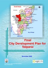
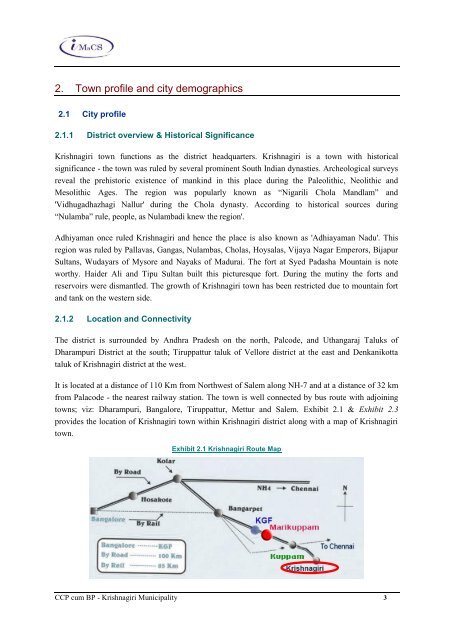
towns; viz: Dharampuri, Bangalore, Tiruppattur, Mettur and Salem. Exhibit 2.1 & Exhibit 2.3<br />
provides the location of Krishnagiri town within Krishnagiri district along with a map of Krishnagiri<br />
town.<br />
Exhibit 2.1 Krishnagiri Route Map<br />
CCP cum BP - Krishnagiri <strong>Municipal</strong>ity 3