The Davis Strait - DCE - Nationalt Center for Miljø og Energi
The Davis Strait - DCE - Nationalt Center for Miljø og Energi
The Davis Strait - DCE - Nationalt Center for Miljø og Energi
You also want an ePaper? Increase the reach of your titles
YUMPU automatically turns print PDFs into web optimized ePapers that Google loves.
56<br />
from the inner parts of the Godthåbsfjord (Rignot & Kanagaratnam 2006).<br />
<strong>The</strong> extent to which the increased freshwater input from the fjord systems<br />
affects the characteristics of the West Greenland Current is currently unknown.<br />
3.3.1 <strong>The</strong> West Ice and drift patterns<br />
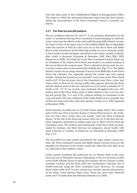
<strong>The</strong> ice conditions between 60° and 71° N are primarily determined by the<br />
north- or northwest-flowing West Greenland Current bringing in relatively<br />
warm water and the effects of the cold south-flowing Baffin Island Current.<br />
Ice starts to <strong>for</strong>m in the open water in the northern Baffin Bay in September<br />
when the amount of West Ice (first year ice) in the <strong>Davis</strong> <strong>Strait</strong> and Baffin<br />
Bay is at the lowest level. In the following months, ice cover increases steadily<br />
from north to south reaching a maximum in late winter, usually in March,<br />
after which it decreases (Nazareth & Steensboe 1998, Buch 2000, 2002,<br />
Hansen et al. 2004). <strong>The</strong> relatively warm West Greenland Current delays sea<br />
ice <strong>for</strong>mation in the eastern <strong>Davis</strong> <strong>Strait</strong> and results in an earlier breakup of<br />
the sea ice than in the western parts. <strong>The</strong>re is there<strong>for</strong>e always more ice cover<br />
in the western than in the eastern half of Baffin Bay (Fig. 3.3.1). <strong>The</strong> Baffin<br />
Island Current conveys large amounts of sea ice from Baffin Bay to the <strong>Davis</strong><br />
<strong>Strait</strong> and Labrador Sea, especially during the winter and early spring<br />
months. During this period sea ice normally covers most of the <strong>Davis</strong> <strong>Strait</strong><br />
north of 65° N, but not areas close to the Greenland coast. Here, a flaw lead<br />
(open water or thin ice) of varying widths often appears between the shore<br />
and the offshore parts of the fast- and drift ice as far north as latitude 67° N.<br />
South of 65°- 67° N, sea ice-free areas dominate throughout the year. <strong>The</strong><br />
eastern part of the <strong>Davis</strong> <strong>Strait</strong>, south of Disko Island, is free of sea ice during<br />
this period (Fig. 3.3.1 and 3.3.2), whereas drifting ice dominates to the<br />
west and north. <strong>The</strong> area northwest of the Fyllas Banke area is normally free<br />
of West Ice from early May until early January (Valeur et al. 1996, Nazareth<br />
& Steensboe 1998).<br />
Small amounts of multi-year ice of Arctic Ocean origin drift to the western<br />
parts of the area from Lancaster Sound or Nares <strong>Strait</strong>; however, the multiyear<br />
ice from these waters does not usually reach the West Greenland<br />
shores. At the end of the freeze-up season, first-year ice in the thin and medium<br />
categories dominates in eastern parts (up to about 100 km from the<br />
Greenland coast). <strong>The</strong> western and central parts of the <strong>Davis</strong> <strong>Strait</strong> are dominated<br />
by medium and thick first-year ice categories, mixed locally with<br />
small amounts (1-3 tenths) of multi-year ice (Nazareth & Steensboe 1998)<br />
(Fig. 3.3.1).<br />
<strong>The</strong> local drift is to some extent controlled by the major surface current systems,<br />
the West Greenland Current and Baffin Island Current; however, the<br />
strength and direction of the surface winds also affect the local drift of sea<br />
ice, especially in the southern waters.<br />
Under normal conditions the multi-year sea ice (Storis) drifts to the Cape<br />
Farewell area in December/January depending on the low pressure system<br />
of the North Atlantic Ocean. In spring and summer, the low pressure system<br />
normally weakens and the Storis drift into Northeastern Labrador Sea or<br />
North-westward along the West Greenland coast. However, on average<br />
Storis drifts north of 63º N every second year, but the amount and presence<br />
of the Storis varies between these years. Storis has never been observed<br />
north of 63º N earlier than late February (Hansen et al. 2004).


