

CockburnCoast - Western Australian Planning Commission
CockburnCoast - Western Australian Planning Commission
CockburnCoast - Western Australian Planning Commission

You also want an ePaper? Increase the reach of your titles
YUMPU automatically turns print PDFs into web optimized ePapers that Google loves.
<strong>CockburnCoast</strong><br />
Low rise apartments are those within the three- to five-storey range;<br />
while medium rise apartments are classified as six to eight storeys<br />
and high rise apartments are those greater than eight storeys.<br />
These dwelling type allocations are anticipated to be applied<br />
throughout the district structure plan area, although it is recognised<br />
that some precincts have a greater propensity for accommodating<br />
density. A built form code is required to guide the form and density<br />
of development, however for the purposes of enabling modelling<br />
and providing a guide to local structure plans, the housing type mix<br />
generally translates into the following mix of residential densities:<br />
R30 single house;<br />
R50 semi detached/row or terrace;<br />
R80 low rise apartment (3-5 storeys); and<br />
R100/160 medium to high rise apartments (over 5 storeys)<br />
The densities applied, although significantly higher than would be<br />
found in a greenfields or outer metropolitan location, are considered<br />
to reflect the density required to support the urban form and<br />
structure planned for the project area in accordance with the<br />
Regional Framework and the Directions 2031 strategy. The relatively<br />
removed location from existing residential areas provides the<br />
opportunity for this to be achieved without significant community<br />
impact, while the housing form will support the urban consolidation,<br />
public transport and sustainability objectives for the project area.<br />
The adjoining South Beach and Port Coogee developments are<br />
dominated with single residential product, as is the case with the<br />
residential areas further to the east. The structure plan area<br />
therefore offers an opportunity to increase the diversity of housing<br />
types, reflective of the changing demographic trends and urban<br />
consolidation objectives while also enabling the practical<br />
rehabilitation of the area.<br />
Final density levels will be established through the local structure<br />
plans which will be developed for each precinct, with variation<br />
dependent on the local context within the precinct (refer Chapter<br />
2.10).<br />
The structure plan does not allocate definitive densities to specific<br />
areas. Instead, it is intended that the full density/dwelling mix be<br />
provided within each precinct as it is planned, to ensure a real<br />
diversity and vitality of residential environments at each stage of the<br />
Cockburn coast's redevelopment.<br />
The residential area is expected to yield in the order of 3800<br />
dwellings, however the timing and extent is dependent on a number<br />
of factors, including market conditions and transitioning<br />
arrangements for existing industries.<br />
In the interests of facilitating contemporary lifestyle choices in the<br />
Cockburn coast, it is intended that work-live uses should be<br />
permitted in the project area, subject to the usual development and<br />
building approvals processes and having regard for parking<br />
requirements and other details.<br />
Suitable uses for residential areas:<br />
• Medium density residential<br />
• High density residential<br />
• Home based business.<br />
Uses not suitable:<br />
• All other uses.<br />
2.4.2.2 Mixed use<br />
A mixed use land classification has been strategically placed<br />
through much of the project area, in order to allow a range of<br />
compatible uses to co-locate adjacent to one another, and vertically<br />
in individual buildings.<br />
By allowing the opportunity for a mix of uses, the objective is to<br />
promote the redevelopment of the Cockburn coast into a vibrant and<br />
sustainable environment that integrates living, working and leisure<br />
opportunities.<br />
The mixed use classification has been located in areas where it is<br />
considered that the market could, at some time, sustain some<br />
commercial use, and where it would be appropriate for these types<br />
of uses to develop – along important road linkages and in the vicinity<br />
of the activity nodes, the power station and the mixed business<br />
areas.<br />
It was considered particularly important to allow a mix of uses for the<br />
full length of Cockburn Road. It is intended that Cockburn Road<br />
develops into the attractive and vibrant heart of the Cockburn coast<br />
area, providing an urban complement to the natural assets of Beeliar<br />
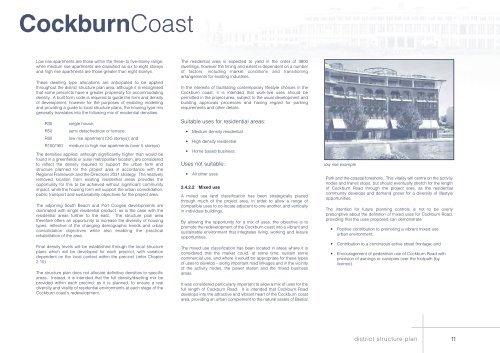
low rise example<br />
Park and the coastal foreshore. This vitality will centre on the activity<br />
nodes and transit stops, but should eventually stretch for the length<br />
of Cockburn Road through the project area, as the residential<br />
community develops and demand grows for a diversity of lifestyle<br />
opportunities.<br />
The intention for future planning controls is not to be overly<br />
prescriptive about the definition of mixed uses for Cockburn Road,<br />
providing that the uses proposed can demonstrate:<br />
• Positive contribution to promoting a vibrant mixed use<br />
urban environment;<br />
• Contribution to a continuous active street frontage; and<br />
• Encouragement of pedestrian use of Cockburn Road with<br />
provision of awnings or canopies over the footpath (by<br />
licence).<br />
district structure plan<br />
11


