

CockburnCoast - Western Australian Planning Commission
CockburnCoast - Western Australian Planning Commission
CockburnCoast - Western Australian Planning Commission

You also want an ePaper? Increase the reach of your titles
YUMPU automatically turns print PDFs into web optimized ePapers that Google loves.
<strong>CockburnCoast</strong><br />
Further information regarding lanes reallocation is provided in<br />
section 2.6.4.3.<br />
2.6.3.2 Cockburn Coast Drive (Fremantle to Rockingham<br />
Controlled Access Highway)<br />
The land uses proposed in the structure plan change the nature of<br />
the proposed Fremantle-Rockingham Highway from a controlled<br />
access highway (with limited local connections and high travel<br />
speed, as the name suggests) to more of a district distributor<br />
integrator style road, with local connections (at appropriate spacing)<br />
and a lowered design speed. To reflect this change in character the<br />
road has been identified as Cockburn Coast Drive within the<br />
structure plan. Cockburn Coast Drive will carry regional traffic<br />
(currently using Cockburn Road) as well as some local traffic from<br />
the structure plan area. Forecast traffic volumes range between<br />
14 000 and 20 500 vpd.<br />
It is proposed that the major T-intersections along Cockburn Coast<br />
Drive be signalised, and intersections with minor east-west roads<br />
managed with priority control.<br />
Cockburn Coast Drive should be constructed initially as two lanes<br />
with the reserve width to construct four lanes in the future. A<br />
preliminary alignment study is required to determine whether the<br />
existing reserve can be rationalised from its current width. The<br />
preliminary alignment study should be based on a reduced<br />
operating speed (60-70 km/h) from that identified in the original<br />
alignment concept and be responsive to the topography.<br />
It is estimated that the revised Cockburn Coast Drive road<br />
alignment, as shown on the district structure plan (Figure 2.1) could<br />
return in the order of 5.7 hectares of land back to Beeliar Park.<br />
It is anticipated that the built form adjacent to the western side of<br />
Cockburn Coast Drive will be a highly urbanised environment, with<br />
provisions for a general range of heights between 3-6 storeys and<br />
higher elements at landmark and gateway sites. Cockburn Coast<br />
Drive will perform both a district and regional function and therefore<br />
access is likely to be limited, through rear loading of development<br />
via laneways. Development however, will be required to front onto<br />
Cockburn Coast Drive for passive surveillance and aesthetic<br />
reasons.<br />
2.6.3.3 Cockburn Road<br />
Cockburn Road through the structure plan area is intended to carry<br />
low speed, local traffic with forecast volumes ranging from 7400 to<br />
16 500 vpd. Regional traffic will instead use Cockburn Coast Drive<br />
or Stock Road, which should provide a higher standard of road and<br />
greater travel speed.<br />
Cockburn Road will have many intersections. Those involving major<br />
east-west roads will be signalised, providing safe crossing<br />
opportunities for pedestrians as well as increasing the capacity of<br />
the four-way intersections.<br />
The ultimate configuration of Cockburn Road is two general traffic<br />
lanes and two dedicated transit lanes, with provision for on-street<br />
parking where appropriate.<br />
2.6.3.4 Coastal roads<br />
The coastal roads have been so named because they do not<br />
represent one individual link between the structure plan area and<br />
Douro Road; rather they represent up to three potential connections.<br />
The coastal roads provide an important local connection for traffic<br />
generated within the structure plan area; allowing this traffic to<br />
access South Fremantle without using the congested Hampton<br />
Road. It is important to note that traffic using these roads generated<br />
by the structure plan area will be local traffic.<br />
The coastal roads should be constructed as low order and slow<br />
speed connections to limit through traffic. Coastal mitigation<br />
measures may also be required where the roads are seawards of the<br />
physical processes setback line.<br />
2.6.3.5 Other roads<br />
The potential for a new connection to the west of the existing freight<br />
rail should be maintained, however, any road constructed should not<br />
be greater than a local access street.<br />
The potential to construct a new local road providing a connection<br />
to Douro Road, in the vicinity of Fremantle Village, should also be<br />
considered further in the future planning for the South Fremantle<br />
landfill site. Any road constructed should be lower order and<br />
designed to limit through traffic.<br />
Other local road networks will be detailed through the local structure<br />
planning process.<br />
2.6.4 Proposed public transport network<br />
A critical consideration in the structure plan is the way the travel<br />
needs of new residents of Cockburn coast are accommodated<br />
within the sub-regional transport network. Within the immediate<br />
vicinity of the project area, considerable measures, in the form of<br />
both physical infrastructure (Hampton Road dedicated bus lane)<br />
and behaviour programs (i.e. Travelsmart), have been undertaken to<br />
encourage alternatives to the use of private vehicles and effect<br />
changes to traffic movement patterns. In doing so, public transport,<br />
cycling and walking have been prioritised.<br />
Similarly, the structure plan aims to promote the use of alternatives<br />
to the private car within the Cockburn coast area to ensure that<br />
these emerging sustainable transport patterns are reinforced and<br />
prioritised in new urban areas. It is not intended that this be<br />
achieved by the provision of a single public transport mode, but<br />
through the development of a structural framework that is sufficiently<br />
robust to accommodate a range of complementary services that<br />
operate at the local, regional and metropolitan level.<br />
At the regional and metropolitan level, the WAPC has resolved to<br />
progress an integrated transport strategy for the south west corridor<br />
as a matter of priority. The scope of the strategy is described in<br />
section 2.6.2, however the primary objectives are to identify the high<br />
order public transport requirements for the sub-region, in terms of<br />
both mode and alignment, and consider implementation and<br />
funding mechanisms in the context of broader metropolitan public<br />
transport priorities.<br />
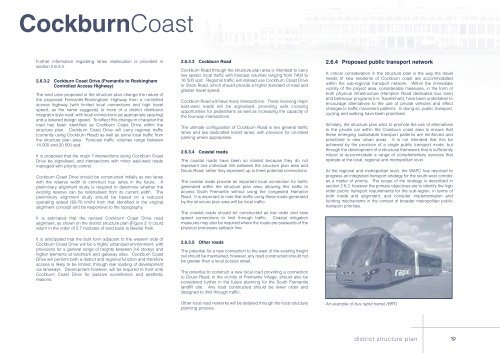
An example of bus rapid transit (BRT)<br />
district structure plan<br />
19


