

CockburnCoast - Western Australian Planning Commission
CockburnCoast - Western Australian Planning Commission
CockburnCoast - Western Australian Planning Commission

Create successful ePaper yourself
Turn your PDF publications into a flip-book with our unique Google optimized e-Paper software.
<strong>CockburnCoast</strong><br />
2.6.4.3 Public transport alignment<br />
In determining the desirable alignment of the public transport<br />
network, both within and surrounding the project area, the following<br />
factors were considered:<br />
• Requirement for a northern terminus at Fremantle station;<br />
• The location of existing trip generators and attractors;<br />
• Potential future changes to land uses;<br />
• The creation of “full” and “active” catchments for<br />
stops/stations (opportunities for catchments that have a<br />
high density of residential development or intensity of<br />
commercial use and do not contain large amounts of<br />
public open space, water etc.);<br />
• The ability to maximise the use of existing infrastructure;<br />
• Constructability and operability of future services (beyond<br />
the district structure plan area); and<br />
• Integration with existing Transperth services.<br />
Two public transport alignments were identified, the first being the<br />
coastal alignment primarily using the freight rail reserve, and an<br />
eastern route centred on Cockburn Road.<br />
The preferred, and therefore proposed, alignment for bus rapid<br />
transit is the Cockburn Road-Hampton Road corridor, including<br />
three transit stops at regular intervals through the project area, for<br />
the following reasons:<br />
• It is a direct route through the project area and to<br />
Fremantle Station, which also provides opportunities for<br />
further expansion to the south or east in the future;<br />
• It creates the ability to achieve priority for transit vehicles<br />
along Cockburn Road for the entire length of the route<br />
within the structure plan area;<br />
• It allows utilisation of existing bus priority lanes on<br />
Hampton Road, north of Douro Road;<br />
• It creates increased justification for the provision of transit<br />
priority on Hampton Road benefiting services from the<br />
wider region;<br />
• The capacity to extend supplementary public transport<br />
services along the coastal corridor is not precluded in the<br />
future; and<br />
• The alignment assists in creating a highly legible public<br />
transport spine, around which urban development can be<br />
concentrated.<br />
Two kerbside transit lanes will be provided on Cockburn Road<br />
through the project area. The need to establish transit priority on<br />
Hampton Road linking the project area north to Fremantle is a matter<br />
of urgency to allow the Cockburn coast to function effectively as a<br />
transit oriented development.<br />
The decision on how to provide priority for BRT on Hampton Road is<br />
not an easy one. The reallocation of kerbside lanes is likely to cause<br />
complications in terms of community perception, as it is often<br />
difficult to communicate the long-term benefits of such projects. The<br />
recent creation of bus lanes on South Street, however, sets a strong<br />
precedent for this type of project and demonstrates outcomes<br />
achieved while successfully managing negative impacts. The<br />
reallocation of lanes on Hampton Road, north of Douro Road, also<br />
sets an important precedent. The impacts of this reallocation have<br />
been carefully monitored by the City of Fremantle, and indicate that<br />
negative impacts can be managed successfully in a local context.<br />
Analysis of intersections on Hampton Road undertaken as part of<br />
this project (and described in detail in the Transport Analysis Report<br />
– see Appendix) has indicated that the opportunity does exist to<br />
reallocate the existing kerbside lanes with limited impacts to general<br />
traffic. This option would provide priority for buses in the short term<br />
(which is required to support development of the structure plan<br />
area) while preserving the option for widening Hampton Road in the<br />
future through the acquisition or additional road reserve, should this<br />
be deemed necessary.<br />
It is recommended, based on the various investigations undertaken<br />
as part of this study, that reallocation of the kerbside lanes on<br />
Hampton Road between Douro Road and Rockingham Road should<br />
occur in the short term (five years), in order to provide priority for<br />
existing services and future services from the structure plan area.<br />
Further studies are required to determine the preferred route for the<br />
connection of the BRT system with the Fremantle Train Station and<br />
the desired terminus, with Port Coogee and Cockburn Central<br />
identified as potential end points for the transit service.<br />
Although not directly related to this project, the opportunity for<br />
extending priority lanes south along Rockingham Road should also<br />
be examined in the short to medium term, in effect creating the<br />
Hampton Road, Rockingham Road/Cockburn Road location as a<br />
‘transit hub’.<br />
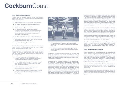
2.6.5 Pedestrian and cyclists<br />
Existing pedestrian and cyclist infrastructure within the structure<br />
plan is limited to a shared use path located along the coast<br />
extending south from Fremantle. This path ceases at the northern<br />
end of Robb Road and then commences again to the south of Robb<br />
Road. A second shared use path runs parallel to the existing freight<br />
railway from its existing level crossing at Cockburn Road east<br />
connecting to Spearwood Avenue. There are currently no Perth<br />
bicycle network routes within the structure plan area.<br />
It will be important to improve this infrastructure as part of the<br />
redevelopment of the Cockburn coast, to ensure that pedestrians<br />
and cyclists are well catered for in terms of local trips and longer<br />
regional trips.<br />
The future detailed urban design and planning must ensure that<br />
pedestrian movement and localised bicycle transport are given the<br />
highest priority in the design of the traffic networks and public open<br />
spaces.<br />
22 district structure plan


