

ABSTRACTS / RESUMES - Comitato Glaciologico Italiano
ABSTRACTS / RESUMES - Comitato Glaciologico Italiano
ABSTRACTS / RESUMES - Comitato Glaciologico Italiano

You also want an ePaper? Increase the reach of your titles
YUMPU automatically turns print PDFs into web optimized ePapers that Google loves.
MERVIN OLIVIER 1,2 & GERALD GARLAND 1<br />
Data collection and analysis for the study of foredune formation<br />
on the East Coast of South Africa<br />
1 Geographical & Environmental Sciences, University of Natal (Durban),<br />
P/Bag X10, Dalbridge 4014, South Africa<br />
2 Geography, University of Transkei (Butterworth),<br />
P/Bag X5092, Umtata, South Africa<br />
As part of a study assessing the effects of inland impoundments<br />
on the lower reaches and adjacent coast of the Tugela<br />
river, Natal, dune formation and growth was surveyed in<br />
detail at regular intervals for a period of four years.<br />
Amongst the techniques used were Abney level cross sections,<br />
tacheometric and theodelite mapping, and real-time<br />
Gps surveys. An historical perspective was obtained from<br />
analysis of air photos from 1937 to 1994. To analyse the<br />
data certain digital terrain models were employed.<br />
This paper critically reviews the results of survey and<br />
analysis techniques used, discusses a number of difficulties<br />
encountered and makes suggestions for future surveys.<br />
JEFF OLLERHEAD<br />
Quantifying shoreline geomorphology at Cape Jourimain,<br />
NB, Canada<br />
Department of Geography, Mount Allison University, Sackville,<br />
New Brunswick, EOA3CO Canada<br />
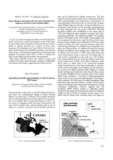
Cape Jourimain is the point on the New Brunswick shoreline<br />
where the Confederation Bridge to Prince Edward<br />
Island is attached (fig. 1). This area was studied extensively<br />
prior to the granting of government approval for construction<br />
of the bridge. Since construction began in 1995, a wide<br />
variety of ongoing studies has been conducted in the<br />
area, both to enhance the existing database and as part of<br />
efforts to monitor numerous environmental parameters<br />
FIG. 1 - Location of Cape Jourimain, NB.<br />
that may be influenced by bridge construction. The first<br />
objective of this research project was to document the shoreline<br />
geomorphology and sedimentary characteristics of<br />
Cape Jourimain, New Brunswick, as work on the Confederation<br />
Bridge began in this area. A second objective is to<br />
re-measure some aspects of the shoreline geomorphology<br />
at Cape Jourimain over the period 1995-1997. Thirteen<br />
shoreline profiles were established in the study area in<br />
1995 and measured using standard surveying and echosounding<br />
techniques. Six additional profiles were established<br />
in 1996 based on the 1995 results. These profiles will<br />
be re-measured several times a year for the next few years.<br />
Seventy bottom samples were collected in 1995 from a grid<br />
pattern covering the study area and analyzed using standard<br />
sieving techniques to establish their composition and<br />
grain size characteristics. An additional thirty-four bottom<br />
samples and eighteen dune samples were collected in 1996<br />
to enhance the work done in 1995. These data along with<br />
visual observations made at each site are being used to<br />
map bottom composition in the study area. The preliminary<br />
results indicate that the sediments offshore tend to be<br />
poorly-sorted sand, pebble, and cobble sediments, while<br />
those closer to shore tend to be well-sorted medium<br />
sands.Investigations are also being undertaken to determine<br />
the recent and longer-term evolution of the sandy barrier<br />
systems that flank Jourimain Island (Figure 2). These<br />
barrier systems are of particular value because they protect<br />
a. Canadian Wildlife Service sanctuary from wave attack.<br />
Their recent .evolution « 50 years) is being documented<br />
using. recent surveys and aerial photographs. Their longerterm<br />
evolution (50-1,000 years) is being investigated using<br />
historical maps, historical written.records, and the assessment<br />
of sand dune ages using optical luminescence dating<br />
techniques. Preliminary evidence suggests that the<br />
northwest (NW) barrier system is migrating slowly<br />
landward with rising sea level and that there is a sufficient<br />
supply of sand to ensure its integrity. In fact, there is evidence<br />
that the dunes near Gunning Point (see Figure 2)<br />
FIG. 2 - Cape Jourimain, NB study site.<br />
293


