

ABSTRACTS / RESUMES - Comitato Glaciologico Italiano
ABSTRACTS / RESUMES - Comitato Glaciologico Italiano
ABSTRACTS / RESUMES - Comitato Glaciologico Italiano

Create successful ePaper yourself
Turn your PDF publications into a flip-book with our unique Google optimized e-Paper software.
have been accreting at a noticeable rate over the past few<br />
decades. On the other hand, the southeast (SE) barrier system<br />
appears to be migrating landward more quickly than<br />
the NW barrier system and eroding at the same time. Historical<br />
evidence indicates that the road that used to follow<br />
this barrier system washed away several times between<br />
1915 and 1920 (it has never been replaced). Understanding<br />
the recent geomorphic history of this area is complicated<br />
by various types of human disturbance ranging from<br />
the construction of dikes by the Acadian People in the<br />
1700s to the present construction of the Confederation<br />
Bridge.<br />
CLIFFORD D. aLLIER<br />
Geomorphic constraints on tectonic theories<br />
Centre for Resource and Environmental Studies,<br />
Australian National University, Canberre Act 0200, Australia<br />
Too often geomorphologists have accepted tectonic hypotheses<br />
from geologists and geophysicists instead of starting<br />
from their own basic data. In contrast, tectonic geologists<br />
and geophysicists often invoke uplift (for example<br />
over subduction sites or thermal domes) without any consideration<br />
of how such uplift will affect landforms. In reality<br />
many landforms are older than the tectonic movement,<br />
and severely constrain possible tectonic interpretations.<br />
Changes in elevation and slope, effects on drainage patterns,<br />
and distribution of regolith are the most obvious<br />
constraints on tectonic theories. Planation surfaces indicate<br />
long periods of tectonic stability. Where present such<br />
surfaces deny simultaneous folding and uplift, commonly<br />
assumed in hypotheses of compressional mountain building.<br />
Through feedback processes such as isostatic response<br />
and gravity spreading, some tectonic processes are actually<br />
driven by erosional processes.<br />
YUICHI ONDA \ CHISATO TAKENAKA2<br />
& TAKAHISA MIZUYAMA3<br />
The mechanism inducing the infiltration rate lowering of<br />
Unzen Volcanic Ash<br />
1 Lab. of Forest Hydrology & Erosion Control Engineering, School of<br />
Agricultural Sciences, Nagoya University, Nagoya 464-01, Japan<br />
2 Lab. of Forest Environment and Resources, School of Agricultural<br />
Sciences, Nagoya University, Nagoya 464-01, Japan<br />
3 Lab. of Forest Hydrology & Erosion Control, Faculty of Agriculture,<br />
Kyoto University, Kyoto, 606-01, Japan<br />
After volcanic eruption, surface infiltration rates of the<br />
tephra deposits have been reported extremely low (e.g.,<br />
Allen, 1981, Hendrayanto & alii, 1995), which sometimes<br />
294<br />
causes debris flow (Yamamoto & alii, 1980) or rapid surface<br />
erosion (Collins & Dunne, 1988). However, the mechanism<br />
still remains unresolved. Here, the authors studied<br />
the mechanism inducing the infiltration rate lowering of<br />
the Unzen volcanic ash through permeability tests using<br />
varying electrolyte concentration, Esp (Exchangeable Sodium<br />
Percentage) measurement of the fallout deposits, and<br />
Sem (Scanning Electron Microscope) observation.<br />
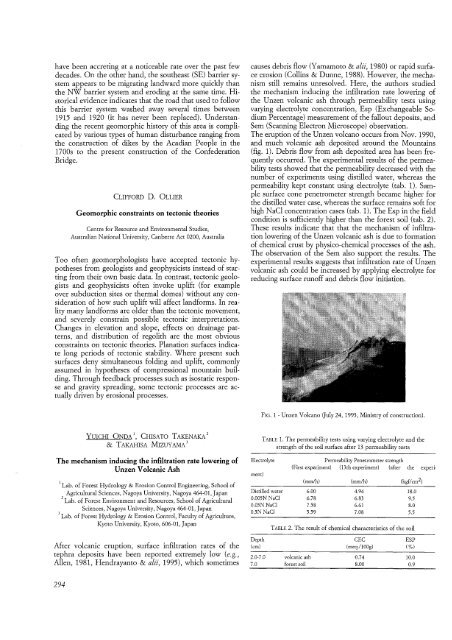
The eruption of the Unzen volcano occurs from Nov. 1990,<br />
and much volcanic ash deposited around the Mountains<br />
(fig. 1). Debris flow from ash deposited area has been frequently<br />
occurred. The experimental results of the permeability<br />
tests showed that the permeability decreased with the<br />
number of experiments using distilled water, whereas the<br />
permeability kept constant using electrolyte (tab. 1). Sample<br />
surface cone penetrometer strength became higher for<br />
the distilled water case, whereas the surface remains soft for<br />
high NaCI concentration cases (tab. 1). The Esp in the field<br />
condition is sufficiently higher than the forest soil (tab. 2).<br />
These results indicate that that the mechanism of infiltration<br />
lowering of the Unzen volcanic ash is due to formation<br />
of chemical crust by physico-chemical processes of the ash.<br />
The observation of the Sem also support the results. The<br />
experimental results suggests that infiltration rate of Unzen<br />
volcanic ash could be increased by applying electrolyte for<br />
reducing surface runoff and debris flow initiation.<br />
FIG. 1 - Unzen Volcano (July 24, 1993, Ministry of construction).<br />
TABLE 1. The permeability tests using varying electrolyte and the<br />
strength of the soil surface after 13 permeability tests<br />
Electrolyte<br />
merit)<br />
Distilled water<br />
0.005N NaCl<br />
0.05N NaCl<br />
05N NaCl<br />
Depth<br />
(em)<br />
2.0-7.0<br />
7.0<br />
Permeability Penetrometer strength<br />
(First experiment) (13th experiment) (after the experi-<br />
(mm/h) (mm/h) (kgf/cm 2)<br />
6.00 4.94 18.0<br />
6.78 6.83 9.5<br />
758 6.61 8.0<br />
559 7.08 55<br />
TABLE 2. The result of chemical characteristics of the soil<br />
volcanic ash<br />
forest soil<br />
CEC<br />
(meq./100g)<br />
0.74<br />
8.00<br />
ESP<br />
(%)<br />
10.0<br />
0.9


