

ABSTRACTS / RESUMES - Comitato Glaciologico Italiano
ABSTRACTS / RESUMES - Comitato Glaciologico Italiano
ABSTRACTS / RESUMES - Comitato Glaciologico Italiano

You also want an ePaper? Increase the reach of your titles
YUMPU automatically turns print PDFs into web optimized ePapers that Google loves.
LOMBORINCHEN RADNA<br />
Periglacial processes in the territory<br />
of Khan-Hentei nature reserve, Mongolia<br />
Institute of Geography, Mongolian Academy of Sciences,<br />
Ulan Bator, 210620, Mongolia<br />
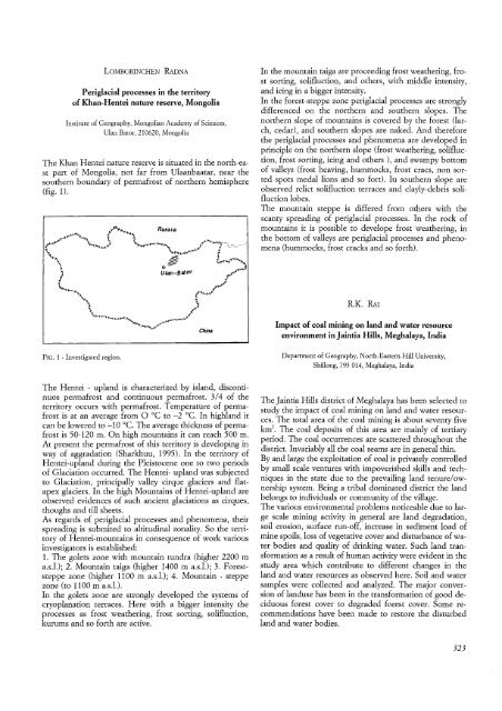
The Khan Hentei nature reserve is situated in the north-east<br />
part of Mongolia, not far from Ulaanbaatar, near the<br />
southern boundary of permafrost of northern hemisphere<br />
(fig. 1).<br />
FIG. 1 - Investigated region.<br />
The Hentei - upland is characterized by island, discontinuos<br />
permafrost and continuous permafrost. 3/4 of the<br />
territory occurs with permafrost. Temperature of permafrost<br />
is at an average from 0 °C to -2°C. In highland it<br />
can be lowered to -10°C. The average thickness of permafrost<br />
is 50-120 m. On high mountains it can reach 500 m.<br />
At present the permafrost of this territory is developing in<br />
way of aggradation (Sharkhuu, 1995). In the territory of<br />
Hentei-upland during the Pleistocene one to two periods<br />
of Glaciation occurred. The Hentei- upland was subjected<br />
to Glaciation, principally valley cirque glaciers and flatapex<br />
glaciers. In the high Mountains of Hentei-upland are<br />
observed evidences of such ancient glaciations as cirques,<br />
thoughs and till sheets.<br />
As regards of periglacial processes and phenomena, their<br />
spreading is submited to altitudinal zonality. So the territory<br />
of Hentei-mountains in consequence of work various<br />
investigators is established:<br />
1. The golets zone with mountain tundra (higher 2200 m<br />
a.s.l.); 2. Mountain taiga (higher 1400 m a.s.l.); 3. Foreststeppe<br />
zone (higher 1100 m a.s.l.); 4. Mountain - steppe<br />
zone (to 1100 m a.s.l.).<br />
In the golets zone are strongly developed the systems of<br />
cryoplanation terraces. Here with a bigger intensity the<br />
processes as frost weathering, frost sorting, solifluction,<br />
kurums and so forth are active.<br />
In the mountain taiga are proceeding frost weathering, frost<br />
sorting, solifluction, and others, with middle intensity,<br />
and icing in a bigger intensity.<br />
In the forest-steppe zone periglacial processes are strongly<br />
differenced on the northern and southern slopes. The<br />
northern slope of mountains is covered by the forest (larch,<br />
cedar), and southern slopes are naked. And therefore<br />
the periglacial processes and phenomena are developed in<br />
principle on the northern slope (frost weathering, solifluction,<br />
frost sorting, icing and others ), and swampy bottom<br />
of valleys (frost heaving, hummocks, frost cracs, non sorted<br />
spots medal lions and so fort). Iu southern slope are<br />
observed relict solifluction terraces and clayly-debris solifluction<br />
lobes.<br />
The mountain steppe is differed from others with the<br />
scanty spreading of periglacial processes. In the rock of<br />
mountains it is possible to develope frost weathering, in<br />
the bottom of valleys are periglacial processes and phenomena<br />
(hummocks, frost cracks and so forth).<br />
R.K. RAl<br />
Impact of coal. mining on land and water resource<br />
environment in Jaintia Hills, Meghalaya, India<br />
Department of Geography, North-Eastern Hill University,<br />
Shillong, 793 014, Meghalaya, India<br />
TheJaintia Hills district of Meghalaya has been selected to<br />
study the impact of coal mining on land and water resources.<br />
The total area of the coal mining is about seventy five<br />
km'. The coal deposits of this area are mainly of tertiary<br />
period. The coal occurrences are scattered throughout the<br />
district. Invariably all the coal seams are in general thin.<br />
By and large the exploitation of coal is privately controlled<br />
by small scale ventures with impoverished skills and techniques<br />
in the state due to the prevailing land tenure/ownership<br />
system. Being a tribal dominated district the land<br />
belongs to individuals or community of the village.<br />
The various environmental problems noticeable due to large<br />
scale mining activity in general are land degradation,<br />
soil erosion, surface run-off, increase in sediment load of<br />
mine spoils, loss of vegetative cover and disturbance ofwater<br />
bodies and quality of drinking water. Such land transformation<br />
as a result of human activity were evident in the<br />
study area which contribute to different changes in the<br />
land and water resources as observed here. Soil and water<br />
samples were collected and analyzed. The major conversion<br />
of landuse has been in the transformation of good deciduous<br />
forest cover to degraded forest cover. Some recommendations<br />
have been made to restore the disturbed<br />
land and water bodies.<br />
323


