- Page 1 and 2:
Faculté de Sciences Appliquées Se
- Page 3 and 4:
Abstract Nowadays, in many applicat
- Page 5 and 6:
3.2.4 Overlapping Raster and Vector
- Page 7 and 8:
D.5 Geology, Geophysics and Geochem
- Page 9 and 10:
4.9 Raster cell [16]. . . . . . . .
- Page 11 and 12:
Chapter 1 Introduction 1.1 Context
- Page 13 and 14:
Chapter 2 Geographic Information Sy
- Page 15 and 16:
2.2.3 Imagery Figure 2.3: Polygon f
- Page 17 and 18:
Figure 2.8: Surface expressed by co
- Page 19 and 20:
4-foot logo. The file size is the s
- Page 21 and 22:
2.4.2 Data Theme Figure 2.14: Multi
- Page 23 and 24:
measures of latitude. Longitude mea
- Page 25 and 26:
2.6 GIS Applications 2.6.1 Crime Ma
- Page 27 and 28:
2.6.3 Traditional Knowledge GIS Tra
- Page 29 and 30:
These additional functionalities ma
- Page 31 and 32:
Figure 3.3: Physical storage of Geo
- Page 33 and 34:
DROP INDEX spain_images_idx; CREATE
- Page 35 and 36:
In summary, the intersection is muc
- Page 37 and 38:
Attribute information Table 4.1: Po
- Page 39 and 40:
Figure 4.2: Information representat
- Page 41 and 42:
for discrete data while floating-po
- Page 43 and 44:
the matrix are parallel to the x-ax
- Page 45 and 46:
Lines Figure 4.15: Raster point rep
- Page 47 and 48:
Choosing an appropriate cell size i
- Page 49 and 50:
The multi-band conception is result
- Page 51 and 52:
"32BUI" = 32-bit unsigned integer "
- Page 53 and 54:
Figure 4.30: Pyramids at different
- Page 55 and 56:
ectangular because there might be s
- Page 57 and 58:
Figure 4.39: Vector to raster conve
- Page 59 and 60:
Figure 4.42: Web application with o
- Page 61 and 62: In this example, the dummy_rast tab
- Page 63 and 64: One approach to make this intersect
- Page 65 and 66: 4.19 Intersection The fact that Pos
- Page 67 and 68: Figure 4.51: Raster and raster inte
- Page 69 and 70: ST_Present and ST_Passes predicates
- Page 71 and 72: Chapter 5 User Guide Sometimes stor
- Page 73 and 74: SELECT rast As origin, ST_Resample(
- Page 75 and 76: • gvSIG plugin • MapServer thro
- Page 77 and 78: SELECT ST_AsJPEG(rast) As rastjpg F
- Page 79 and 80: FROM buff_temp GROUP BY id ORDER BY
- Page 81 and 82: Chapter 6 Application Most of GIS a
- Page 83 and 84: 6.2 Tools Figure 6.3: PostGIS conne
- Page 85 and 86: Figure 6.6: Band area. controlled b
- Page 87 and 88: Figure 6.10: The loading map parall
- Page 89 and 90: Figure 6.14: Maps representing worl
- Page 91 and 92: Figure 6.17: Maps with a color lege
- Page 93 and 94: their levels of awareness of geogra
- Page 95 and 96: [15] Jorge Arevalo. PostGIS Raster
- Page 97 and 98: Appendix A PostGIS Raster Utilisati
- Page 99 and 100: eturn "Version 0.1" def qgisMinimum
- Page 101 and 102: Appendix C Code Implementation C.1
- Page 103 and 104: name="" # Setting table name and mo
- Page 105 and 106: Figure D.1: Synthetic aperture rada
- Page 107 and 108: D.4 Digital Image Processing D.4.1
- Page 109 and 110: Figure D.4: Age of the sea floor. M
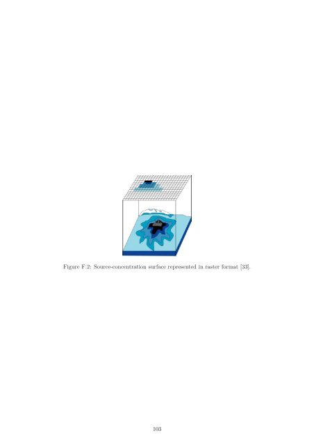
- Page 111: Appendix F Continuous Surfaces One