

PostGIS Raster : Extending PostgreSQL for The Support of ... - CoDE
PostGIS Raster : Extending PostgreSQL for The Support of ... - CoDE
PostGIS Raster : Extending PostgreSQL for The Support of ... - CoDE

Create successful ePaper yourself
Turn your PDF publications into a flip-book with our unique Google optimized e-Paper software.
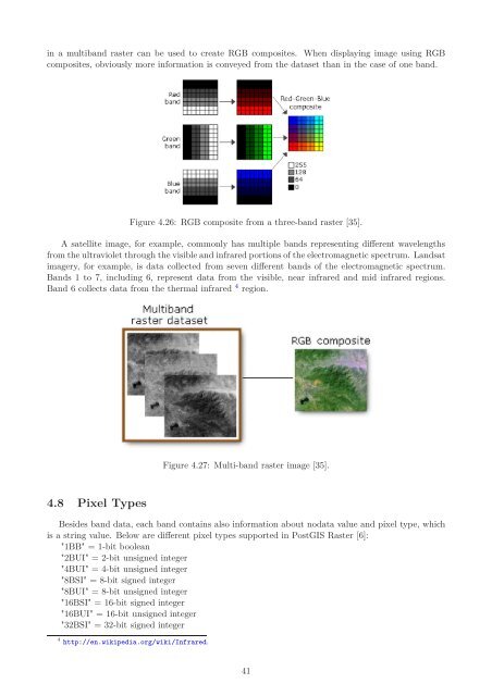
in a multiband raster can be used to create RGB composites. When displaying image using RGB<br />
composites, obviously more in<strong>for</strong>mation is conveyed from the dataset than in the case <strong>of</strong> one band.<br />
Figure 4.26: RGB composite from a three-band raster [35].<br />
A satellite image, <strong>for</strong> example, commonly has multiple bands representing different wavelengths<br />
from the ultraviolet through the visible and infrared portions <strong>of</strong> the electromagnetic spectrum. Landsat<br />
imagery, <strong>for</strong> example, is data collected from seven different bands <strong>of</strong> the electromagnetic spectrum.<br />
Bands 1 to 7, including 6, represent data from the visible, near infrared and mid infrared regions.<br />
Band 6 collects data from the thermal infrared 4 region.<br />
4.8 Pixel Types<br />
Figure 4.27: Multi-band raster image [35].<br />
Besides band data, each band contains also in<strong>for</strong>mation about nodata value and pixel type, which<br />
is a string value. Below are different pixel types supported in <strong>PostGIS</strong> <strong>Raster</strong> [6]:<br />
"1BB" = 1-bit boolean<br />
"2BUI" = 2-bit unsigned integer<br />
"4BUI" = 4-bit unsigned integer<br />
"8BSI" = 8-bit signed integer<br />
"8BUI" = 8-bit unsigned integer<br />
"16BSI" = 16-bit signed integer<br />
"16BUI" = 16-bit unsigned integer<br />
"32BSI" = 32-bit signed integer<br />
4 http://en.wikipedia.org/wiki/Infrared.<br />
41


