

PostGIS Raster : Extending PostgreSQL for The Support of ... - CoDE
PostGIS Raster : Extending PostgreSQL for The Support of ... - CoDE
PostGIS Raster : Extending PostgreSQL for The Support of ... - CoDE

Create successful ePaper yourself
Turn your PDF publications into a flip-book with our unique Google optimized e-Paper software.
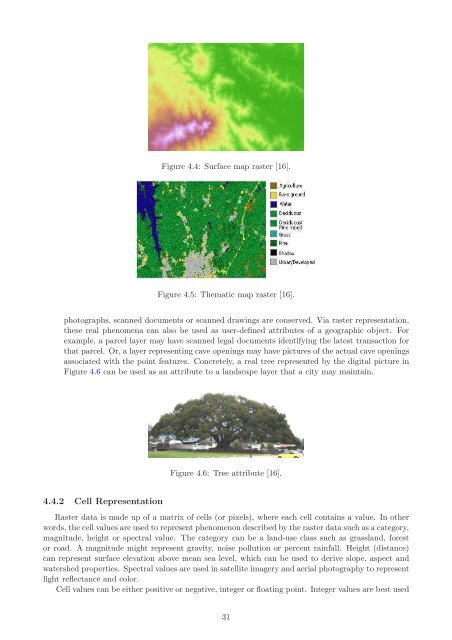
Figure 4.4: Surface map raster [16].<br />
Figure 4.5: <strong>The</strong>matic map raster [16].<br />
photographs, scanned documents or scanned drawings are conserved. Via raster representation,<br />
these real phenomena can also be used as user-defined attributes <strong>of</strong> a geographic object. For<br />
example, a parcel layer may have scanned legal documents identifying the latest transaction <strong>for</strong><br />
that parcel. Or, a layer representing cave openings may have pictures <strong>of</strong> the actual cave openings<br />
associated with the point features. Concretely, a real tree represented by the digital picture in<br />
Figure 4.6 can be used as an attribute to a landscape layer that a city may maintain.<br />
4.4.2 Cell Representation<br />
Figure 4.6: Tree attribute [16].<br />
<strong>Raster</strong> data is made up <strong>of</strong> a matrix <strong>of</strong> cells (or pixels), where each cell contains a value. In other<br />
words, the cell values are used to represent phenomenon described by the raster data such as a category,<br />
magnitude, height or spectral value. <strong>The</strong> category can be a land-use class such as grassland, <strong>for</strong>est<br />
or road. A magnitude might represent gravity, noise pollution or percent rainfall. Height (distance)<br />
can represent surface elevation above mean sea level, which can be used to derive slope, aspect and<br />
watershed properties. Spectral values are used in satellite imagery and aerial photography to represent<br />
light reflectance and color.<br />
Cell values can be either positive or negative, integer or floating point. Integer values are best used<br />
31


