

PostGIS Raster : Extending PostgreSQL for The Support of ... - CoDE
PostGIS Raster : Extending PostgreSQL for The Support of ... - CoDE
PostGIS Raster : Extending PostgreSQL for The Support of ... - CoDE

Create successful ePaper yourself
Turn your PDF publications into a flip-book with our unique Google optimized e-Paper software.
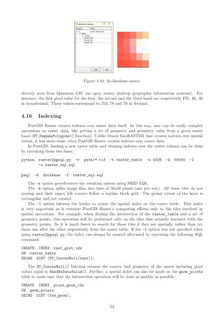
Figure 4.44: In-database raster.<br />
directly seen from Quantum GIS (an open source desktop geographic in<strong>for</strong>mation systems). For<br />
instance, the first pixel value <strong>for</strong> the first, the second and the third band are respectively FD, 4E, 46<br />
in hexadecimal. <strong>The</strong>se values correspond to 253, 78 and 70 in decimal.<br />
4.16 Indexing<br />
<strong>PostGIS</strong> <strong>Raster</strong> creates indexes over raster data itself. In this way, user can do really complex<br />
operations on raster data, like getting a set <strong>of</strong> geometry and geometry value from a given raster<br />
band (ST_DumpAsPolygons() function). Unlike Oracle GeoRASTER that creates indexes over spatial<br />
extent, it has more sense when <strong>PostGIS</strong> <strong>Raster</strong> creates indexes over raster data.<br />
In <strong>PostGIS</strong>, loading a new raster table and creating indexes over the raster column can be done<br />
by executing these two lines:<br />
python raster2pgsql.py -r path/*.tif -t raster_table -s 4326 -k 50x50 -I<br />
-o raster_sql.sql<br />
psql -d database -f raster_sql.sql<br />
<strong>The</strong> -s option georeferences the resulting rasters using SRID 4326.<br />
<strong>The</strong> -k option splits image files into tiles <strong>of</strong> 50x50 pixels (one per row). All these tiles do not<br />
overlap and their upper left corners follow a regular block grid. <strong>The</strong> global extent <strong>of</strong> the layer is<br />
rectangular and not rotated.<br />
<strong>The</strong> -I option in<strong>for</strong>ms the loader to create the spatial index on the raster table. This index<br />
is very important as it restricts <strong>PostGIS</strong> <strong>Raster</strong>’s computing ef<strong>for</strong>ts only to the tiles involved in<br />
spatial operations. For example, when finding the intersection <strong>of</strong> the raster_table and a set <strong>of</strong><br />
geometry points, this operation will be per<strong>for</strong>med only on the tiles that actually intersect with the<br />
geometry points. So it is much faster to search <strong>for</strong> those tiles if they are spatially rather than try<br />
them one after the other sequentially from the raster table. If the -I option was not specified when<br />
using raster2pgsql.py, the index can always be created afterward by executing the following SQL<br />
command:<br />
CREATE INDEX rast_gist_idx<br />
ON raster_table<br />
USING GIST (ST_ConvexHull(rast));<br />
<strong>The</strong> ST_ConvexHull() function returns the convex hull geometry <strong>of</strong> the raster including pixel<br />
values equal to BandNoDataValue(). Further, a spatial index can also be made on the geom_points<br />
table to make sure that the intersection operation will be done as quickly as possible:<br />
CREATE INDEX point_geom_idx<br />
ON geom_points<br />
USING GIST (the_geom);<br />
53


