

PostGIS Raster : Extending PostgreSQL for The Support of ... - CoDE
PostGIS Raster : Extending PostgreSQL for The Support of ... - CoDE
PostGIS Raster : Extending PostgreSQL for The Support of ... - CoDE

Create successful ePaper yourself
Turn your PDF publications into a flip-book with our unique Google optimized e-Paper software.
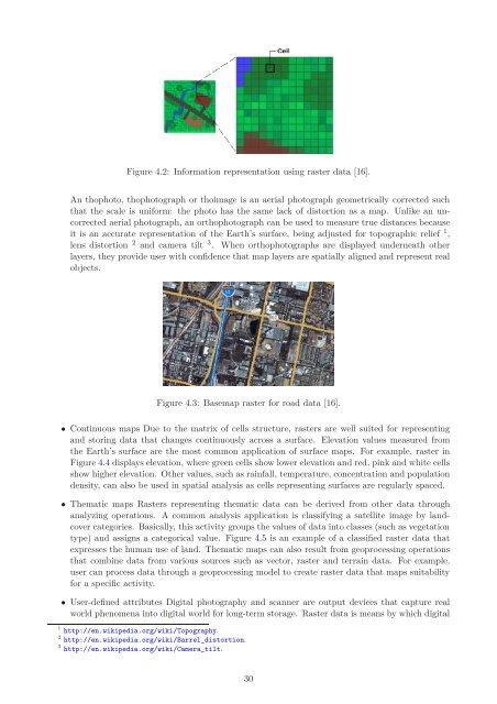
Figure 4.2: In<strong>for</strong>mation representation using raster data [16].<br />
An thophoto, thophotograph or thoimage is an aerial photograph geometrically corrected such<br />
that the scale is uni<strong>for</strong>m: the photo has the same lack <strong>of</strong> distortion as a map. Unlike an uncorrected<br />
aerial photograph, an orthophotograph can be used to measure true distances because<br />
it is an accurate representation <strong>of</strong> the Earth’s surface, being adjusted <strong>for</strong> topographic relief 1 ,<br />
lens distortion 2 and camera tilt 3 . When orthophotographs are displayed underneath other<br />
layers, they provide user with confidence that map layers are spatially aligned and represent real<br />
objects.<br />
Figure 4.3: Basemap raster <strong>for</strong> road data [16].<br />
• Continuous maps Due to the matrix <strong>of</strong> cells structure, rasters are well suited <strong>for</strong> representing<br />
and storing data that changes continuously across a surface. Elevation values measured from<br />
the Earth’s surface are the most common application <strong>of</strong> surface maps. For example, raster in<br />
Figure 4.4 displays elevation, where green cells show lower elevation and red, pink and white cells<br />
show higher elevation. Other values, such as rainfall, temperature, concentration and population<br />
density, can also be used in spatial analysis as cells representing surfaces are regularly spaced.<br />
• <strong>The</strong>matic maps <strong>Raster</strong>s representing thematic data can be derived from other data through<br />
analyzing operations. A common analysis application is classifying a satellite image by landcover<br />
categories. Basically, this activity groups the values <strong>of</strong> data into classes (such as vegetation<br />
type) and assigns a categorical value. Figure 4.5 is an example <strong>of</strong> a classified raster data that<br />
expresses the human use <strong>of</strong> land. <strong>The</strong>matic maps can also result from geoprocessing operations<br />
that combine data from various sources such as vector, raster and terrain data. For example,<br />
user can process data through a geoprocessing model to create raster data that maps suitability<br />
<strong>for</strong> a specific activity.<br />
• User-defined attributes Digital photography and scanner are output devices that capture real<br />
world phenomena into digital world <strong>for</strong> long-term storage. <strong>Raster</strong> data is means by which digital<br />
1 http://en.wikipedia.org/wiki/Topography.<br />
2 http://en.wikipedia.org/wiki/Barrel_distortion.<br />
3 http://en.wikipedia.org/wiki/Camera_tilt.<br />
30


