

PostGIS Raster : Extending PostgreSQL for The Support of ... - CoDE
PostGIS Raster : Extending PostgreSQL for The Support of ... - CoDE
PostGIS Raster : Extending PostgreSQL for The Support of ... - CoDE

Create successful ePaper yourself
Turn your PDF publications into a flip-book with our unique Google optimized e-Paper software.
2.4.2 Data <strong>The</strong>me<br />
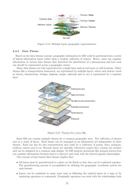
Figure 2.14: Multiple layers geographic representation.<br />
Based on the data themes concept, geographic in<strong>for</strong>mation in GIS could be partitioned into a series<br />
<strong>of</strong> logical in<strong>for</strong>mation layers rather than a random collection <strong>of</strong> objects. Hence, users can organize<br />
in<strong>for</strong>mation in various data themes that described the distribution <strong>of</strong> a phenomenon and how each<br />
one should be represented across a geographic extent.<br />
Many data themes are best represented by a single layer such as soil types or well locations. Other<br />
themes like a transportation framework, are represented by multiple layers, where each feature (such<br />
as streets, intersections, bridges, highway ramps, railroads and so on) is represented by a separate<br />
layer.<br />
Figure 2.15: <strong>The</strong>mes <strong>for</strong> a area [30].<br />
Each GIS can contain multiple themes <strong>for</strong> a common geographic area. <strong>The</strong> collection <strong>of</strong> themes<br />
acts as a stack <strong>of</strong> layers. Each theme can be managed as an in<strong>for</strong>mation set independent <strong>of</strong> other<br />
themes. Each one has its own representation and could be a collection <strong>of</strong> points, lines, polygons,<br />
surfaces, rasters and so on. Because layers are spatially referenced, maybe they overlap one another<br />
and can be displayed in a common map display. So GIS analysis operations like polygon intersection<br />
can combine in<strong>for</strong>mation between layers to discover and work with the derived spatial relationships.<br />
<strong>The</strong> concept <strong>of</strong> layer-based data themes implies that:<br />
• All layers must be georeferenced to a place on the Earth so that they can be combined together.<br />
<strong>The</strong> georeferencing process is accomplished by defining the geographic coordinate system <strong>for</strong><br />
each dataset.<br />
• Layers can be combined in many ways such as following the ordered layers in a map or by<br />
employing operators or commands. Geographic operators can work with the relationships both<br />
12


