

PostGIS Raster : Extending PostgreSQL for The Support of ... - CoDE
PostGIS Raster : Extending PostgreSQL for The Support of ... - CoDE
PostGIS Raster : Extending PostgreSQL for The Support of ... - CoDE

You also want an ePaper? Increase the reach of your titles
YUMPU automatically turns print PDFs into web optimized ePapers that Google loves.
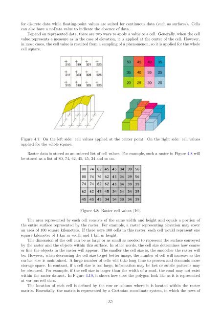
<strong>for</strong> discrete data while floating-point values are suited <strong>for</strong> continuous data (such as surfaces). Cells<br />
can also have a noData value to indicate the absence <strong>of</strong> data.<br />
Depend on represented data, there are two ways to apply a value to a cell. Generally, when the cell<br />
value represents a measure as in the case <strong>of</strong> elevation, it is applied at the center <strong>of</strong> the cell. However,<br />
in most cases, the cell value is resulted from a sampling <strong>of</strong> a phenomenon, so it is applied <strong>for</strong> the whole<br />
cell square.<br />
Figure 4.7: On the left side: cell values applied at the center point. On the right side: cell values<br />
applied <strong>for</strong> the whole square.<br />
<strong>Raster</strong> data is stored as an ordered list <strong>of</strong> cell values. For example, such a raster in Figure 4.8 will<br />
be stored as a list <strong>of</strong> 80, 74, 62, 45, 45, 34 and so on.<br />
Figure 4.8: <strong>Raster</strong> cell values [16].<br />
<strong>The</strong> area represented by each cell consists <strong>of</strong> the same width and height and equals a portion <strong>of</strong><br />
the entire surface represented by the raster. For example, a raster representing elevation may cover<br />
an area <strong>of</strong> 100 square kilometers. If there were 100 cells in this raster, each cell would represent one<br />
square kilometer <strong>of</strong> 1 km in width and 1 km in height.<br />
<strong>The</strong> dimension <strong>of</strong> the cell can be as large or as small as needed to represent the surface conveyed<br />
by the raster and the objects within this surface. In other words, the cell size determines how coarse<br />
or fine the objects in the raster will appear. <strong>The</strong> smaller the cell size is, the smoother the raster will<br />
be. However, when decreasing the cell size to get better image, the number <strong>of</strong> cell will increase as the<br />
surface size is maintained. A large number <strong>of</strong> cells will take long time to process and demands more<br />
storage space. In contrast, if a cell size is too large, in<strong>for</strong>mation may be lost or subtle patterns may<br />
be obscured. For example, if the cell size is larger than the width <strong>of</strong> a road, the road may not exist<br />
within the raster dataset. In Figure 4.10, it shows how does the polygon look like as it is represented<br />
at various cell sizes.<br />
<strong>The</strong> location <strong>of</strong> each cell is defined by the row or column where it is located within the raster<br />
matrix. Essentially, the matrix is represented by a Cartesian coordinate system, in which the rows <strong>of</strong><br />
32


