

NEW_Accomplishments.indd - IRIS
NEW_Accomplishments.indd - IRIS
NEW_Accomplishments.indd - IRIS

Create successful ePaper yourself
Turn your PDF publications into a flip-book with our unique Google optimized e-Paper software.
2006 <strong>IRIS</strong> 5-YEAR PROPOSAL UPWELLING AND DOWNWELLING<br />
Receiver Function Analysis of the Nicoya Peninsula, Costa Rica<br />
Claudia Flores, Susan Schwartz • University of California, Santa Cruz<br />
CRSEIZE (Costa Rica Seismogenic Zone Experiment) was a collaborative effort to identify and describe subduction<br />
zone processes occurring on the southern section of the Middle American Trench. This experiment consisted of deployed<br />
standard <strong>IRIS</strong>/PASSCAL three-component broadband<br />
and short period instruments on land as well<br />
as three-component broadband ocean bottom seismometers<br />
and hydrophones, and geodetic surveying<br />
throughout Costa Rica.<br />
Receiver function analysis using time-domain<br />
deconvolution techniques (Ammon,1991; Ligorría<br />
and Ammon,1999) is applied to broadband<br />
data collected during CRSEIZE to constrain the<br />
depths to major boundaries such as the top of the<br />
subducting slab, the oceanic crust-mantle interface<br />
of the slab, and the base of continental crust in<br />
the overlying plate. Previous tomography studies<br />
using CRSEIZE data (Deshon, 2004; Deshon<br />
and Schwartz, 2004) suggest the existence of a<br />
serpentinized forearc mantle wedge and a change<br />
in the location and depth of the seismogenic zone<br />
from north to south beneath Nicoya Peninsula.<br />
With receiver function analysis, we hope to verify<br />
the depth and range of this mantle wedge and find<br />
other characteristics of the slab-plate interface<br />
where interplate earthquakes occur. Current work<br />
suggests that the velocity contrast resulting from<br />
the slab-continental crust interface seems to be<br />
reduced as you move away from the trench. Other<br />
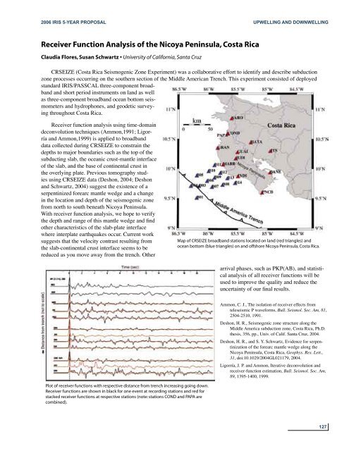
Map of CRSEIZE broadband stations located on land (red triangles) and<br />
ocean bottom (blue triangles) on and offshore Nicoya Peninsula, Costa Rica.<br />
arrival phases, such as PKP(AB), and statistical<br />
analysis of all receiver functions will be<br />
used to improve the quality and reduce the<br />
uncertainty of our final results.<br />
Ammon, C. J., The isolation of receiver effects from<br />
teleseismic P waveforms, Bull. Seismol. Soc. Am, 81,<br />
2504-2510, 1991.<br />
Deshon, H. R., Seismogenic zone structure along the<br />
Middle America subduction zone, Costa Rica, Ph.D.<br />
thesis, 356, pp., Univ. of Calif. Santa Cruz, 2004.<br />
Deshon, H. R., and S. Y. Schwartz, Evidence for serpentinization<br />
of the forearc mantle wedge along the<br />
Nicoya Peninsula, Costa Rica, Geophys. Res. Lett.,<br />
31, doi:10.1029/2004GL021179, 2004.<br />
Ligorría, J. P. and Ammon, Iterative deconvolution and<br />
receiver-function estimation, Bull. Seismol. Soc. Am,<br />
89, 1395-1400, 1999.<br />
Plot of receiver functions with respective distance from trench increasing going down.<br />
Receiver functions are shown in black for one event at recording stations and red for<br />
stacked receiver functions at respective stations (note: stations COND and PAPA are<br />
combined).<br />
127


