

NEW_Accomplishments.indd - IRIS
NEW_Accomplishments.indd - IRIS
NEW_Accomplishments.indd - IRIS

You also want an ePaper? Increase the reach of your titles
YUMPU automatically turns print PDFs into web optimized ePapers that Google loves.
2006 <strong>IRIS</strong> 5-YEAR PROPOSAL EDUCATION AND OUTREACH<br />
The Use of <strong>IRIS</strong> Instrumentation in Undergraduate Education<br />
Gary L. Pavlis • Indiana University<br />
It has been my experience that teaching<br />
college undergraduates basic geophysics is<br />
more effective when taught in a hands-on<br />
fashion. I have taught a senior-level class<br />
in elementary geophysics for a number of<br />
years. I focus the class around a series of<br />
real-data exercises collecting common geophysical<br />
data including gravity, magnetics,<br />
electrical resistivity, electromagnetic, and<br />
one or more seismic methods. <strong>IRIS</strong> recently<br />
acquired several multichannel seismic systems<br />
that I have used over the past several<br />
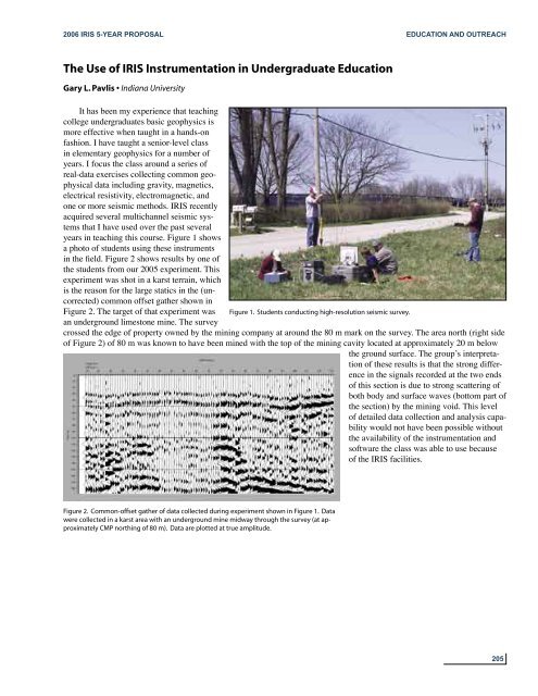
years in teaching this course. Figure 1 shows<br />
a photo of students using these instruments<br />
in the field. Figure 2 shows results by one of<br />
the students from our 2005 experiment. This<br />
experiment was shot in a karst terrain, which<br />
is the reason for the large statics in the (uncorrected)<br />
common offset gather shown in<br />
Figure 2. The target of that experiment was Figure 1. Students conducting high-resolution seismic survey.<br />
an underground limestone mine. The survey<br />
crossed the edge of property owned by the mining company at around the 80 m mark on the survey. The area north (right side<br />
of Figure 2) of 80 m was known to have been mined with the top of the mining cavity located at approximately 20 m below<br />
the ground surface. The groupʼs interpretation<br />
of these results is that the strong difference<br />
in the signals recorded at the two ends<br />
of this section is due to strong scattering of<br />
both body and surface waves (bottom part of<br />
the section) by the mining void. This level<br />
of detailed data collection and analysis capability<br />
would not have been possible without<br />
the availability of the instrumentation and<br />
software the class was able to use because<br />
of the <strong>IRIS</strong> facilities.<br />
Figure 2. Common-offset gather of data collected during experiment shown in Figure 1. Data<br />
were collected in a karst area with an underground mine midway through the survey (at approximately<br />
CMP northing of 80 m). Data are plotted at true amplitude.<br />
205


