

Piedmont Greenway Master Plan - Town of Kernersville
Piedmont Greenway Master Plan - Town of Kernersville
Piedmont Greenway Master Plan - Town of Kernersville
- No tags were found...

Create successful ePaper yourself
Turn your PDF publications into a flip-book with our unique Google optimized e-Paper software.
main <strong>Piedmont</strong> <strong>Greenway</strong> trail along Mountain Street and South Main Street.<br />
• Hester-Vance House - located on Salisbury Street in <strong>Kernersville</strong>, originally was used as slave<br />
quarters.<br />
• Fourth <strong>of</strong> July Park School House - The historic restored one-room schoolhouse stands<br />
in the 16-acre wooded park.<br />
Existing Bicycle and Trail Routes<br />
Many roadways in the study area are not suitable for bicycle traffic. There is a system <strong>of</strong><br />
designated routes and cyclists can use the North Carolina Bicycle Transportation Map as a guide.<br />
This map was developed as part <strong>of</strong> a Bicycle and Pedestrian <strong>Plan</strong> funded by NCDOT, and is available<br />
from NCDOT. The map shows several roadways in the study area and their bicycle suitability<br />
rating—easy, moderate, advanced and use extreme caution—according to traffic conditions, sight<br />
distances and pavement width. In Guilford County, the City <strong>of</strong> Greensboro has also produced a<br />
• Old Mill <strong>of</strong> Guilford - Listed on the National Register <strong>of</strong> Historic Places, the mill is nestled<br />
just outside <strong>of</strong> Greensboro along highway 68 on the banks <strong>of</strong> Beaver Creek. The Mill<br />
started operation around 1764. Products from the Old Mill such as stone ground meals, grits<br />
and flours are sold on the premises and are shipped all over the world.<br />
• Oak Ridge Military Academy - The columned brick buildings <strong>of</strong> the Oak Ridge Military<br />
Academy have stood since the academy was established in 1852. Oak Ridge Military Academy was<br />
founded more than 150 years ago and continues to follow military traditions that have spanned world<br />
wars and other conflicts.<br />
Since both Körner’s Folly and the Hester-Vance House are important historical sites, the <strong>Piedmont</strong><br />
<strong>Greenway</strong> could provide interpretation trail <strong>of</strong> these sites in context <strong>of</strong> the historic evolution <strong>of</strong> the <strong>Town</strong> <strong>of</strong><br />
<strong>Kernersville</strong>.<br />
Careful planning and consideration must be given to these important cultural and historic sites in order<br />
to link <strong>Piedmont</strong> <strong>Greenway</strong> and future corridors within the town. Current access to these facilities from<br />
the corridor is generally inadequate. Many <strong>of</strong> the streets parallel to the corridor could provide access to the<br />
<strong>Piedmont</strong> <strong>Greenway</strong>, while others lack sidewalks and necessary width for safe walking and bicycling. The<br />
<strong>Piedmont</strong> <strong>Greenway</strong> can link to many <strong>of</strong> these historical and cultural sites. The proposed <strong>Piedmont</strong> <strong>Greenway</strong><br />
provides an expansion <strong>of</strong> the community-related theme that in the future can extend into the neighborhoods <strong>of</strong><br />
<strong>Kernersville</strong> and create an exciting partnership among its diverse socioeconomic groups.<br />
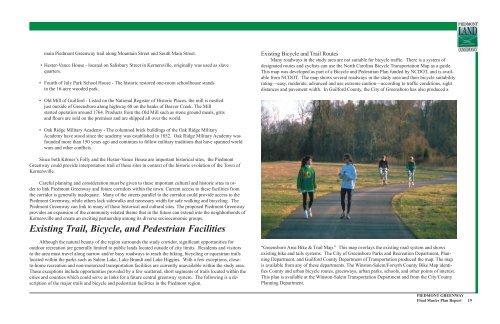
Existing Trail, Bicycle, and Pedestrian Facilities<br />
Although the natural beauty <strong>of</strong> the region surrounds the study corridor, significant opportunities for<br />
outdoor recreation are generally limited to public lands located outside <strong>of</strong> city limits. Residents and visitors<br />
to the area must travel along narrow and/or busy roadways to reach the hiking, bicycling or equestrian trails<br />
located within the parks such as Salem Lake, Lake Brandt and Lake Higgins. With a few exceptions, closeto-home<br />
recreation and non-motorized transportation facilities are currently unavailable within the study area.<br />
These exceptions include opportunities provided by a few scattered, short segments <strong>of</strong> trails located within the<br />
cities and counties which could serve as links for a future central greenway system. The following is a description<br />
<strong>of</strong> the major trails and bicycle and pedestrian facilities in the <strong>Piedmont</strong> region.<br />
“Greensboro Area Bike & Trail Map.” This map overlays the existing road system and shows<br />
existing bike and tails systems. The City <strong>of</strong> Greensboro Parks and Recreation Department, <strong>Plan</strong>ning<br />
Department, and Guilford County Department <strong>of</strong> Transportation produced the map. The map<br />
is available from any <strong>of</strong> these departments. The Winston-Salem/Forsyth County Bike Map identifies<br />
County and urban bicycle routes, greenways, urban parks, schools, and other points <strong>of</strong> interest.<br />
This plan is available at the Winston-Salem Transportation Department and from the City/County<br />
<strong>Plan</strong>ning Department.<br />
PIEDMONT GREENWAY<br />
Final <strong>Master</strong> <strong>Plan</strong> Report 19


