

Piedmont Greenway Master Plan - Town of Kernersville
Piedmont Greenway Master Plan - Town of Kernersville
Piedmont Greenway Master Plan - Town of Kernersville
- No tags were found...

You also want an ePaper? Increase the reach of your titles
YUMPU automatically turns print PDFs into web optimized ePapers that Google loves.
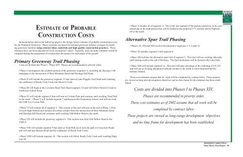
ESTIMATE OF PROBABLE<br />
CONSTRUCTION COSTS<br />
Itemized below and on the following pages is the design team's estimate <strong>of</strong> probable construction costs<br />
for the <strong>Piedmont</strong> <strong>Greenway</strong>. These estimates are based on national greenway industry averages for building<br />
greenway facilities using contract labor, materials and high-quality construction practices. These<br />
estimates have not been adjusted for local construction values. Typically, more accurate estimates would be<br />
compiled during the preparation <strong>of</strong> construction documents for each phase <strong>of</strong> the project.<br />
Primary <strong>Greenway</strong> Trail Phasing<br />
Costs are divided into Phase I - Phase XIV. Phases are recommended in priority order.<br />
• Phase I encompasses the southern portion <strong>of</strong> the greenway (segment 1), including the Business I-40<br />
underpass to the intersection <strong>of</strong> West Mountain Street and Hastings Hill Road.<br />
• Phase II will include the greenway segment 13 that starts at Lake Higgins Trail Head until reaching<br />
the confluence <strong>of</strong> Reedy Fork Creek and Moore's Creek.<br />
• Phase III will begin at the Lewiston Road Trail Head (segment 12) and will follow Moore's Creek to<br />
Northwest School Road.<br />
• Phase IV will include segment 8 that will start at Civitian Park and continue until reaching Triad Park<br />
to the north. • Phase V will include segment 7 and <strong>Kernersville</strong> Elementary School, and will run from<br />
the YMCA to Civitan Park.<br />
• Phase VI will contain all <strong>of</strong> segment 2. This section <strong>of</strong> the trail will start at the end <strong>of</strong> Phase 1 (East<br />
Forsyth High School) and includes the urban corridor from the intersection <strong>of</strong> West Mountain Street<br />
and Hastings Hill Road and continues until reaching Old Hollow Road to the north.<br />
• Phase VII will include the greenway segment 4. This section runs from Old Hollow Road to the<br />
YMCA.<br />
• Phase X incudes all <strong>of</strong> segment 11. This is the last segment <strong>of</strong> the primary greenway to be completed<br />
due to the underpasses that will be needed at the proposed I-73 corridor and at Highway<br />
68 to the south.<br />
Alternative Spur Trail Phasing<br />
• Phase's XI, XII and XIII involve the alternative segments 3, 5, 6 and 14.<br />
• Phase XI includes segment 5 and segment 6.<br />
• Phase XII includes the alternative spur trail <strong>of</strong> segment 3. This trail will use existing sidewalks<br />
until turning north at the end <strong>of</strong> Roxbury. The final destination will be <strong>Kernersville</strong> Lake Park.<br />
• Phase XIII will include segment 14. This trail will take advantage <strong>of</strong> the widening <strong>of</strong> US 220<br />
and will use an existing abandoned railroad corridor to the north to reach Summerfield Elementary<br />
School.<br />
These cost estimates assume that all work will be completed by contract labor. These projects<br />
are viewed as long-term development objectives and no time frame for development has been established.<br />
Costs are divided into Phases I to Phases XIV.<br />
Phases are recommended in priority order.<br />
These cost estimates as <strong>of</strong> 2002 assume that all work will be<br />
completed by contract labor.<br />
These projects are viewed as long-range development objectives<br />
and no time frame for development has been established.<br />
• Phase VIII will include segment 9 that starts at Triad Park (as it exits the park at Crosscreek Road)<br />
and will end near Beeson Road and the confluence <strong>of</strong> Reedy Fork Creek.<br />
• Phase VIIII will include segment 10. This section will follow Reedy Fork Creek until reaching Highway<br />
68.<br />
PIEDMONT GREENWAY<br />
Final <strong>Master</strong> <strong>Plan</strong> Report 60


