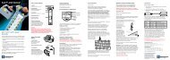
Leica GPS1200+ System Field Manual
Leica GPS1200+ System Field Manual
Leica GPS1200+ System Field Manual

Create successful ePaper yourself
Turn your PDF publications into a flip-book with our unique Google optimized e-Paper software.
Ellipsoid ......................................................... 79ID template .................................................. 104Job ................................................................. 46Line ................................................................ 58Measured coordinate triplet ........................... 55Option ............................................................ 41Point ............................................................... 50Projection ....................................................... 79Transformation ............................................... 79Value in input field ......................................... 13EGNOS, real-time data format .......................... 143Elevation mask .................................................. 118Ellipsoid management, access ........................... 78Ellipsoid, create/edit ............................................ 79Ellipsoids ............................................................. 78End date .............................................................. 59End time .............................................................. 59ENTER ................................................................ 10Equipment setup ................................................. 23ESC ....................................................................... 9European Geostationary Navigation Overlay Service........................................................................... 143Exceeded limitAbsolute coordinate difference ...................... 55Average ......................................................... 55DOP ............................................................. 109Exclude coordinate triplet from averaging ........... 54Expiry date, software maintenance ................... 203ExportASCII Data ..................................................... 92DXF Data ....................................................... 94Format ........................................................... 91LandXML Data ............................................... 95EXPRT ................................................................ 47FFile Viewer ........................................................ 180FILES ................................................................ 110FILT ..................................................................... 42Height smoothing ......................................... 142FilterActivate/deactivate for codes ......................... 63Point, line and area codes ............................. 63Points in Stakeout application program ......... 61Points, lines and areas .................................. 61Symbol ........................................................... 21Filter settings, define ........................................... 42Firmware, version ............................................. 203FormatExport .............................................................91Import .............................................................97Format file, export ASCII .....................................91Format memory device ......................................177Formats .............................................................125Frequency, change for radio ..............................169Front panel ..........................................................23GGAGAN, real-time data format ..........................143General settings ................................................123Geoid model ........................................................81Create from CompactFlash card ....................81Create from internal memory ..........................81GGA, key ...........................................................149GPS Aided Geo Augmentation Navigation ........143Graph, showing satellites ..................................186GROUP ...............................................................66GSI16 ..................................................................97GSI8 ....................................................................97HHeating, screen .................................................129Height filter ........................................................142Height mode ........................................................79Height smoothing ...............................................142Height, pole .........................................................32HELTH ...............................................................118Hidden point, interface .......................................151Hot keys, configure ............................................124IIcons ....................................................................15ID .........................................................................49ID template ........................................................103Create ...........................................................104Delete ...........................................................104Edit ...............................................................104Identification number .........................................121Bluetooth ......................................................167IFACEData export .....................................................92Status ...........................................................204IlluminationKeyboard ......................................................129Screen ..........................................................129ImportData ................................................................98Index <strong>GPS1200+</strong> 217