Proceedings of the 2009 northeastern recreation research symposium
Proceedings of the 2009 northeastern recreation research symposium
Proceedings of the 2009 northeastern recreation research symposium

Create successful ePaper yourself
Turn your PDF publications into a flip-book with our unique Google optimized e-Paper software.
Figure 1.—Map showing <strong>the</strong> location <strong>of</strong> GPS points along <strong>the</strong> Highland Scenic Highway.<br />
trails that visitors may use. Using <strong>the</strong> viewshed tool along<br />
with DEMs and land cover maps <strong>of</strong> <strong>the</strong> area, analysts<br />
can determine <strong>the</strong> total area <strong>of</strong> diff erent land cover types<br />
visible from particular points on <strong>the</strong> ground.<br />
Maximum visibility, however, does not necessarily<br />
correspond with scenic beauty. Scenic beauty is a relative<br />
measure <strong>of</strong> visual preference for a landscape (Daniel<br />
and Boster 1976), which may also vary with season.<br />
Th erefore, selection <strong>of</strong> <strong>the</strong> best sites for scenic beauty<br />
in <strong>the</strong> natural environment requires integration <strong>of</strong> <strong>the</strong><br />
visibility factor with perceived beauty metrics. Most<br />
<strong>research</strong> on scenic beauty assessments has focused on<br />
local features, ra<strong>the</strong>r than distant views. Adequate models<br />
<strong>of</strong> distant views have not been developed (Meitner and<br />
Daniel 1997). Th erefore, <strong>the</strong> purpose <strong>of</strong> this paper was<br />
to model <strong>the</strong> perceived scenic beauty <strong>of</strong> <strong>the</strong> Highland<br />
Scenic Highway (HSH), West Virginia, in early and late<br />
fall <strong>of</strong> 2007 using both public preferences and viewshed<br />
analysis. Th e specifi c objectives were to explore what and<br />
how much can be seen along <strong>the</strong> HSH in West Virginia<br />
and to model <strong>the</strong> perceived beauty <strong>of</strong> <strong>the</strong> HSH with <strong>the</strong><br />
visible land cover features.<br />
2.0 METHODOLOGY<br />
2.1 Study Area<br />
Th e section <strong>of</strong> <strong>the</strong> HSH selected for this study is<br />
approximately 69.2 km long and runs through<br />
Pocahontas, Greenbrier, and Nicholas counties in West<br />
Virginia. Th e highway passes through mountainous<br />
terrain <strong>of</strong> <strong>the</strong> Alleghany Highland and Plateau. It is one<br />
<strong>of</strong> <strong>the</strong> most forested scenic highways in <strong>the</strong> state. Th e<br />
elevation along <strong>the</strong> highway ranges from 708 m to more<br />
than 1371 m above mean sea level.<br />
2.2 Dataset<br />
Th e data used for calculating <strong>the</strong> viewshed included<br />
topography from 30-m U.S. Geological Surveys, DEMs,<br />
and land cover maps created using Th ematic Mapper<br />
satellite images for <strong>the</strong> WV Gap Analysis Project (GAP)<br />
(Strager and Yuill 2002). In addition, GPS points and<br />
photographs <strong>of</strong> <strong>the</strong> study area were used. Th e eff ect <strong>of</strong><br />
vegetation on <strong>the</strong> viewable area was estimated by adding<br />
<strong>the</strong> average height <strong>of</strong> vegetation classes to local elevation<br />
in <strong>the</strong> DEMs. Th e height <strong>of</strong> <strong>the</strong> vegetation was estimated<br />
using data on <strong>the</strong> average height <strong>of</strong> trees from <strong>the</strong> U. S.<br />
Department <strong>of</strong> Agriculture site (http://fi atools.fs.fed.us/<br />
fi adb-downloads/datamart.html). Th e estimated average<br />
height <strong>of</strong> <strong>the</strong> trees for <strong>the</strong> study area was 17.5 m.<br />
2.3 Viewshed Calculation<br />
Sixteen GPS points were selected along <strong>the</strong> highway.<br />
Some <strong>of</strong> <strong>the</strong> selected points were located at mountain<br />
ridges or existing overlooks, and some were random<br />
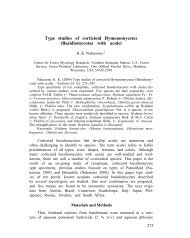
points along <strong>the</strong> highway. Figure 1 shows <strong>the</strong> location<br />
<strong>of</strong> <strong>the</strong> 16 points along <strong>the</strong> highway (point 1 to point 16<br />
from left to right). Th ese GPS points were used as input<br />
data along with DEMs <strong>of</strong> West Virginia for <strong>the</strong> viewshed<br />
analysis. Land cover maps were used to calculate <strong>the</strong> area<br />
<strong>of</strong> each land cover type visible from each <strong>of</strong> <strong>the</strong> sites.<br />
<strong>Proceedings</strong> <strong>of</strong> <strong>the</strong> <strong>2009</strong> Nor<strong>the</strong>astern Recreation Research Symposium GTR-NRS-P-66<br />
181