- Page 1 and 2:
STANDARDIZATION OF ENVIRONMENTAL DA
- Page 3 and 4:
The designations employed and the p
- Page 5 and 6:
Chapter 8 Chapter 9 Chapter 10 Chap
- Page 7 and 8:
Standardization of Environmental Da
- Page 9 and 10:
Foreword Statement by the Secretary
- Page 11 and 12:
Participants Mr. Baïdy Diène, Spe
- Page 13 and 14:
Dr. Rahul Sharma, Scientist, Nation
- Page 15 and 16:
“Necessary measures shall be take
- Page 17 and 18:
three working groups, on chemistry
- Page 19 and 20:
Some vital procedures are not amena
- Page 21 and 22:
(Kingston, Jamaica), 289 pp. The re
- Page 23 and 24:
He observed that the Regulations, u
- Page 25 and 26:
Dr. Smith reviewed in detail the pr
- Page 27 and 28:
Notes and References 1. Internation
- Page 29 and 30:
- The Authority must be notified of
- Page 31 and 32:
area, but within one or two years e
- Page 33 and 34:
- A description of proposed measure
- Page 35 and 36:
??It has been previously made avail
- Page 37 and 38:
SUMMARY OF DISCUSSION Financial obl
- Page 39 and 40:
In the discussion, flexibility in t
- Page 41 and 42:
Chapter 2 Overview of the Authority
- Page 43 and 44:
2.3. Chemical oceanography - Object
- Page 45 and 46:
3. Environmental Impact Assessment
- Page 47 and 48:
?? Nodule crushing methods, if any;
- Page 49 and 50:
SUMMARY OF DISCUSSION Biological co
- Page 51 and 52:
The Secretary-General responded tha
- Page 53 and 54:
edeposit on the surrounding seafloo
- Page 55 and 56:
1.3. Importance of standardization
- Page 57 and 58:
detailed guidelines recommended by
- Page 59 and 60:
and “transect physical oceanograp
- Page 61 and 62:
eference to seven biological catego
- Page 63 and 64:
2.4.1.6. Demersal scavengers It is
- Page 65 and 66:
e measured must be specified. I rec
- Page 67 and 68:
3.2. Taxonomic standardization I st
- Page 69 and 70:
ecological comparisons. Several oth
- Page 71 and 72:
that supplied the benthos with ener
- Page 73 and 74:
speculate on the rates of recolonis
- Page 75 and 76:
Geographical variation Speaking nex
- Page 77 and 78:
Knowledge limitations Concluding hi
- Page 79 and 80:
on the other hand it turned out tha
- Page 81 and 82:
ecolonisation rates. If the area wa
- Page 83 and 84:
had been used to look at resediment
- Page 85 and 86:
ecover. In the case of the seabed,
- Page 87 and 88:
13. International Seabed Authority,
- Page 89 and 90:
Chapter 3 Current State of Knowledg
- Page 91 and 92:
side. Exploration contractors will
- Page 93 and 94:
However, for scientific endeavours
- Page 95 and 96:
50-m altitude (i.e., within the bot
- Page 97 and 98:
2.4. Biological communities The LTC
- Page 99 and 100:
sediment/water interface of each bo
- Page 101 and 102:
strata), with sampling on a diel ba
- Page 103 and 104:
abyssal seafloor communities 25 sea
- Page 105 and 106:
very useful to the design of baseli
- Page 107 and 108:
PRESENTATION ON DEEP-SEA ECOSYSTEM
- Page 109 and 110:
Most of the seabed macrofauna in th
- Page 111 and 112:
the CCFZ. Without understanding lev
- Page 113 and 114:
One could also make the opposite ar
- Page 115 and 116:
had to be mined each day. Assuming
- Page 117 and 118:
There was an increasing appreciatio
- Page 119 and 120:
whether the effects were severe in
- Page 121 and 122:
collect samples wherever he went in
- Page 123 and 124:
Forschungsverbund Tiefsee-Umweltsch
- Page 125 and 126:
25. C.R. Smith et al (1997), Latitu
- Page 127 and 128:
esistance and resilience of seafloo
- Page 129 and 130:
other parameters had been recorded
- Page 131 and 132:
environment, a conscious effort was
- Page 133 and 134:
oceanographic measurements, monitor
- Page 135 and 136:
Chapter 4 Priorities for Environmen
- Page 137 and 138:
and government organisations have c
- Page 139 and 140:
information. On the other hand, the
- Page 141 and 142:
contractors (1.5 x 10 6 km 2 ). Dur
- Page 143 and 144:
Contractors must carefully optimise
- Page 145 and 146:
3.4. Benthic and demersal community
- Page 147 and 148:
for environmental characterisation
- Page 149 and 150:
4.2.3. Observations of marine mamma
- Page 151 and 152:
Local topography exerts significant
- Page 153 and 154:
ooze can consist of more than 90% o
- Page 155 and 156:
Table 3 Benthic currents in the CCF
- Page 157 and 158:
5.3.2. Benthic currents and sedimen
- Page 159 and 160:
polychaetes and nematodes in the co
- Page 161 and 162:
from the DOMES sites illustrate thi
- Page 163 and 164:
5.5.1.1. Climate The climate is dom
- Page 165 and 166:
Surface temperatures typically reve
- Page 167 and 168:
process. With increasing depth, pho
- Page 169 and 170:
phosphorus. In the oceanic environm
- Page 171 and 172:
are found at about 40 m, while the
- Page 173 and 174:
often seen closer to land. The Paci
- Page 175 and 176:
square kilometres in two different
- Page 177 and 178:
In closing, Morgan discussed how to
- Page 179 and 180:
C.L. Morgan, N.A. Odunton and A.T.
- Page 181 and 182:
26. Y. Morel and R. LeSuave (1986),
- Page 183 and 184:
45. United States Office of Ocean M
- Page 185 and 186:
68. Ibid. 69. Ibid. 70. Ibid. 71. T
- Page 187 and 188:
300 m deep basins alternating with
- Page 189 and 190:
in water depths at or close to the
- Page 191 and 192:
eyond the semi-liquid layer, to whi
- Page 193 and 194:
3.3. Modelling long-term propagatio
- Page 195 and 196:
) Take two or three cores at each s
- Page 197 and 198:
facies type, which was affected by
- Page 199 and 200:
Another useful way to define the to
- Page 201 and 202:
transport would not take any partic
- Page 203 and 204:
Use of geological data for environm
- Page 205 and 206:
Mining of Polymetallic Nodules from
- Page 207 and 208:
About 50 scientists were involved i
- Page 209 and 210:
the programme was to learn the beha
- Page 211 and 212:
econciled with the findings of othe
- Page 213 and 214:
located at almost every 2-minute in
- Page 215 and 216:
?? Geological studies: ?? Bathymetr
- Page 217 and 218:
the tracks. The range and average o
- Page 219 and 220:
designed to minimise the plume risi
- Page 221 and 222:
SUMMARY OF DISCUSSION Sediment cond
- Page 223 and 224:
mining system would remain suspende
- Page 225 and 226:
design a collector. That device had
- Page 227 and 228:
?? For the upper layer environmenta
- Page 229 and 230:
Figure 1 Survey components of the u
- Page 231 and 232:
Figure 2. Map of the investigation
- Page 233 and 234:
2.4. Sample processing and size cat
- Page 235 and 236:
Figure 5 Schematic illustration of
- Page 237 and 238:
JET 3: the field study conducted on
- Page 239 and 240:
Besides the above, measurements wer
- Page 241 and 242:
3.3. Sample processing and size cat
- Page 243 and 244:
Figure 10. Location of the five FDC
- Page 245 and 246:
?? Calculation from discharged sedi
- Page 247 and 248:
5. Total mass of dried sediment dis
- Page 249 and 250:
Figure 14 Thickness contour map of
- Page 251 and 252:
The use of GIS has many advantages.
- Page 253 and 254: than the 200-metre depth distributi
- Page 255 and 256: Among the chemical parameters, the
- Page 257 and 258: SUMMARY OF DISCUSSION Impact of dis
- Page 259 and 260: Mining (Metal Mining Agency of Japa
- Page 261 and 262: Chapter 9 Data Standards Utilised i
- Page 263 and 264: the three major categories of the b
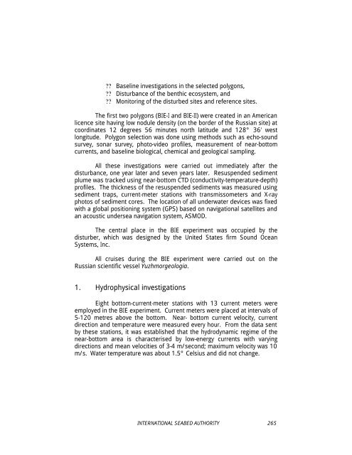
- Page 265 and 266: Various kinds of equipment were bei
- Page 267 and 268: for biological research, but if it
- Page 269 and 270: Asked for an estimate of the microb
- Page 271 and 272: Sibuet agreed with Smith, emphasisi
- Page 273 and 274: Chapter 10 Data Standards Utilised
- Page 275 and 276: 2.1.4. High precision depth recorde
- Page 277 and 278: 2.2.6. Piston corer ?? Acquiring bo
- Page 279 and 280: 2.3.3. Geotechnical properties ?? U
- Page 281 and 282: ?? Concentration of cells by settle
- Page 283 and 284: 3.3. Zooplankton (protozoan) 3.3.1.
- Page 285 and 286: ?? The abundance data from the phot
- Page 287 and 288: 4.3. Statistical analysis Kriging w
- Page 289 and 290: Figure 4 Sampling-sites map of KODO
- Page 291 and 292: o Temperature ( C) o 5 N o 6 N o 7
- Page 293 and 294: PRESENTATION AND DISCUSSION OF DATA
- Page 295 and 296: een placed in the experimental bott
- Page 297 and 298: phosphate concentration had been me
- Page 299 and 300: KORDI was having trouble with a 10-
- Page 301 and 302: Other environmental studies Lee sai
- Page 303: Chapter 11 Data Standards Utilised
- Page 307 and 308: and 5-6 cm. Samples from all layers
- Page 309 and 310: 4. Proposals 1. To evaluate environ
- Page 311 and 312: second part of BIE, beginning in 20
- Page 313 and 314: counted and classified into higher
- Page 315 and 316: procedures could be followed for th
- Page 317 and 318: PART III Environmental Parameters N
- Page 319 and 320: a third trap beneath the two that h
- Page 321 and 322: of a nodule-strewn plain, picking u
- Page 323 and 324: Possible impacts on the pelagic com
- Page 325 and 326: Chapter 12 Chemical Oceanography Dr
- Page 327 and 328: To obtain quality data on metals in
- Page 329 and 330: egin right from the start of the ac
- Page 331 and 332: was ambient water. The system teste
- Page 333 and 334: characteristics of sediments in the
- Page 335 and 336: discussed by Dr. Gerald Matisoff (c
- Page 337 and 338: Citing difficulties in measuring sh
- Page 339 and 340: Sediment traps A participant asked
- Page 341 and 342: Commenting on a suggestion to utili
- Page 343 and 344: diversity at the community level. A
- Page 345 and 346: Stuart and Rex 22 have shown that l
- Page 347 and 348: the fauna in these samples. If the
- Page 349 and 350: made up of mountain chains, faultin
- Page 351 and 352: adiated extensively there in many e
- Page 353 and 354: etween shelf and slope adjoined an
- Page 355 and 356:
een mined some time before, and con
- Page 357 and 358:
Another participant observed that h
- Page 359 and 360:
identifying species at various loca
- Page 361 and 362:
addition, the multi-corer was being
- Page 363 and 364:
20. R.J. Etter and L.S. Mullineaux
- Page 365 and 366:
Chapter 15 Seafloor Macrofauna in P
- Page 367 and 368:
Figure 2 The plough-harrow. 1. Resu
- Page 369 and 370:
deeper sediment and soft, partly re
- Page 371 and 372:
Year No. Year Phase 0 1989 Baseline
- Page 373 and 374:
uttons on the onboard unit so that
- Page 375 and 376:
a stainless steel collar with three
- Page 377 and 378:
the majority of samples were obtain
- Page 379 and 380:
whirled up into the plume may reset
- Page 381 and 382:
to recover (see above) and the comm
- Page 383 and 384:
Different methods have been propose
- Page 385 and 386:
For the 12 most abundant families o
- Page 387 and 388:
area in the southeast Pacific Ocean
- Page 389 and 390:
should be treated with a lot of wat
- Page 391 and 392:
ack-up camera, had also housed smal
- Page 393 and 394:
in 1992 compared to 1989. Seven yea
- Page 395 and 396:
distribution of the samples. Anothe
- Page 397 and 398:
have reacted similarly by becoming
- Page 399 and 400:
Another participant thought that th
- Page 401 and 402:
Need for a large-scale experiment A
- Page 403 and 404:
3. E.J. Foell, H. Thiel and G. Schr
- Page 405 and 406:
22. Detailed description in ibid. 2
- Page 407 and 408:
held in Sanya, Hainan Island, Peopl
- Page 409 and 410:
1.1. Meiofaunal abundance Some exam
- Page 411 and 412:
Central Equatorial Pacific 2° N 44
- Page 413 and 414:
Nematode ecological diversity is un
- Page 415 and 416:
discrete but morphologically simila
- Page 417 and 418:
too difficult to deal with and were
- Page 419 and 420:
Institution, had collected 148 spec
- Page 421 and 422:
California and the Rockall Trough),
- Page 423 and 424:
Another factor supposed to influenc
- Page 425 and 426:
shallow water, where nematodes were
- Page 427 and 428:
speaking, TNHM had the types for an
- Page 429 and 430:
samples every two days. The equipme
- Page 431 and 432:
marine nematologist there were 10,0
- Page 433 and 434:
core might have worked because the
- Page 435 and 436:
16. P.J.D. Lambshead (2001), Marine
- Page 437 and 438:
Chapter 17 Pelagic Community Impact
- Page 439 and 440:
1.2. Potential phytoplankton impact
- Page 441 and 442:
spatial variability. Sampling shoul
- Page 443 and 444:
2.6. Zooplankton Depth-stratified s
- Page 445 and 446:
helping to achieve consensus among
- Page 447 and 448:
One potential impact of discharging
- Page 449 and 450:
Consequently, in sampling these reg
- Page 451 and 452:
elevated levels of cadmium. It migh
- Page 453 and 454:
?? Marine mammals and seabirds: The
- Page 455 and 456:
Asked whether the impact would be d
- Page 457 and 458:
on some of the mesopelagic fishes.
- Page 459 and 460:
9. K.H. Coale (1998), The Galapagos
- Page 461 and 462:
PART IV Sampling, Database and Stan
- Page 463 and 464:
In the discussion, one participant
- Page 465 and 466:
The paper went on to make recommend
- Page 467 and 468:
1. Challenges for Developing a Base
- Page 469 and 470:
and impact sites were attributed to
- Page 471 and 472:
differential response of the commun
- Page 473 and 474:
etter assess the spatial extent of
- Page 475 and 476:
x x x x x x x x x x x x x x x x x x
- Page 477 and 478:
Challenges to sampling studies If p
- Page 479 and 480:
un. On the other hand, if test mini
- Page 481 and 482:
the plume, could be a large area wi
- Page 483 and 484:
e needed to elucidate data about do
- Page 485 and 486:
and he might be underestimating. An
- Page 487 and 488:
Chapter 19 Database Requirements Dr
- Page 489 and 490:
• Professional Development and Ma
- Page 491 and 492:
model used at the British Museum of
- Page 493 and 494:
Agreeing, Rex said the management o
- Page 495 and 496:
the importance of including informa
- Page 497 and 498:
Environmental concerns The Secretar
- Page 499 and 500:
Asking participants for their views
- Page 501 and 502:
A participant suggested that echino
- Page 503 and 504:
detritus in the oceans. Smith agree
- Page 505 and 506:
oceanographer, go to sea with the v
- Page 507 and 508:
A participant observed that, by the
- Page 509 and 510:
controversial items such as macrofa
- Page 511 and 512:
Chapter 21 Standardization Strategi
- Page 513 and 514:
have described methods for the stud
- Page 515 and 516:
a. Direct impacts along the track o
- Page 517 and 518:
3.3.2. Water column As the operatio
- Page 519 and 520:
3.6. Applications of environmental
- Page 521 and 522:
d. The duration of the operations w
- Page 523 and 524:
?? Avoiding the disturbance of the
- Page 525 and 526:
information for consideration and a
- Page 527 and 528:
?? Total inorganic carbon by coulom
- Page 529 and 530:
Table 2 Core sections analyzed for
- Page 531 and 532:
4200- 4400 4400- 4600 4600- 4800 48
- Page 533 and 534:
Besides their utility for impact as
- Page 535 and 536:
Turning to the requirements for fut
- Page 537 and 538:
SUMMARY OF DISCUSSION Size of envir
- Page 539 and 540:
Asked whether he thought the result
- Page 541 and 542:
2. J. S. Chung and K. Tsurusaki (19
- Page 543 and 544:
PART V Conclusions and Recommendati
- Page 545 and 546:
Chapter 22 Report of the Workshop T
- Page 547 and 548:
identified in square brackets [BB =
- Page 549 and 550:
available such information as (1) k
- Page 551 and 552:
y the Commission as ISBA/7/LTC/1/Re
- Page 553 and 554:
1. Sediment Properties Sediment pro
- Page 555 and 556:
Table 2 lists the chemical paramete
- Page 557 and 558:
4. Trace metals in benthic and epi-
- Page 559 and 560:
The following key parameters should
- Page 561 and 562:
enthic boundary layer) to evaluate
- Page 563 and 564:
a. Meteorological variables: sea st
- Page 565 and 566:
3. A.R. Hiby and P.S. Hammond (1989
- Page 567 and 568:
DGPS differential global positionin
- Page 569 and 570:
PEIS P-I POC PON PRZ QA/QC RCM RDBM
- Page 571 and 572:
Discipline Category Parameter Metho
- Page 573 and 574:
Discipline Category Parameter Metho
- Page 575 and 576:
Area Parameters Instruments Levels
- Page 577 and 578:
3b Parameter Variables Methodology


