District II Quebec City-Les Escoumins - Transports Canada
District II Quebec City-Les Escoumins - Transports Canada
District II Quebec City-Les Escoumins - Transports Canada
You also want an ePaper? Increase the reach of your titles
YUMPU automatically turns print PDFs into web optimized ePapers that Google loves.
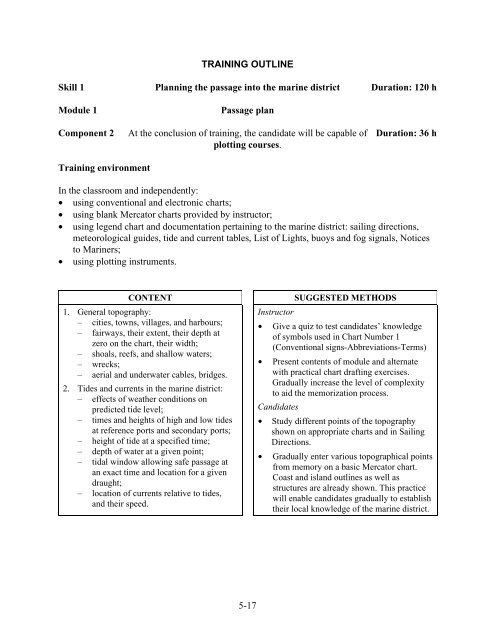
TRAINING OUTLINE<br />
Skill 1 Planning the passage into the marine district Duration: 120 h<br />
Module 1<br />
Passage plan<br />
Component 2 At the conclusion of training, the candidate will be capable of Duration: 36 h<br />
plotting courses.<br />
Training environment<br />
In the classroom and independently:<br />
• using conventional and electronic charts;<br />
• using blank Mercator charts provided by instructor;<br />
• using legend chart and documentation pertaining to the marine district: sailing directions,<br />
meteorological guides, tide and current tables, List of Lights, buoys and fog signals, Notices<br />
to Mariners;<br />
• using plotting instruments.<br />
CONTENT<br />
1. General topography:<br />
– cities, towns, villages, and harbours;<br />
– fairways, their extent, their depth at<br />
zero on the chart, their width;<br />
– shoals, reefs, and shallow waters;<br />
– wrecks;<br />
– aerial and underwater cables, bridges.<br />
2. Tides and currents in the marine district:<br />
– effects of weather conditions on<br />
predicted tide level;<br />
– times and heights of high and low tides<br />
at reference ports and secondary ports;<br />
– height of tide at a specified time;<br />
– depth of water at a given point;<br />
– tidal window allowing safe passage at<br />
an exact time and location for a given<br />
draught;<br />
– location of currents relative to tides,<br />
and their speed.<br />
SUGGESTED METHODS<br />
Instructor<br />
• Give a quiz to test candidates’ knowledge<br />
of symbols used in Chart Number 1<br />
(Conventional signs-Abbreviations-Terms)<br />
• Present contents of module and alternate<br />
with practical chart drafting exercises.<br />
Gradually increase the level of complexity<br />
to aid the memorization process.<br />
Candidates<br />
• Study different points of the topography<br />
shown on appropriate charts and in Sailing<br />
Directions.<br />
• Gradually enter various topographical points<br />
from memory on a basic Mercator chart.<br />
Coast and island outlines as well as<br />
structures are already shown. This practice<br />
will enable candidates gradually to establish<br />
their local knowledge of the marine district.<br />
5-17


