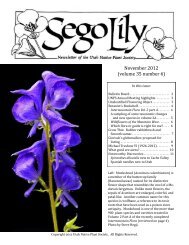
December 2012 Number 1 - Utah Native Plant Society
December 2012 Number 1 - Utah Native Plant Society
December 2012 Number 1 - Utah Native Plant Society

Create successful ePaper yourself
Turn your PDF publications into a flip-book with our unique Google optimized e-Paper software.
Calochortiana <strong>December</strong> <strong>2012</strong> <strong>Number</strong> 1<br />
Cedar Breaks also has a fairly low number of endemic<br />
and rare species.<br />
It is in terms of complementarity that Cedar Breaks<br />
makes its primary contribution to the state’s protected<br />
area network. Jaccard’s Coefficient of Similarity is a<br />
useful formula for measuring complementarity as it<br />
weights similarities in floristic composition between<br />
areas by discrepancies in total species richness. With an<br />
average JCS of 0.128, Cedar Breaks National Monument<br />
has the most dissimilar flora of any parkland considered<br />
in this study other than Golden Spike National<br />
Historic Site. The monument’s low JCS score is a consequence<br />
of its relatively high number of unique plant<br />
species (63 taxa or nearly 18% of the local flora) that<br />
are not protected elsewhere in the state. While many of<br />
these unique species are Claron endemics, the majority<br />
are taxa restricted to elevations above 3000 meters. The<br />
average elevation of Cedar Breaks is 2800 meters, a figure<br />
that exceeds the highest elevation of all other parks<br />
in the <strong>Utah</strong> reserve network. The 14 parklands in the<br />
preserve network analyzed here protect 2007 of <strong>Utah</strong>’s<br />
3659 native and naturalized vascular plant species<br />
(54.8% of the total state flora). Cedar Breaks’ unique<br />
contributions account for 3.1% of the total. Ten of the<br />
24 rare plant species recognized for Cedar Breaks and 9<br />
of the 38 local or regional endemics are among the species<br />
protected nowhere else.<br />
The flora of Cedar Breaks is most similar to that of<br />
Bryce Canyon National Park, with the two parks sharing<br />
227 plant taxa. This degree of similarity is not surprising<br />
given the proximity of the areas and their similar<br />
elevation, vegetation, and geology (both parks have extensive<br />
outcrops of reddish-orange Claron Formation<br />
badlands). Although there is redundancy in the protection<br />
of some species in both parks, this is not necessarily<br />
disadvantageous, as having multiple populations in the<br />
protected area network can reduce the risk of catastrophic<br />
loss and enhance the preservation of multiple genotypes<br />
(Noss and Cooperrider 1994, Margules and Sarkar<br />
2007). Similar redundancy occurs among common montane<br />
forest and meadow species found in both Cedar<br />
Breaks and Timpanogos Cave national monuments,<br />
which despite their great distance from each other share<br />
similar vegetation types and a relatively high Jaccard’s<br />
Coefficient of Similarity.<br />
Based on our analysis of vascular plant checklists<br />
from selected parklands, nearly 45% of the native and<br />
naturalized flora of <strong>Utah</strong> is not represented in the state’s<br />
existing preserve network. Some of the omissions may<br />
be an artifact of incomplete sampling or data synthesis,<br />
especially of wilderness areas, research natural areas,<br />
national wildlife refuges, private nature preserves, and<br />
other protected areas that could not be included in this<br />
analysis for lack of data. Other holes will only be filled<br />
by targeting specific plant taxa identified by analyzing<br />
system-wide complementarity. Fortunately, many of the<br />
missing species occur in specific geographic areas or<br />
habitat types which are, themselves, poorly represented<br />
in the current network. Fertig (2010a) identified just 12<br />
geographic areas that, if protected, would capture 70%<br />
of the missing plant species in the preserve network on<br />
<strong>Utah</strong>’s Colorado Plateau. These are mostly “hotspots”<br />
of unprotected endemism and include the La Sal, Abajo,<br />
Henry, Tushar, Boulder, and Pine Valley mountains,<br />
Book Cliffs, Tavaputs, and Fish Lake plateaus, Uinta<br />
Basin, Sevier Valley, and San Rafael Swell. Statewide,<br />
important gaps also exist in the Great Basin, lowland<br />
riparian areas, and the foothills and montane zones of<br />
northern mountains. Future additions to the network<br />
may well be sites like Cedar Breaks that are of relatively<br />
small size or modest species richness but which have<br />
significant beta diversity.<br />
For any reserve network to function, it will be increasingly<br />
important to keep score of what species are<br />
represented, how many populations are captured, and<br />
whether these populations are of sufficient size or quality<br />
to persist. Annotated species lists and databases of<br />
distributions are critical tools for identifying gaps in the<br />
reserve network. Efficient planning and implementation<br />
of a complete reserve system requires that intelligent<br />
choices be made in selecting geographic areas and species<br />
to target for inclusion. Measuring complementarity,<br />
as we have done for Cedar Breaks and other parklands,<br />
is a key step in the prioritization process.<br />
ACKNOWLEDGEMENTS<br />
We would like to thank Paul Roelandt, Superintendent<br />
of Cedar Breaks National Monument, for encouragement<br />
and support; Cynthia Wanschura and Matt Betenson,<br />
formerly of the Zion National Park GIS lab, for<br />
help with maps; and Amy Tendick and Sarah Topp of<br />
the NPS Northern Colorado Plateau Network for sharing<br />
data on new species occurrences. Thanks also to our 2<br />
anonymous reviewers for helpful suggestions.<br />
REFERENCES<br />
Buchanan, H. 1992. Wildflowers of southwestern<br />
<strong>Utah</strong>. Bryce Canyon Natural History Association and<br />
Falcon Press, Helena, MT. 119 pp.<br />
Dewey, S. and K. Andersen. 2005. An inventory of<br />
invasive non-native plants in Cedar Breaks National<br />
Monument (2004): Final report. <strong>Utah</strong> State University.<br />
Weed Science Research Project #SD0515A.<br />
Evenden, A., M. Miller, M. Beer, E. Nance, S. Daw,<br />
A. Wight, M. Estenson, and L. Cudlip. 2002. Northern<br />
Colorado Plateau Vital Signs Network and Prototype<br />
Cluster, Plan for Natural Resources Monitoring: Phase 1<br />
Report, October 1, 2002 [two volumes]. National Park<br />
Service, Northern Colorado Plateau Network, Moab,<br />
UT. 138 pp. + app.<br />
43