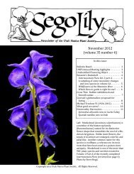
December 2012 Number 1 - Utah Native Plant Society
December 2012 Number 1 - Utah Native Plant Society
December 2012 Number 1 - Utah Native Plant Society

Create successful ePaper yourself
Turn your PDF publications into a flip-book with our unique Google optimized e-Paper software.
Calochortiana <strong>December</strong> <strong>2012</strong> <strong>Number</strong> 1<br />
sima) and Russian knapweed (Acroptilon repens) found<br />
throughout Carson Slough, as well as in the parceled<br />
wet meadows created adjacent to Rogers Spring where<br />
spring water once flowed unobstructed into the slough.<br />
The Refuge is in the habitat restoration stage and will<br />
remain so for many years. Goals of the restoration plan<br />
include restoring natural hydrology and native vegetation<br />
communities, establishing a baseline of existing<br />
vegetation communities, and managing and recovering<br />
rare and endangered species occurring on the Refuge<br />
(McKelvey 2007). The U.S. Fish and Wildlife Service<br />
is conducting long-range, strategic management and<br />
restoration planning at AMNWR to accomplish the recovery<br />
goals of ecosystem and species restoration. The<br />
recovery objective for the Refuge is: “delisting for all<br />
species but the Devil’s Hole pupfish, which can only be<br />
downlisted to threatened status” (Sada 1990).<br />
PRELIMINARY VEGETATION MAPPING AND<br />
CLASSIFICATION<br />
The consulting firm BIO-WEST, Inc. undertook two<br />
studies designed to assist the AMNWR with its restoration<br />
efforts. The first study involved mapping all vegetation<br />
communities to a fine scale (0.25 acres), with the<br />
objective of providing a baseline data set for evaluation<br />
of management actions and future vegetation change,<br />
while the second included a comprehensive survey of<br />
distribution and abundance for twelve rare plant species.<br />
Completion of vegetation mapping on the Refuge has<br />
resulted in 6,237 delineated polygons (Figure 2). Of the<br />
delineated polygons, 5,913 (or 95 percent) have been<br />
assigned a preliminary alliance. Alliance assignments<br />
will be referred to as preliminary until classification is<br />
finalized. These classifications are being derived from<br />
multiple sources including Alliances of the Mojave Desert<br />
(USGS 2004), the National Vegetation Classification<br />
System (Grossman et al. 1998), and community<br />
data available on NatureServe (USGS 2004).<br />
As currently assigned, the alliances comprising the<br />
highest total acreage on the Refuge are the Atriplex confertifolia<br />
Shrubland Alliance, the Larrea tridentata-<br />
Ambrosia dumosa Shrubland Alliance, and the Isocoma<br />
acradenia Shrubland Alliance. Several delineated vegetation<br />
communities do not correspond to any previous<br />
classifications. Often this is the result of a Refuge community<br />
that has a typical dominant species occurring<br />
with an atypical co-dominant. An example of this is the<br />
Atriplex confertifolia Shrubland Alliance compared with<br />
the Atriplex confertifolia-Suaeda moquinii Shrubland<br />
Alliance. The first is a common community throughout<br />
the desert southwest. However, communities with both<br />
Atriplex confertifolia and Sueda moquinii occurring as<br />
co-dominants have not been classified. In these cases a<br />
new alliance classification may be written to best represent<br />
the vegetation community. Once final classifica-<br />
tions have been assigned, botanical descriptions will be<br />
developed for each of the newly created alliances.<br />
Association classifications are also currently in the<br />
developmental stage. Many of the common botanical<br />
associations are applicable to communities at the Refuge.<br />
However, a significant number of the delineated<br />
polygons contain associations of plants that are not<br />
commonly recognized in current classifications. These<br />
associations are being thoroughly researched in order to<br />
identify appropriate resources for classification assignments.<br />
As with the alliance classifications, we expect to<br />
develop several new association classifications to accurately<br />
describe the communities at the Refuge (BIO-<br />
WEST 2008).<br />
The vegetation mapping effort has resulted in a<br />
clearer picture of the diverse composition of vegetation<br />
communities that exist within AMNWR (Figure 2).<br />
Common vegetation communities that have been identified<br />
include Alkali Sink (an extensive shrubland community<br />
dominated by succulent shrubs such as Mojave<br />
seablite, [Suaeda moquinii] that occur adjacent to seasonally<br />
flooded wetlands and along desert washes), as<br />
well as a variety of wetland communities. Lowland Riparian<br />
Woodlands are found in the lowest elevations of<br />
the Refuge; they support a variety of canopy species<br />
such as velvet ash (Fraxinus velutina), mesquite<br />
(Prosopis), and narrow-leaf willow (Salix exigua). One<br />
of the more unique community types is the Alkali Playa<br />
community found west of Crystal Reservoir and Lower<br />
Marsh. This community may support the largest populations<br />
of rare and endemic plants on the Refuge.<br />
The western portion of the Refuge also supports<br />
well-established populations of salt cedar, Russian<br />
knapweed, and five-hook bassia (Bassia hyssopifolia).<br />
The salt cedar communities function as riparian woodlands<br />
and in some cases may provide important wildlife<br />
habitat. Several of the abandoned agricultural fields<br />
have been infested with five-hook bassia. However,<br />
these fields currently receive enough seasonal inundation<br />
to sustain recruiting populations of native wetland<br />
vegetation.<br />
Fairly intact transitional Upland and Desert Shrubland<br />
communities are present in the central and eastern<br />
portions of the Refuge. The Alkali Shrub community<br />
type transitions from a mesic phase as the topography<br />
rises in elevation from west to east. A noticeable<br />
change in vegetation composition occurs as whiteflower<br />
rabbitbrush (Chrysothamnus albidus)-dominated communities<br />
become replaced by alkali goldenbush<br />
(Isocoma acradenia) in the higher elevations where the<br />
water table is less accessible. Moving up into the alluvial<br />
fans, what was once classified as part of Creosote<br />
Shrubland is now classified as Salt Desert Shrubland<br />
composed of desert holly (Atriplex hymenelytra), shad-<br />
81