December 2012 Number 1 - Utah Native Plant Society
December 2012 Number 1 - Utah Native Plant Society
December 2012 Number 1 - Utah Native Plant Society

Create successful ePaper yourself
Turn your PDF publications into a flip-book with our unique Google optimized e-Paper software.
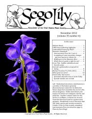
Calochortiana <strong>December</strong> <strong>2012</strong> <strong>Number</strong> 1<br />
prohibiting genetic exchange with nearby populations,<br />
leading to progressive differentiation in plant and animal<br />
species now endemic to the area (Reveal 1980).<br />
Reveal (1980) concluded that four of the endemic Ash<br />
Meadows species (Astragalus phoenix, Mentzelia leucophylla,<br />
Grindelia fraxinopratensis and Centarium<br />
namophilum) are most closely related to congeners presently<br />
found in montane portions of the Intermountain<br />
Region. Their persistence to the present day is attributed<br />
to successful adaptation to a more xeric environment,<br />
the local persistence of water, and to relatively cool<br />
temperatures created by cool air drainage from the surrounding<br />
mountains (Beatley 1977, Reveal 1980).<br />
Current-day vegetation at AMNWR is composed of a<br />
typical Mohave creosote shrub vegetation community in<br />
addition to emergent marshes, wet meadows, distinctive<br />
spring complexes, alkaline desert uplands, and velvet<br />
ash community assemblages, several of which are<br />
known to exist only within the Refuge (Figure 2). These<br />
vegetation communities provide habitat for several rare<br />
and endangered plants, including endemic species, as<br />
well as federally-listed fish and wildlife species (Bio-<br />
West 2007).<br />
CREATION OF THE REFUGE<br />
Several legal and management documents led to the<br />
establishment of AMNWR in 1984. Devil’s Hole National<br />
Monument was declared by presidential proclamation<br />
in 1953, and federal water rights for it were adjudicated<br />
by the Supreme Court in 1976. The 1966 National<br />
Wildlife Refuge System Administration Act provided<br />
direction on Refuge management responsibilities<br />
and guidance. The Endangered Species Act of 1973, as<br />
amended, provided authority for appropriate protection<br />
and management of federally listed species. The U.S.<br />
Fish and Wildlife Service (USFWS) prepared a Warm<br />
Springs Pupfish Recovery Plan in 1976, and a Devil’s<br />
Hole Pupfish Recovery Plan in 1980. The Refuge was<br />
established on 18 June, 1984 with the purchase of<br />
12,654 acres of land from The Nature Conservancy.<br />
The Refuge now occupies a total of 23,488 acres in<br />
the Ash Meadows valley. Since designation, several<br />
documents have guided Refuge management. The 1987<br />
Ash Meadows Refuge Management Plan outlined general<br />
principles for management of Refuge ecosystems<br />
and listed species. The 1990 AMNWR Recovery Plan<br />
for the Listed Species of Ash Meadows outlined recovery<br />
needs for 12 listed species, and identified tasks to be<br />
completed to recover and downlist or delist endangered<br />
species (Sada 1990). In addition to the individual threatened<br />
and endangered plants and animals of Ash Meadows,<br />
the plan recognized the need for the recovery of<br />
Ash Meadows habitats, processes and ecosystems. The<br />
plan also included specific guidance on management<br />
objectives (Sada 1990). In 2000, an Environmental Assessment<br />
was completed (Otis Bay and Stevens Ecological<br />
Consulting 2006).<br />
ECOSYSTEM RESTORATION<br />
Managers at AMNWR are seeking to restore impacted<br />
wetland and desert upland habitats to conditions<br />
that existed 100 years ago in an effort to promote endemic<br />
species recovery. Large-scale ecosystem restoration<br />
plans include impacted habitats in the Carson<br />
Slough and Crystal Reservoir areas. Successful restoration<br />
projects have been completed at Kings Pool in the<br />
Point of Rocks area, and at Jackrabbit Spring, where<br />
visitors can view desert pupfish (Bio-West 2008).<br />
While the Refuge still supports a complex system of<br />
important native communities, portions have been significantly<br />
impacted by historic agricultural and mining<br />
activities. Impacts have included peat mining in marshlands<br />
surrounding Carson Slough in the 1960s and alfalfa<br />
farming and cattle grazing in the 1970s. These activities<br />
reduced discharge from all springs, and many<br />
spring outflows were channelized (Sada 1984). A complex<br />
irrigation system was constructed to support farming<br />
efforts, and resulting agricultural impacts included<br />
grading, cutting irrigation trenches, pumping spring<br />
pools, and creating water holding areas such as Crystal<br />
Reservoir (Otis Bay and Stevens Ecological Consulting<br />
2006). Land disturbances created by farming and grazing<br />
activities, as well as severe alteration of an ecosystem’s<br />
hydrology, can cause considerable change in<br />
vegetation community composition and allow for the<br />
encroachment of weedy and non-native species (Fraser<br />
and Martinez 2002).<br />
Two of the most obvious chronic threats to AMNWR<br />
species and ecosystems involve flow modification and<br />
land conversion associated with former agricultural development<br />
and invasive species. The most severe longterm<br />
threat to the Refuge is potential future groundwater<br />
extraction from the regional carbonate aquifer (Otis Bay<br />
and Stevens Ecological Consulting 2006). Currently, the<br />
Refuge is developing large-scale habitat restoration<br />
plans for Carson Slough, Crystal Reservoir, and other<br />
springs and areas around the Refuge. The proposed<br />
plans consider the removal of the remaining irrigation<br />
system and water control structures in an effort to restore<br />
the hydrology and geomorphology of the Refuge<br />
to a natural system. The hydrologic restoration will also<br />
support vegetation community and wildlife habitat restoration<br />
attempts. However, restoring an existing water<br />
system that has supported an area for decades could<br />
have unintended consequences.<br />
Within the Refuge, impacts resulting from the historic<br />
alterations to the landscape are evident both in the<br />
extensive monocultures of salt cedar (Tamarix ramosis-<br />
79