Impact of Climate Change on Arab Countries - (IPCC) - Working ...
Impact of Climate Change on Arab Countries - (IPCC) - Working ...
Impact of Climate Change on Arab Countries - (IPCC) - Working ...

You also want an ePaper? Increase the reach of your titles
YUMPU automatically turns print PDFs into web optimized ePapers that Google loves.
82<br />
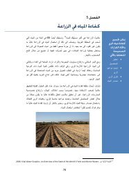
CHAPTER 6<br />
FRESH WATER<br />
<str<strong>on</strong>g>of</str<strong>on</strong>g> relatively high salinity. Overexploitati<strong>on</strong> <str<strong>on</strong>g>of</str<strong>on</strong>g><br />
fresh water lenses plus the expected intrusi<strong>on</strong> <str<strong>on</strong>g>of</str<strong>on</strong>g><br />
sea water in low-elevati<strong>on</strong> areas will certainly<br />
affect the use <str<strong>on</strong>g>of</str<strong>on</strong>g> these aquifers and possibly lead<br />
to the polluti<strong>on</strong> <str<strong>on</strong>g>of</str<strong>on</strong>g> soil as well. If parts <str<strong>on</strong>g>of</str<strong>on</strong>g> the<br />
lands parallel to the sea shore are inundated, then<br />
it will not <strong>on</strong>ly be groundwater that is going to be<br />
affected, the whole landscape will be changed<br />
with vast areas <str<strong>on</strong>g>of</str<strong>on</strong>g> land aband<strong>on</strong>ed and large numbers<br />
<str<strong>on</strong>g>of</str<strong>on</strong>g> citizens displaced.<br />
Nile Basin<br />
The Nile Basin is composed <str<strong>on</strong>g>of</str<strong>on</strong>g> three main subbasins:<br />
• Equatorial Lakes sub-basin.<br />
• Ethiopian plateau sub-basin.<br />
• Bahr El Ghazal sub-basin.<br />
Precipitati<strong>on</strong> <strong>on</strong> the Ethiopian Plateau comes in<br />
<strong>on</strong>e seas<strong>on</strong> and takes around 100 to 110 days<br />
lasting from early June to mid-September. The<br />
sub-basin is marked with steep slopes which<br />
cause heavy storms to erode vast areas <str<strong>on</strong>g>of</str<strong>on</strong>g> land. In<br />
the Bahr El Ghazal sub-basin, land is fairly flat<br />
and precipitati<strong>on</strong> is spread over large areas <str<strong>on</strong>g>of</str<strong>on</strong>g><br />
swamps and marches occupied by wild animals<br />
and aquatic plantati<strong>on</strong>s. The Equatorial Lake<br />
plateau is flat as well; however, the Nile’s route<br />
allows water to flow downstream inside a regular<br />
channel. Both the Bahr El Ghazal and Equatorial<br />
Lakes sub-basins experience two rainy seas<strong>on</strong>s,<br />
<strong>on</strong>e <str<strong>on</strong>g>of</str<strong>on</strong>g> them is l<strong>on</strong>g (4-6 m<strong>on</strong>ths) and the other<br />
is short (2-3 m<strong>on</strong>ths).<br />
Research <strong>on</strong> the Nile Basin has proved that the<br />
river’s natural flow is very sensitive to precipitati<strong>on</strong><br />
which falls <strong>on</strong> the Ethiopian highlands. An<br />
increase <str<strong>on</strong>g>of</str<strong>on</strong>g> 20% in precipitati<strong>on</strong> may increase the<br />
Nile’s natural flow at Aswan by 80%.<br />
C<strong>on</strong>versely, if precipitati<strong>on</strong> is reduced by 20%,<br />
THE WATER EXPLOITATION INDEX (WEI)<br />
The Water Exploitati<strong>on</strong> Index is a figure calculated by dividing<br />
annual total abstracti<strong>on</strong> <str<strong>on</strong>g>of</str<strong>on</strong>g> fresh water by the l<strong>on</strong>g-term average<br />
freshwater resources. It is used as a measure <str<strong>on</strong>g>of</str<strong>on</strong>g> how sustainable<br />
a country’s use <str<strong>on</strong>g>of</str<strong>on</strong>g> fresh water resources is in light <str<strong>on</strong>g>of</str<strong>on</strong>g><br />
water availability.<br />
Source: European Envir<strong>on</strong>ment Agency<br />
the natural flow may fall to a mere 20% <str<strong>on</strong>g>of</str<strong>on</strong>g> the<br />
usual average. To a lesser extent, natural flow is<br />
also sensitive to temperature variati<strong>on</strong>, particularly<br />
in the Equatorial Lakes and Bahr El Ghazal<br />
sub-basins. An increase <str<strong>on</strong>g>of</str<strong>on</strong>g> two degrees Celsius in<br />
temperature might cause the natural flow to fall<br />
to 50% <str<strong>on</strong>g>of</str<strong>on</strong>g> the average in these two sub-basins.<br />
These facts lead to the important c<strong>on</strong>clusi<strong>on</strong> that<br />
Egypt and Sudan are both extremely vulnerable<br />
to increased or decreased rainfall in the Nile<br />
Basin as well as to increased temperature levels.<br />
Both increased and reduced flows have negative<br />
effects <strong>on</strong> the two countries. If the natural flow is<br />
c<strong>on</strong>siderably increased, the storage capacity <str<strong>on</strong>g>of</str<strong>on</strong>g><br />
both water systems might not be sufficient to<br />
accommodate these high flows which might<br />
cause destructive floods. Even if the storage<br />
capacity is adequate, as might be the case in<br />
Egypt, the c<strong>on</strong>veyance and distributi<strong>on</strong> network<br />
<str<strong>on</strong>g>of</str<strong>on</strong>g> canals and drains might not be sufficient. If<br />
the opposite happens, i.e. natural flows are substantially<br />
reduced, the two countries will face<br />
droughts that might not be tolerable.<br />
The applicati<strong>on</strong> <str<strong>on</strong>g>of</str<strong>on</strong>g> Global Circulati<strong>on</strong> Models <strong>on</strong><br />
the Nile Basin flows resulted in variable figures<br />
over a very wide range. This uncertainty c<strong>on</strong>firms<br />
the fact that regi<strong>on</strong>al or even local circulati<strong>on</strong><br />
models are needed. Unfortunately these types <str<strong>on</strong>g>of</str<strong>on</strong>g><br />
models are not available at the present time. The<br />
<strong>on</strong>ly attempts cited are the series <str<strong>on</strong>g>of</str<strong>on</strong>g> studies carried<br />
out by an Egyptian team <str<strong>on</strong>g>of</str<strong>on</strong>g> experts to use the<br />
United Kingdom Meteorological Office<br />
Circulati<strong>on</strong> Model (UKMO) to produce a<br />
regi<strong>on</strong>al model <strong>on</strong> the Nile Basin by downscaling<br />
using statistical and dynamic modelling. This<br />
process needs <strong>on</strong>e to two years to be completed<br />
and the results would yield the highest accuracy<br />
possible using the best globally available techniques<br />
at the present time.<br />
Vulnerability <str<strong>on</strong>g>of</str<strong>on</strong>g> Water Resources<br />
in Turkey<br />
In an interesting study <strong>on</strong> <strong>on</strong>e <str<strong>on</strong>g>of</str<strong>on</strong>g> the major river<br />
basins in Seyhan, Turkey, a team <str<strong>on</strong>g>of</str<strong>on</strong>g> Japanese scientists<br />
(Fujihara et al., 2008) explored the impact<br />
<str<strong>on</strong>g>of</str<strong>on</strong>g> climate change <strong>on</strong> the hydrology and water<br />
flows <str<strong>on</strong>g>of</str<strong>on</strong>g> the river. A dynamic downscaling<br />
method (pseudo Global Warming Method<br />
PGWM) was used to c<strong>on</strong>nect the outputs <str<strong>on</strong>g>of</str<strong>on</strong>g> two<br />
General Circulati<strong>on</strong> Models (GCMs) namely: