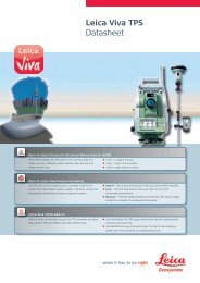
GPT-3000 SERIES - FLT Geosystems
GPT-3000 SERIES - FLT Geosystems
GPT-3000 SERIES - FLT Geosystems

Create successful ePaper yourself
Turn your PDF publications into a flip-book with our unique Google optimized e-Paper software.
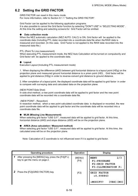
6.2 Setting the GRID FACTORGRID FACTOR can reset in this menu mode.For more information, refer to Section 8.1.1 “Setting the GRID FACTOR”.6 SPECIAL MODE (Menu Mode)Grid Factor can be applied to the following application programs.It is also possible to cancel the Grid factor function by selecting "DON'T USE" in “SELECTING MODE” .At this time the setting and selecting screens for Grid Factor will be omitted.● Data collection modeWhen the NEZ automatic calculation (NEZ AUTO. CALC) is ON, Grid factor will be applied to thecoordinate data (Including PTL data) recorded into a coordinate data file when the RAW data ismeasured and recorded. (In this case, Grid Factor is not applied to the RAW data recorded into themeasured data file.)PTL (Point To Line measurement)When executing PTL measurement mode, the NEZ Auto Calculation wil be turned on compulsorily andGrid factor will be applied to the coordinate data.● LayoutExecution Layout (Including PTL measurement mode)1. When displaying the difference (dHD) between grid horizontal distance to a layout point (HDg) on theprojection plane and measured ground horizontal distance to a prism point (HD) , Grid factor will beapplied to grid distance (HDg) in order to reverse-convert grid distance to ground distance.2. After completion of a layout point, the displayed coordinate data will be applied to grid factor in orderto compare with surveying data and calculated data on the projection plane.(NEW POINT-Side Shot)In side shot method, a new point coordinate data will be applied to grid factor and the new pointcoordinate data will be recorded into a coordinate data file.(NEW POINT - Resection)In resection method, when a new point calculated coordinate data is displayed or recorded, the newpoint coordinate data will be applied to grid factor and the coordinate data will be recorded into acoordinate data file.● MLM (Missing Line Measurement)When selecting grid factor "USE G.F.", measured data will be applied to grid factor. At this time,horizontal distance (dHD) and slope distance (dSD) will be on the projection plane.● AREA (Area calculation / Measured method)When selecting grid factor "USE G.F.", measured data will be applied to grid factor. At this time, thecalculated area will be on the projection plane.Note: Calculation of Z coordinate is not influenced even if it is applied to grid factor.Operating procedure Operation Display1 After pressing the [MENU] key, press the [F4](P↓)key to get the menu on page 2.[MENU][F4]MENU 2/3F1:PROGRAMSF2:GRID FACTORF3:ILLUMINATION P↓2 Press the [F2](GRID FACTOR) key. [F2]GRID FACTOR=0.998843>MODIFY?[YES][NO]6-16