- Page 1:
Air transport services inregional A
- Page 4 and 5:
© Commonwealth of Australia, 2008I
- Page 7:
At a glance• Revenue passengers c
- Page 10 and 11:
2.3.4 Aircraft payload ............
- Page 12 and 13:
TablesTable 1.1Box 1.1ivAirports in
- Page 14 and 15:
Table 4.20Table 5.1Table 5.2Table 5
- Page 16 and 17:
FiguresFigure 1.1 ASGC Remoteness C
- Page 18 and 19:
Figure 3.1Figure 3.2Figure 3.3Figur
- Page 20 and 21:
Figure 4.14 Intrastate air services
- Page 22 and 23:
Executive summaryBackgroundIn recen
- Page 24 and 25:
Executive summaryKey findingsHistor
- Page 26 and 27:
Executive summaryThese contrasting
- Page 28 and 29:
Executive summaryhigh numbers of UC
- Page 30 and 31:
Executive summary4. Air services at
- Page 32:
IntroductionChapter 1
- Page 35 and 36:
BITRE | Report 115certain regional
- Page 37 and 38:
BITRE | Report 1151.4 Project ratio
- Page 39 and 40:
BITRE | Report 115Analyses undertak
- Page 41 and 42:
BITRE | Report 115This definition a
- Page 43 and 44:
BITRE | Report 115Also, in this rep
- Page 45 and 46:
BITRE | Report 115Figure 1.2 Differ
- Page 48 and 49:
Chapter 2Historical trends inregion
- Page 50 and 51:
Chapter 2 | Historical trends in re
- Page 52 and 53:
Chapter 2 | Historical trends in re
- Page 54 and 55:
Chapter 2 | Historical trends in re
- Page 56 and 57:
Chapter 2 | Historical trends in re
- Page 58 and 59:
Chapter 2 | Historical trends in re
- Page 60 and 61:
Chapter 2 | Historical trends in re
- Page 62 and 63:
Chapter 2 | Historical trends in re
- Page 64 and 65:
Chapter 2 | Historical trends in re
- Page 66 and 67:
Chapter 2 | Historical trends in re
- Page 68 and 69:
Chapter 2 | Historical trends in re
- Page 70 and 71:
Chapter 2 | Historical trends in re
- Page 72 and 73:
Chapter 2 | Historical trends in re
- Page 74 and 75:
Chapter 2 | Historical trends in re
- Page 76 and 77:
Chapter 2 | Historical trends in re
- Page 78 and 79:
Chapter 2 | Historical trends in re
- Page 80 and 81:
Chapter 2 | Historical trends in re
- Page 82 and 83:
Chapter 2 | Historical trends in re
- Page 84 and 85:
Chapter 2 | Historical trends in re
- Page 86 and 87:
Chapter 2 | Historical trends in re
- Page 88 and 89:
Chapter 2 | Historical trends in re
- Page 90:
Chapter 3Past performance of air se
- Page 93 and 94:
BITRE | Report 115Between 2000 and
- Page 95 and 96:
BITRE | Report 115Figure 3.3 Per ce
- Page 97 and 98:
BITRE | Report 115Figure 3.5 Averag
- Page 99 and 100:
BITRE | Report 1153.2.1 Flight freq
- Page 101 and 102:
BITRE | Report 1153.2.2 Route densi
- Page 103 and 104:
BITRE | Report 115(b) Number of air
- Page 105 and 106:
BITRE | Report 115Most regional air
- Page 107 and 108:
BITRE | Report 115Figure 3.13 Route
- Page 109 and 110:
BITRE | Report 115As shown in Figur
- Page 111 and 112:
BITRE | Report 115Virgin Blue start
- Page 113 and 114:
BITRE | Report 115Northern Territor
- Page 115 and 116:
BITRE | Report 115Table 3.4Airlines
- Page 117 and 118:
BITRE | Report 115Major regional ai
- Page 119 and 120:
BITRE | Report 115Figure 3.23 Numbe
- Page 121 and 122:
BITRE | Report 115Major regional ai
- Page 123 and 124:
BITRE | Report 115Figure 3.27 Numbe
- Page 125 and 126:
BITRE | Report 115Figure 3.29 Numbe
- Page 127 and 128:
BITRE | Report 11596The number of r
- Page 130:
Chapter 4Access to regional air ser
- Page 133 and 134:
Figure 4.1 Changes in distribution
- Page 135 and 136:
BITRE | Report 115to provide air se
- Page 137 and 138:
BITRE | Report 115Figure 4.2 Inters
- Page 139 and 140:
BITRE | Report 115Figure 4.4 shows
- Page 141 and 142:
BITRE | Report 1154.2.3 Intrastate
- Page 143 and 144:
BITRE | Report 115There were 13 air
- Page 145 and 146:
BITRE | Report 115There were seven
- Page 147 and 148:
BITRE | Report 115QueenslandFigure
- Page 149 and 150:
BITRE | Report 115There were 10 air
- Page 151 and 152:
BITRE | Report 115Figure 4.13 Chang
- Page 153 and 154:
BITRE | Report 115Figure 4.14 Intra
- Page 155 and 156:
BITRE | Report 115Figure 4.16 Intra
- Page 157 and 158:
BITRE | Report 115Figure 4.18 Intra
- Page 159 and 160:
BITRE | Report 1154.3 Airport catch
- Page 161 and 162:
BITRE | Report 115The second analys
- Page 163 and 164:
BITRE | Report 115Table 4.18 shows
- Page 165 and 166:
Figure 4.21 Locations beyond the as
- Page 167 and 168:
BITRE | Report 1154.4 Concluding ob
- Page 170 and 171:
Chapter 5Projections of passengermo
- Page 172 and 173:
Chapter 5 | Projections of passenge
- Page 174 and 175:
Chapter 5 | Projections of passenge
- Page 176 and 177:
Chapter 5 | Projections of passenge
- Page 178 and 179:
Chapter 5 | Projections of passenge
- Page 180 and 181:
Chapter 5 | Projections of passenge
- Page 182 and 183:
Chapter 5 | Projections of passenge
- Page 184 and 185:
Chapter 5 | Projections of passenge
- Page 186 and 187:
Chapter 5 | Projections of passenge
- Page 188 and 189:
Chapter 5 | Projections of passenge
- Page 190 and 191:
Chapter 5 | Projections of passenge
- Page 192:
Chapter 6Air services in regional c
- Page 195 and 196:
BITRE | Report 115Figure 6.1 Region
- Page 197 and 198:
BITRE | Report 115Table 6.3 Distrib
- Page 199 and 200:
BITRE | Report 115Table 6.5 Distrib
- Page 201 and 202:
BITRE | Report 115Table 6.7Distribu
- Page 203 and 204:
BITRE | Report 115Table 6.11 Distri
- Page 205 and 206:
BITRE | Report 115one) provided mor
- Page 207 and 208:
BITRE | Report 115Table 6.16 Distri
- Page 209 and 210:
BITRE | Report 1156.5 Summary and i
- Page 211 and 212:
BITRE | Report 115180Aircraft type
- Page 213 and 214:
BITRE | Report 115It is important t
- Page 216 and 217:
Appendix AHistorical trends inregio
- Page 218 and 219:
Appendix A | Historical trends in r
- Page 220 and 221:
Appendix A | Historical trends in r
- Page 222 and 223:
Appendix A | Historical trends in r
- Page 224 and 225:
Appendix A | Historical trends in r
- Page 226 and 227:
Appendix A | Historical trends in r
- Page 228 and 229:
Appendix A | Historical trends in r
- Page 230:
Appendix BHistorical performance of
- Page 233 and 234:
BITRE | Report 115Table B1 Number o
- Page 235 and 236:
BITRE | Report 115Table B2 Regional
- Page 237 and 238:
BITRE | Report 115Table B2Regional
- Page 239 and 240:
BITRE | Report 115Table B3 Route de
- Page 241 and 242:
BITRE | Report 115Table B3 Route de
- Page 243 and 244:
BITRE | Report 115Table B3 Route de
- Page 245 and 246:
BITRE | Report 115Table B3 Route de
- Page 247 and 248: BITRE | Report 115Table B3 Route de
- Page 249 and 250: BITRE | Report 115Table B3 Route de
- Page 251 and 252: BITRE | Report 115Table B3 Route de
- Page 253 and 254: BITRE | Report 115Table B3 Route de
- Page 255 and 256: BITRE | Report 115Table B3 Route de
- Page 257 and 258: BITRE | Report 115Table B3 Route de
- Page 259 and 260: BITRE | Report 115Table B3 Route de
- Page 261 and 262: BITRE | Report 115Table B3 Route de
- Page 263 and 264: BITRE | Report 115Table B3 Route de
- Page 265 and 266: BITRE | Report 115Table B3 Route de
- Page 267 and 268: BITRE | Report 115Table B3 Route de
- Page 269 and 270: BITRE | Report 115Table B3 Route de
- Page 271 and 272: BITRE | Report 115Table B3 Route de
- Page 273 and 274: BITRE | Report 115Table B3 Route de
- Page 275 and 276: BITRE | Report 115Table B3Route den
- Page 278 and 279: Appendix CAccess to regionalair ser
- Page 280 and 281: Appendix C | Access to regional air
- Page 282: Appendix C | Access to regional air
- Page 286 and 287: Appendix DForecasting process detai
- Page 288 and 289: Appendix D | Forecasting process de
- Page 290: Appendix D | Forecasting process de
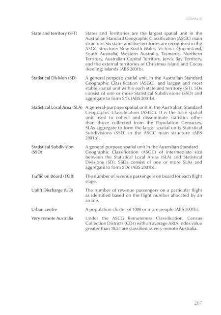
- Page 294 and 295: GlossaryAircraft movementASGC Remot
- Page 296 and 297: GlossaryIndividual income(weekly)In
- Page 300: Abbreviations
- Page 304: References
- Page 307 and 308: BITRE | Report 115Department of Hea


