Desktop Study on - Regional Climate Change Adaptation ...
Desktop Study on - Regional Climate Change Adaptation ...
Desktop Study on - Regional Climate Change Adaptation ...

Create successful ePaper yourself
Turn your PDF publications into a flip-book with our unique Google optimized e-Paper software.
Assessment of Capacity Gaps and Needs of South East Asia Countries<br />
in Addressing Impacts, Vulnerability and Adaptati<strong>on</strong> to <strong>Climate</strong> Variability and <strong>Climate</strong> <strong>Change</strong><br />
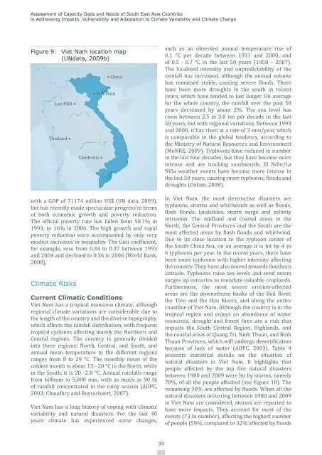
Figure 9: Viet Nam locati<strong>on</strong> map<br />
(UNdata, 2009b)<br />
Lao PDR •<br />
Thailand •<br />
with a GDP of 71174 milli<strong>on</strong> US$ (UN data, 2009),<br />
but has recently made spectacular progress in terms<br />
of both ec<strong>on</strong>omic growth and poverty reducti<strong>on</strong>.<br />
The official poverty rate has fallen from 58.1% in<br />
1993, to 16% in 2006. The high growth and rapid<br />
poverty reducti<strong>on</strong> were accompanied by <strong>on</strong>ly very<br />
modest increases in inequality. The Gini coefficient,<br />
for example, rose from 0.34 to 0.37 between 1993<br />
and 2004 and declined to 0.36 in 2006 (World Bank,<br />
2008).<br />
<strong>Climate</strong> Risks<br />
Cambodia •<br />
• China<br />
• Viet Nam<br />
Current Climatic C<strong>on</strong>diti<strong>on</strong>s<br />
Viet Nam has a tropical m<strong>on</strong>so<strong>on</strong> climate, although<br />
regi<strong>on</strong>al climate variati<strong>on</strong>s are c<strong>on</strong>siderable due to<br />
the length of the country and the diverse topography,<br />
which affects the rainfall distributi<strong>on</strong>, with frequent<br />
tropical cycl<strong>on</strong>es affecting mainly the Northern and<br />
Central regi<strong>on</strong>s. The country is generally divided<br />
into three regi<strong>on</strong>s: North, Central, and South, and<br />
annual mean temperature in the different regi<strong>on</strong>s<br />
ranges from 8 to 29 °C. The m<strong>on</strong>thly mean of the<br />
coldest m<strong>on</strong>th is about 13 - 20 °C in the North, while<br />
in the South, it is 20 -2 8 °C. Annual rainfalls range<br />
from 600mm to 5,000 mm, with as much as 90 %<br />
of rainfall c<strong>on</strong>centrated in the rainy seas<strong>on</strong> (ADPC,<br />
2003; Chaudhry and Ruysschaert, 2007).<br />
Viet Nam has a l<strong>on</strong>g history of coping with climatic<br />
variability and natural disasters. For the last 40<br />
years climate has experienced some changes,<br />
such as an observed annual temperature rise of<br />
0.1 °C per decade between 1931 and 2000, and<br />
of 0.5 - 0.7 °C in the last 50 years (1958 – 2007).<br />
The localized intensity and unpredictability of the<br />
rainfall has increased, although the annual volume<br />
has remained stable, causing severe floods. There<br />
have been more droughts in the south in recent<br />
years, which have tended to last l<strong>on</strong>ger. On average<br />
for the whole country, the rainfall over the past 50<br />
years decreased by about 2%. The sea level has<br />
risen between 2.5 to 3.0 cm per decade in the last<br />
50 years, but with regi<strong>on</strong>al variati<strong>on</strong>s. Between 1993<br />
and 2008, it has risen at a rate of 3 mm/year, which<br />
is comparable to the global tendency, according to<br />
the Ministry of Natural Resources and Envir<strong>on</strong>ment<br />
(MoNRE, 2009). Typho<strong>on</strong>s have reduced in number<br />
in the last four decades, but they have become more<br />
intense and are tracking southwards. El Niño/La<br />
Niña weather events have become more intense in<br />
the last 50 years, causing more typho<strong>on</strong>s, floods and<br />
droughts (Oxfam, 2008).<br />
In Viet Nam, the most destructive disasters are<br />
typho<strong>on</strong>s, storms and whirlwinds as well as floods,<br />
flash floods, landslides, storm surge and salinity<br />
intrusi<strong>on</strong>. The midland and coastal areas in the<br />
North, the Central Provinces and the South are the<br />
most affected areas by flash floods and whirlwind.<br />
Due to its close locati<strong>on</strong> to the typho<strong>on</strong> center of<br />
the South China Sea, <strong>on</strong> an average it is hit by 4 to<br />
6 typho<strong>on</strong>s per year. In the recent years, there have<br />
been more typho<strong>on</strong>s with higher intensity affecting<br />
the country. They have also moved towards Southern<br />
latitude. Typho<strong>on</strong>s raise sea levels and send storm<br />
surges up estuaries to inundate valuable croplands.<br />
Furthermore, the most severe erosi<strong>on</strong>-affected<br />
areas are the downstream banks of the Red River,<br />
the Tien and the Hau Rivers, and al<strong>on</strong>g the entire<br />
coastline of Viet Nam. Although the country is in the<br />
tropical regi<strong>on</strong> and enjoys an abundance of water<br />
resources, drought and forest fires are a risk that<br />
impacts the South Central Regi<strong>on</strong>, Highlands, and<br />
the coastal areas of Quang Tri, Ninh Thuan, and Binh<br />
Thuan Provinces, which will undergo desertificati<strong>on</strong><br />
because of lack of water (ADPC, 2003). Table 4<br />
presents statistical details <strong>on</strong> the situati<strong>on</strong> of<br />
natural disasters in Viet Nam. It highlights that<br />
people affected by the top five natural disasters<br />
between 1980 and 2009 were hit by storms, namely<br />
70%, of all the people affected (see Figure 10). The<br />
remaining 30% are affected by floods. When all the<br />
natural disasters occurring between 1980 and 2009<br />
in Viet Nam are c<strong>on</strong>sidered, storms are reported to<br />
have more impacts. They account for most of the<br />
events (73 in number), affecting the highest number<br />
of people (59%, compared to 32% affected by floods<br />
33