Undergraduate - Clarion University
Undergraduate - Clarion University
Undergraduate - Clarion University
- No tags were found...

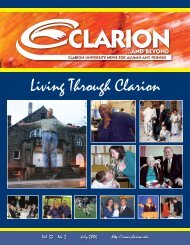
You also want an ePaper? Increase the reach of your titles
YUMPU automatically turns print PDFs into web optimized ePapers that Google loves.
pages i-viiiCollege of Artsand Sciences96 <strong>Clarion</strong> <strong>University</strong> of PennsylvaniaGEOG 315: Human Geography: Race, Class, And Gender, and Their Spatial Dimensions 3 s.h.Focuses on methods and theories geographers have used to explore how social relations of race, class, and gender have beenstructured, influenced, and expressed spatially. Exposes students to social/spatial construction theories (the social construction of raceand gender, the social production of space, and the role of space in the construction of gender and race), and “postmodern” economicrestructuring and its impact on the location and (race, class, and gender component of the) employment structure of “flexible” industries.Explores contemporary theories on the role of race/gender and class intersection in the reproduction process, and the colonial andpostcolonial geographies of gender and race. Writing intensive course. Prerequisite: None. Offered fall, odd numbered years.GEOG/ES 345: Computer Cartography With Laboratory 4 s.h.Systematic study of the newest dimension of cartography in use today. Designing and constructing computer maps is an integralpart of the course. Students create computer maps with a number of programs, including Atlas Graphics, Atlas Draw, Microam, MapInfo. PC Globe, PS USA, Systate, etc. Introduces students to the use of the digitizer. Every other spring.GEOG/ES 385: Climatology 3 s.h.Examines the major components of climate and climate change. Analyzes physical aspects of the atmosphere as a series of long-termweather phenomena. Studies regional characteristics of climate on the basis of worldwide weather patterns. Emphasizes how appliedaspects of climate demonstrates the interrelationships and importance of both physical and regional climatology to humankind. Alsoexamines the causes of long-term climate change and variability. Acceptable for social science or natural science credits. Prerequisite:ES 280.GEOG/ES 400: Introduction to Remote Sensing with Laboratory 3 s.h.Study and assessment of the physical and cultural with Laboratoryl features of the earth using satellite images and aerialphotographs. Uses black and white photos, color infrared photos, and digital satellite images for planimetric map construction,agricultural and vegetation studies, landform identification, land use assessment, and forestry. Laboratory activities include analysisof imagery in different zones of the electromagnetic spectrum, geometric correction of satellite images, and computer-assisted landcover classification. Each Fall Semester.GEOG/ES 404: Soils With Laboratory 4 s.h.Comprehensibly examines the classification, formation, and interpretation of soils. Explores the processes of soil classification(both the zonal classification and the soil taxonomy classification). Includes soil formation (parent material, climate, slope, time,and organic activity) and the interpretation of pedogenic sequences (as it relates to deposition, diagenesis, and climate change).Laboratory (one credit, two hours) complements lecture. Emphasizes field interpretation, geochemistry, and textual classification ofsoils. Prerequisites: ES 150 and 255 or permission of the instructor.GEOG/ES 425: Advanced Remote Sensing with Laboratory 3 s.h.Builds on the content of Introduction to Air Photo Interpretation and Remote Sensing. Uses Earth imaging satellites, such asLandsat, Spot, and Ikonos, and introduces new instruments, including Radarsat, Space Shuttle, and Space Station Earth imaginginstruments. Examines various digital data sets including digital elevation models (DEMs), digital orthophotos and digital topographicmaps. Students will work together on a drainage basin study to assess the sources of acid pollution using computer-assisted landcover classification, manual photo interpretation, and field reconnaissance to identify strip mine areas and acid discharging oil/gaswells. Prerequisite: Geog/ES 400. Every Spring.GEOG/ES 450: Field Geography With Laboratory 3 s.h.Systematic study of techniques essential to geographic field investigation. Emphasizes practical, first-hand experiences in the fieldwhere students learn techniques and procedures of rural and urban land usage by surveying and field research. Prerequisite: Consentof instructor. Summer on demand.GEOG/ES 470: Introduction to Geographic Information Systems 5 s.h.Addresses basic concepts and principles of geographic information systems, data models, data structures, applications, andtechnical issues. Lab focuses on how these basic principles are implemented in a GIS. Lab includes an entire sequence of buildingspatial database: data capturing, editing, adding attributes, building topography, registering layers to real-world coordinates, makingmap compositions, data conversion, and basic analysis. Fall, annually.GEOG /ES 490: Advanced Geographic Information Systems With Laboratory 3 s.h.Provides students with the ability to apply GIS for spatial problem solving in applied settings. Lecture- and application/projectbasedcourse. Lecture covers spatial modeling and analysis, based on a raster data structure. Laboratory sessions introduce studentsto three-dimensional surface modeling, cost-distance analysis, runoff modeling, and diffusion analysis. Prerequisite: GEOG/ES 470.Each Spring Semester.GEOG 499: Seminar Methods in Geographical Research 3 s.h.Presents the opportunity for students with considerable interest and background in geography to utilize the various methods ofanalysis of the discipline to examine a concrete issue or research problem. Emphasizes analysis, synthesis, and communication.Students produce a written report and give an oral presentation of their project. Prerequisites: Junior or senior status in geography orpermission of instructor. Every other spring.