

Noor Abid_2016-02-19

Create successful ePaper yourself
Turn your PDF publications into a flip-book with our unique Google optimized e-Paper software.
6.6 Site Mapping<br />
6.6.1 Existing conditions and future potentials of East Tamaki<br />
Site<br />
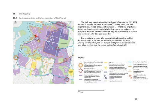
The draft map was developed by the Council officers during 2011-2012<br />
in order to increase the value of the district. 101 Activity hubs, local and<br />
regional cycling routes, and pedestrian routes seem to take a large focus<br />
in the plan. Locations of the activity hubs, however, are showing on the<br />
busy drive ways and intersections where they are mostly visible to workers<br />
and commuters who drive past every day.<br />
Site selection was made after acknowledging the existing and the<br />
future conditions of the area, as well as land availability. Moreover,<br />
working with the activity hub (as marked) on Highbrook drive intersection<br />
was a key to utilise from the current and the future busy traffic.<br />
Legend:<br />
101 Ibid.<br />
35
