

Fourth Study Conference on BALTEX Scala Cinema Gudhjem
Fourth Study Conference on BALTEX Scala Cinema Gudhjem
Fourth Study Conference on BALTEX Scala Cinema Gudhjem

You also want an ePaper? Increase the reach of your titles
YUMPU automatically turns print PDFs into web optimized ePapers that Google loves.
- 28 -<br />
GPS-Based Integrated Water Vapour Estimati<strong>on</strong> <strong>on</strong> Static and Moving<br />
Platforms for Verificati<strong>on</strong> of Regi<strong>on</strong>al Climate Model REMO<br />
Torben Schüler 1 , Andrea Posfay 1 , Eva Krueger 1 , Günter W. Hein 1 and Daniela Jacob 2<br />
1 University FAF Munich, Institute of Geodesy and Navigati<strong>on</strong>, D-85579 Neubiberg, torben.schueler@unibw-muenchen.de<br />
2 Max-Planck-Institute for Meteorology, D-20146 Hamburg, jacob@dkrz.de<br />
1. Introducti<strong>on</strong><br />
Knowledge of the distributi<strong>on</strong> of water vapour is essential<br />
for our understanding of global and regi<strong>on</strong>al climate as this<br />
greenhouse gas is associated with a large latent energy<br />
influencing the vertical stability of the atmosphere<br />
significantly. As a c<strong>on</strong>sequence, water vapour measurements<br />
with sufficient temporal and spatial resoluti<strong>on</strong> are needed for<br />
the validati<strong>on</strong> of climate models such as the coupled climate<br />
model REMO-LARSIM-BSMO developed for the regi<strong>on</strong> of<br />
the Baltic Sea and its catchment.<br />
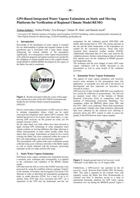
Figure 1. Results presented within the scope of this paper<br />
were carried out as part of the BALTIMOS c<strong>on</strong>sortium and<br />
funded by the German climate research programme<br />
DEKLIM.<br />
Precise carrier-phase measurements of GPS receivers allow<br />
to estimate tropospheric delays which can be easily<br />
c<strong>on</strong>verted into integrated water vapour (IWV) c<strong>on</strong>tents. This<br />
method has proven to be of great value when static, i.e. n<strong>on</strong>moving<br />
GPS receivers <strong>on</strong> the ground are used, see for<br />
instance Schueler (2001).<br />
On the other hand, very little efforts have been devoted to<br />
apply existing GPS technology to sense integrated water<br />
vapour c<strong>on</strong>tents <strong>on</strong> moving platforms like ships allowing to<br />
obtain measurements in areas which usually suffer from<br />
sparse data coverage. Experiments <strong>on</strong> board of two vessels<br />
cruising the Baltic Sea were c<strong>on</strong>ducted within the scope of<br />
this work representing a new and innovative approach.<br />
This presentati<strong>on</strong> will outline both some verificati<strong>on</strong> results<br />
collected using static reference networks in the Baltic regi<strong>on</strong><br />
as well as results obtained with the kinematic processing<br />
technique <strong>on</strong> the two ships used for this study.<br />
2. Static Water Vapour Estimati<strong>on</strong><br />
GPS-based water vapour estimati<strong>on</strong> has meanwhile become<br />
a routinely used technique and, c<strong>on</strong>sequently, it is applied<br />
to the verificati<strong>on</strong> and validati<strong>on</strong> of the REMO climate<br />
model.<br />
GPS data from the IGS as well as the EUREF networks were<br />
processed by using the modified software package TropAC<br />
of the Institute of Geodesy and Navigati<strong>on</strong> (University FAF<br />
Munich) in order to determine the tropospheric propagati<strong>on</strong><br />
delay in zenith directi<strong>on</strong> (ZTD). For a total of up to 63<br />
stati<strong>on</strong>s these ZTD data were c<strong>on</strong>verted into IWV via a<br />
separati<strong>on</strong> of the ZTD into the hydrostatic and the wet<br />
comp<strong>on</strong>ent for the validati<strong>on</strong> period 1999-2002 with<br />
further data tracing back to 1993. The surface pressure at<br />
the site and the mean temperature of the troposphere are<br />
needed for the c<strong>on</strong>versi<strong>on</strong> process. These data were<br />
extracted from numerical weather models (NWM).<br />
Additi<strong>on</strong>ally radios<strong>on</strong>de data of 6 sites were used for the<br />
validati<strong>on</strong> process. Surface meteorological data of selected<br />
IGS stati<strong>on</strong>s serve for the validati<strong>on</strong> of REMO pressure<br />
and temperature data.<br />
The technique and the error budget of static GPS water<br />
vapour estimati<strong>on</strong> will be briefly discussed in the<br />
presentati<strong>on</strong> as well as some results of the validati<strong>on</strong><br />
activities.<br />
3. Kinematic Water Vapour Estimati<strong>on</strong><br />
The aspects of water vapour estimati<strong>on</strong> will, however,<br />
receive more attenti<strong>on</strong> in this presentati<strong>on</strong> since this<br />
applicati<strong>on</strong> is essentially new and still in the process of<br />
development and thus represents an innovative step<br />
forward in science.<br />
GPS-receivers of type Trimble 4000 SSE were installed <strong>on</strong><br />
two vessels for collecti<strong>on</strong> of measurements. The first <strong>on</strong>e<br />
<strong>on</strong> research vessel Alkor of the Institute of Marine<br />
Research (University Kiel) in cooperati<strong>on</strong> with the<br />
Institute of Meteorology (University Hamburg). Two<br />
campaigns within the BRIDGE phase (June 2001 and<br />
Oct./Nov. 2001) were c<strong>on</strong>ducted. These field experiments<br />
are particularly valuable since high resoluti<strong>on</strong> radios<strong>on</strong>de<br />
data were collected by the research crew allowing to<br />
precisely derive the IWV c<strong>on</strong>tent in order to assess the<br />
quality of the GPS-derived water vapour samples.<br />
Figure 2. Sample ground track of oil recovery vessel<br />
“Bottsand” in the Baltic Sea <strong>on</strong> 18 August 2002.<br />
Furthermore, a GPS-receiver was operated <strong>on</strong> the oil<br />
recovery vessel Bottsand from October 2001 till January<br />
2003. This ship is operated by the German Navy and<br />
regularly cruises the Baltic Sea from Warnemuende to<br />
Luebeck and Kiel. It therefore served as a kind of<br />
operati<strong>on</strong>al kinematic platform for GPS water vapour<br />
estimati<strong>on</strong> over sea during the BRIDGE period. Figure 2


