

Download the entire proceedings as an Adobe PDF - Eastern Snow ...
Download the entire proceedings as an Adobe PDF - Eastern Snow ...
Download the entire proceedings as an Adobe PDF - Eastern Snow ...

You also want an ePaper? Increase the reach of your titles
YUMPU automatically turns print PDFs into web optimized ePapers that Google loves.
In this paper, we present import<strong>an</strong>t progress toward development of such <strong>an</strong> approach. We have<br />
found that <strong>the</strong> solution domains for snow depth, snow water equivalent, <strong>an</strong>d snow density have a<br />
predictable shape that c<strong>an</strong> be approximated by <strong>an</strong> <strong>an</strong>alytical equation with only two coefficients.<br />
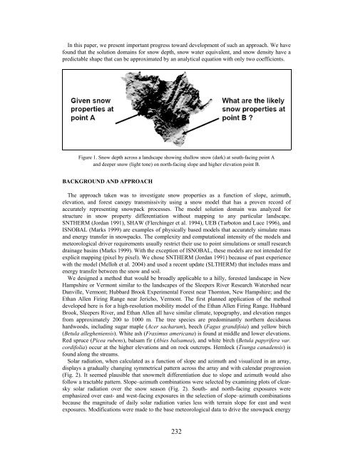
Figure 1. <strong>Snow</strong> depth across a l<strong>an</strong>dscape showing shallow snow (dark) at south-facing point A<br />
<strong>an</strong>d deeper snow (light tone) on north-facing slope <strong>an</strong>d higher elevation point B.<br />
BACKGROUND AND APPROACH<br />
The approach taken w<strong>as</strong> to investigate snow properties <strong>as</strong> a function of slope, azimuth,<br />
elevation, <strong>an</strong>d forest c<strong>an</strong>opy tr<strong>an</strong>smissivity using a snow model that h<strong>as</strong> a proven record of<br />
accurately representing snowpack processes. The model solution domain w<strong>as</strong> <strong>an</strong>alyzed for<br />
structure in snow property differentiation without mapping to <strong>an</strong>y particular l<strong>an</strong>dscape.<br />
SNTHERM (Jord<strong>an</strong> 1991), SHAW (Flerchinger et al. 1994), UEB (Tarboton <strong>an</strong>d Luce 1996), <strong>an</strong>d<br />
ISNOBAL (Marks 1999) are examples of physically b<strong>as</strong>ed models that accurately simulate m<strong>as</strong>s<br />
<strong>an</strong>d energy tr<strong>an</strong>sfer in snowpacks. The complexity <strong>an</strong>d computational intensity of <strong>the</strong> models <strong>an</strong>d<br />
meteorological driver requirements usually restrict <strong>the</strong>ir use to point simulations or small research<br />
drainage b<strong>as</strong>ins (Marks 1999). With <strong>the</strong> exception of ISNOBAL, <strong>the</strong>se models are not intended for<br />
explicit mapping (pixel by pixel). We chose SNTHERM (Jord<strong>an</strong> 1991) because of p<strong>as</strong>t experience<br />
with <strong>the</strong> model (Melloh et al. 2004) <strong>an</strong>d used a recent update (SLTHERM) that includes m<strong>as</strong>s <strong>an</strong>d<br />
energy tr<strong>an</strong>sfer between <strong>the</strong> snow <strong>an</strong>d soil.<br />
We designed a method that would be broadly applicable to a hilly, forested l<strong>an</strong>dscape in New<br />
Hampshire or Vermont similar to <strong>the</strong> l<strong>an</strong>dscapes of <strong>the</strong> Sleepers River Research Watershed near<br />
D<strong>an</strong>ville, Vermont; Hubbard Brook Experimental Forest near Thornton, New Hampshire; <strong>an</strong>d <strong>the</strong><br />
Eth<strong>an</strong> Allen Firing R<strong>an</strong>ge near Jericho, Vermont. The first pl<strong>an</strong>ned application of <strong>the</strong> method<br />
developed here is for a high-resolution mobility model of <strong>the</strong> Eth<strong>an</strong> Allen Firing R<strong>an</strong>ge. Hubbard<br />
Brook, Sleepers River, <strong>an</strong>d Eth<strong>an</strong> Allen all have similar climate, topography, <strong>an</strong>d elevation r<strong>an</strong>ges<br />
from approximately 200 to 1000 m. The tree species are predomin<strong>an</strong>tly nor<strong>the</strong>rn deciduous<br />
hardwoods, including sugar maple (Acer sacharum), beech (Fagus gr<strong>an</strong>difoia) <strong>an</strong>d yellow birch<br />
(Betula allegheniensis). White <strong>as</strong>h (Fraximus americ<strong>an</strong>a) is found at middle <strong>an</strong>d lower elevations.<br />
Red spruce (Picea rubens), balsam fir (Abies balsamea), <strong>an</strong>d white birch (Betula papyrifera var.<br />
cordifolia) occur at <strong>the</strong> higher elevations <strong>an</strong>d on rock outcrops. Hemlock (Tsunga c<strong>an</strong>adensis) is<br />
found along <strong>the</strong> streams.<br />
Solar radiation, when calculated <strong>as</strong> a function of slope <strong>an</strong>d azimuth <strong>an</strong>d visualized in <strong>an</strong> array,<br />
displays a gradually ch<strong>an</strong>ging symmetrical pattern across <strong>the</strong> array <strong>an</strong>d with calendar progression<br />
(Fig. 2). It seemed plausible that snowmelt differentiation due to slope <strong>an</strong>d azimuth would also<br />
follow a tractable pattern. Slope–azimuth combinations were selected by examining plots of clearsky<br />
solar radiation over <strong>the</strong> snow se<strong>as</strong>on (Fig. 2). South- <strong>an</strong>d north-facing exposures were<br />
emph<strong>as</strong>ized over e<strong>as</strong>t- <strong>an</strong>d west-facing exposures in <strong>the</strong> selection of slope–azimuth combinations<br />
because <strong>the</strong> magnitude of daily solar radiation varies less with terrain slope for e<strong>as</strong>t <strong>an</strong>d west<br />
exposures. Modifications were made to <strong>the</strong> b<strong>as</strong>e meteorological data to drive <strong>the</strong> snowpack energy<br />
232


