Create successful ePaper yourself
Turn your PDF publications into a flip-book with our unique Google optimized e-Paper software.
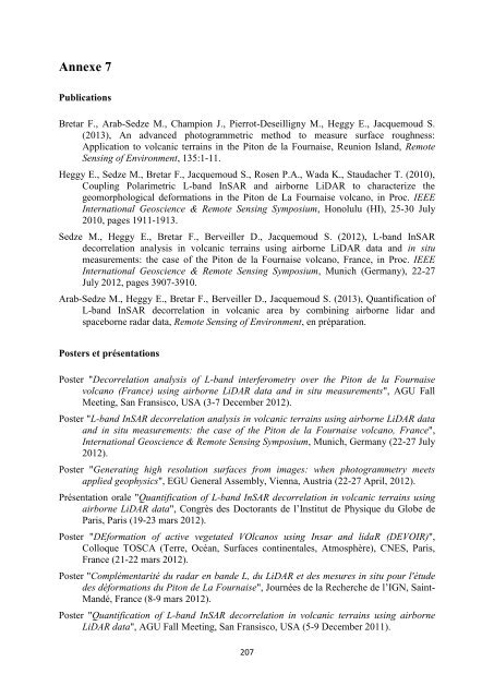
Annexe 7<br />
Publications<br />
Bretar F., Arab-Sedze M., Champion J., Pierrot-Deseilligny M., Heggy E., Jacquemoud S.<br />
(2013), An advanced photogrammetric method to measure surface roughness:<br />
Application to volcanic terrains in the Piton de la Fournaise, Reunion Island, Remote<br />
Sensing of Environment, 135:1-11.<br />
Heggy E., Sedze M., Bretar F., Jacquemoud S., Rosen P.A., Wada K., Staudacher T. (2010),<br />
Coupling Polarimetric L-band InSAR and airborne LiDAR to characterize the<br />
geomorphological deformations in the Piton de La Fournaise volcano, in Proc. IEEE<br />
International Geoscience & Remote Sensing Symposium, Honolulu (HI), 25-30 July<br />
2010, pages 1911-1913.<br />
Sedze M., Heggy E., Bretar F., Berveiller D., Jacquemoud S. (2012), L-band InSAR<br />
decorrelation analysis in volcanic terrains using airborne LiDAR data and in situ<br />
measurements: the case of the Piton de la Fournaise volcano, France, in Proc. IEEE<br />
International Geoscience & Remote Sensing Symposium, Munich (Germany), 22-27<br />
July 2012, pages 3907-3910.<br />
Arab-Sedze M., Heggy E., Bretar F., Berveiller D., Jacquemoud S. (2013), Quantification of<br />
L-band InSAR decorrelation in volcanic area by combining airborne lidar and<br />
spaceborne radar data, Remote Sensing of Environment, en préparation.<br />
Posters et présentations<br />
Poster "Decorrelation analysis of L-band interferometry over the Piton de la Fournaise<br />
volcano (France) using airborne LiDAR data and in situ measurements", AGU Fall<br />
Meeting, San Fransisco, USA (3-7 December 2012).<br />
Poster "L-band InSAR decorrelation analysis in volcanic terrains using airborne LiDAR data<br />
and in situ measurements: the case of the Piton de la Fournaise volcano, France",<br />
International Geoscience & Remote Sensing Symposium, Munich, Germany (22-27 July<br />
2012).<br />
Poster "Generating high resolution surfaces from images: when photogrammetry meets<br />
applied geophysics", EGU General Assembly, Vienna, Austria (22-27 April, 2012).<br />
Présentation orale "Quantification of L-band InSAR decorrelation in volcanic terrains using<br />
airborne LiDAR data", Congrès des Doctorants de l’Institut de Physique du Globe de<br />
Paris, Paris (19-23 mars 2012).<br />
Poster "DEformation of active vegetated VOlcanos using Insar and lidaR (DEVOIR)",<br />
Colloque TOSCA (Terre, Océan, Surfaces continentales, Atmosphère), CNES, Paris,<br />
France (21-22 mars 2012).<br />
Poster "Complémentarité du radar en bande L, du LiDAR et des mesures in situ pour l'étude<br />
des déformations du Piton de La Fournaise", Journées de la <strong>Recherche</strong> de l’<strong>IGN</strong>, Saint-<br />
Mandé, France (8-9 mars 2012).<br />
Poster "Quantification of L-band InSAR decorrelation in volcanic terrains using airborne<br />
LiDAR data", AGU Fall Meeting, San Fransisco, USA (5-9 December 2011).<br />
207


