- Page 3 and 4:
Back Underground in Indiana A Guide
- Page 5 and 6:
Contents Welcome from the NSS Presi
- Page 7 and 8:
Welcome from the NSS President Welc
- Page 9 and 10:
Welcome from the Governor of Indian
- Page 11 and 12:
Color Photography Section We are mu
- Page 13 and 14:
Section I: The Harrison Crawford Ar
- Page 15 and 16:
The Convention Planning staff is pl
- Page 17 and 18:
The Harrison County Visitors’ Cen
- Page 19 and 20:
per day, which includes the right t
- Page 21 and 22:
A Short History of Early Crawford C
- Page 23 and 24:
Section II: Exploration 1
- Page 25 and 26:
Deep below the hills of Crawford Co
- Page 27 and 28:
Gypsum flowers and crusts. Beyond S
- Page 29 and 30:
top of Fools Dome began to take onl
- Page 31 and 32:
The Discovery and Exploration of th
- Page 33 and 34:
previous surface survey of the gulf
- Page 35 and 36:
The Survey Begins On Saturday, Janu
- Page 37 and 38:
through January as well as every we
- Page 39 and 40:
and another team went into the seco
- Page 41 and 42:
were surprised to learn that a tigh
- Page 43 and 44:
Other Exploration in the Lost River
- Page 45 and 46:
flood tube really played on our min
- Page 47 and 48:
efore splitting and ending in break
- Page 49 and 50:
Two Bit Pit Harrison County, Indian
- Page 51 and 52:
Two Bit Pit c l i m b - d o w n i s
- Page 53 and 54:
Two Bit Pit 4
- Page 55 and 56:
downstream passage is generally 6 t
- Page 57 and 58:
Trip #16 August 12, 1990 Greg McNam
- Page 59 and 60:
ing into established survey at the
- Page 61 and 62:
An Exploratory Trip to Gory Hole: J
- Page 63 and 64:
the right side. It was necessary to
- Page 65 and 66:
The Exploration of Harrison Spring
- Page 67 and 68:
guide line was no longer in the ent
- Page 69 and 70:
first that day and had already gone
- Page 71 and 72: along his dive buddy, Ralph, for hi
- Page 73 and 74: visibility out was normal, about 3
- Page 75 and 76: Section III: Geology and Cave Scien
- Page 77 and 78: Regional and Karst Geology of the O
- Page 79 and 80: plains, swallowholes, storm water r
- Page 81 and 82: Regional Physiography and Stratigra
- Page 83 and 84: closely this apparent relationship
- Page 85 and 86: Regional Physiography and Stratigra
- Page 87 and 88: Figure 6. Geologic map of south-cen
- Page 89 and 90: margin of the Mitchell Plain, chara
- Page 91 and 92: cavern development. Somewhat more t
- Page 93 and 94: Geomorphic History of the Mitchell
- Page 95 and 96: idge summits in the Crawford Upland
- Page 97 and 98: to produce such continuous surfaces
- Page 99 and 100: Stratigraphy and Lithology of the O
- Page 101 and 102: upward sequence. [This model shows
- Page 103 and 104: County (Gray, Jenkins, and Weidman,
- Page 105 and 106: He then casually and without explan
- Page 107 and 108: outcrop is an overlooked and deserv
- Page 109 and 110: Geology Field Trip Figure 13. Stop
- Page 111 and 112: This five-stage model may have impl
- Page 113 and 114: Figure 16. The Tower Quarry highwal
- Page 115 and 116: River. Note that the valley is fill
- Page 117 and 118: Smith and Tim Grisson of Ohio Caver
- Page 119 and 120: of the Mitchell Plain were dissolve
- Page 121: Geology Field Trip Figure 21. Trave
- Page 125 and 126: The Battle of Corydon, Indiana’s
- Page 127 and 128: of rocks above the Ste. Genevieve i
- Page 129 and 130: New Albany Shale Gas Wells: A natur
- Page 131 and 132: Geology Field Trip Figure 29. Inter
- Page 133 and 134: Preglacial Regional Drainage and Gl
- Page 135 and 136: Stop 5: The Falls of the Ohio vicin
- Page 137 and 138: Figure 35. Historic map of the Fall
- Page 139 and 140: After experiencing a boat trip down
- Page 141 and 142: Geology Field Trip Figure 36. Geolo
- Page 143 and 144: that time. Locally, they are rarely
- Page 145 and 146: Geology Field Trip Figure 38. U.S.
- Page 147 and 148: depth of 12 feet. This became known
- Page 149 and 150: Lost River Field Trip Figure 40. Ma
- Page 151 and 152: Lost River Field Trip Figure 42 Phy
- Page 153 and 154: Lost River Field Trip Figure 44. Co
- Page 155 and 156: to Lick Creek to the southeast as p
- Page 157 and 158: Lost River Field Trip Figure 46. To
- Page 159 and 160: Figure 48A though D. Clyde Malott
- Page 161 and 162: State Road 37 Corridor to Wesley Ch
- Page 163 and 164: then proceed down hill to the north
- Page 165 and 166: and is located 0.5 miles north. The
- Page 167 and 168: Figure 54. A view of the rise pool
- Page 169 and 170: Lost River Field Trip Figure 56. Ge
- Page 171 and 172: Travel from Wesley Chapel Gulf to O
- Page 173 and 174:
miles (Bassett, 1976 and 2000) to t
- Page 175 and 176:
Crawford Upland morphology, and the
- Page 177 and 178:
historians and eyewitness accounts.
- Page 179 and 180:
Ash, Donald W., 1985: Geomorphology
- Page 181 and 182:
pany the geological map of the stat
- Page 183 and 184:
Mammoth Cave Region, Kentucky, and
- Page 185 and 186:
Little brown bat. The endangered In
- Page 187 and 188:
under flat stones or sticks. Its we
- Page 189 and 190:
Lewis, Julian J.; R. Burns; and S.L
- Page 191 and 192:
cave passages ranging in altitude f
- Page 193 and 194:
The Geology of Wyandotte Cave Monum
- Page 195 and 196:
The Geology of Wyandotte Cave Hall
- Page 197 and 198:
Cave fine-grained sediments were pr
- Page 199 and 200:
Projected Passage Profiles for the
- Page 201 and 202:
The History and Status of Karst Ver
- Page 203 and 204:
Karst Vertebrate Paleobiology in In
- Page 205 and 206:
Karst Vertebrate Paleobiology in In
- Page 207 and 208:
Leidy’s peccary (Platygonus vetus
- Page 209 and 210:
Figure 8. Skull of the dire wolf, C
- Page 211 and 212:
Figure 11. The Bat Room of Megenity
- Page 213 and 214:
Mammalian Faunas during the Last De
- Page 215 and 216:
cene Paleoecology and Archaeology o
- Page 217 and 218:
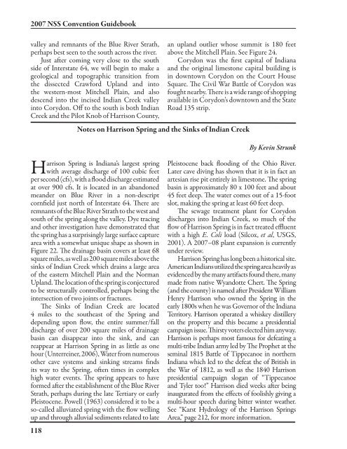
Harrison was by far the largest spr
- Page 219 and 220:
drainage is north to Blue River. Th
- Page 221 and 222:
It may also be noted that Harrison
- Page 223 and 224:
Section IV: Indiana’s Cave Organi
- Page 225 and 226:
The Indiana Karst Conservancy, Inc.
- Page 227 and 228:
esource in cave and karst conservat
- Page 229 and 230:
Indiana Karst Conservancy daylight
- Page 231 and 232:
Indiana Karst Conservancy Heading f
- Page 233 and 234:
property. Meanwhile, Randy Jackson
- Page 235 and 236:
Number of Caves 1,000 Feet or Longe
- Page 237 and 238:
27. Warren 74 28. Miami 63 29. Foun
- Page 239 and 240:
Section V: History 235
- Page 241 and 242:
Lewis D. Lamon: Indiana’s Grand O
- Page 243 and 244:
will find a way in. Lewie’s softs
- Page 245 and 246:
George Jackson getting a drink at C
- Page 247 and 248:
Falls at the age of six, it was par
- Page 249 and 250:
weekends. Sometimes I would bring a
- Page 251 and 252:
Caves, Cave Rescue, and the Nationa
- Page 253 and 254:
lost or overdues or minor injuries:
- Page 255 and 256:
modular NCRC trainings have occurre
- Page 257 and 258:
A History of Indiana Caving We do k
- Page 259 and 260:
22 miles long. The addition of the
- Page 261 and 262:
Pace, Fort, Reeves, Sollman, Powell
- Page 263 and 264:
He formed a short-lived partnership
- Page 265 and 266:
manufactured history of Wyandotte C
- Page 267 and 268:
Section VI: Conservation 263
- Page 269 and 270:
The Richard Blenz Nature Conservanc
- Page 271 and 272:
The Richard Blenz Nature Conservanc
- Page 273 and 274:
pipe. Several dig trips subsequentl
- Page 275 and 276:
Lasiurus cinereus (horary bat), fem
- Page 277 and 278:
Myotis septentrionalis (northern my
- Page 279 and 280:
Cavers have already contributed lar
- Page 281 and 282:
ugs. • Pick up litter (use good j
- Page 283 and 284:
Section VII: Miscellaneous 27
- Page 285 and 286:
Bluespring Caverns “Myst’ry Riv
- Page 287 and 288:
Marengo Cave, located on the edge o
- Page 289 and 290:
of the cave, the scout program was
- Page 291 and 292:
avid spelunkers and loved the cave.
- Page 293 and 294:
Indiana Show Caves hire Richard L.
- Page 295 and 296:
Section VIII: Cave Descriptions 2 1
- Page 297 and 298:
Cave Maps and Descriptions The foll
- Page 299 and 300:
een made but a voice connection sho
- Page 301 and 302:
intersection. The left-hand passage
- Page 303 and 304:
enters from a too-low passage but a
- Page 305 and 306:
This pit is located on a heavily wo
- Page 307 and 308:
Main Passage in Erics River Cave. P
- Page 309 and 310:
drive road. There is a pull off on
- Page 311 and 312:
in 50 feet. This cave has pits and
- Page 313 and 314:
crawling, and very little belly cra
- Page 315 and 316:
Not to be confused with Harrison Co
- Page 317 and 318:
The Old Town Spring Entrance to Mar
- Page 319 and 320:
placed about 150 feet inside the en
- Page 321 and 322:
decorated grotto. In the south end
- Page 323 and 324:
Robinson Ladder Cave is an Indiana
- Page 325 and 326:
dates. Also, except for the entranc
- Page 327 and 328:
Saltpeter Cave Crawford County Cave
- Page 329 and 330:
This cave is located along the base
- Page 331 and 332:
of Texas Creek and is about half a
- Page 333 and 334:
water is from B-B Hole, a nearby ri
- Page 335 and 336:
Harrison County Caves 1915 Cave was
- Page 337 and 338:
meandering, narrow canyon. This pas
- Page 339 and 340:
was rigged in 1979 by Tom Fritsch a
- Page 341 and 342:
Jamie Winner at Big Mouth Spring Ca
- Page 343 and 344:
drop. At the bottom of this drop is
- Page 345 and 346:
Dave Stahl at the top of the first
- Page 347 and 348:
Nick Smith has arranged access to t
- Page 349 and 350:
he returned to remove this ledge, s
- Page 351 and 352:
on the left side of the main passag
- Page 353 and 354:
degree angle. At the bottom of the
- Page 355 and 356:
Ryan Moran climbing Gary Pit. Photo
- Page 357 and 358:
This cave is presently the main cav
- Page 359 and 360:
You can get to the pit in two diffe
- Page 361 and 362:
Willie Hunt at the entrance to Jays
- Page 363 and 364:
T he entrance to King Leo Cave is a
- Page 365 and 366:
The 40-foot-tall canyon. Photo by E
- Page 367 and 368:
way, flowstone and some gypsum flak
- Page 369 and 370:
Manhole Cave, Corydon West 7.5-minu
- Page 371 and 372:
CIG Cave Capers Guidebook: 1984, 19
- Page 373 and 374:
the 56-foot drop known as The Cathe
- Page 375 and 376:
Sharon McConnell in Rocky Hollow Ho
- Page 377 and 378:
Seitz Pit, also known as Fuzzys Pit
- Page 379 and 380:
Harrison County Caves 375
- Page 381 and 382:
with the sandy crawlways and contai
- Page 383 and 384:
it opens into Tourist Avenue. The l
- Page 385 and 386:
and connects back to the main strea
- Page 387 and 388:
to a small room with moss-covered f
- Page 389 and 390:
The Donaldson Cave entrance in 1938
- Page 391 and 392:
Dave Stahl in the lower level of Bu
- Page 393 and 394:
Dave Everton beginning the rappel i
- Page 395 and 396:
the owner, is quite friendly to res
- Page 397 and 398:
Roberts Cave was opened in 2001 by
- Page 399 and 400:
Mike Kennedy at the South Y in Sull
- Page 401 and 402:
Lawrence County Caves Sullivan Cave
- Page 403 and 404:
with breakdown. One passage to the
- Page 405 and 406:
Wayne Cave is the property of the I
- Page 407 and 408:
The natural bridge at Camp Two. Pho
- Page 409 and 410:
Dillon Cave is located in the Hoosi
- Page 411 and 412:
Lost River Cave should be considere
- Page 413 and 414:
Janie Atz preparing to cross the li
- Page 415 and 416:
Tom Duselis looking at cannonballs
- Page 417 and 418:
Owen County Caves 413
- Page 419 and 420:
Washington County Caves Cave River
- Page 421 and 422:
and continues as such to the Flowst
- Page 423 and 424:
een known as the Wet Clifty Cave an
- Page 425 and 426:
water depth, this passage eventuall
- Page 427 and 428:
After entering the gate at Henderso
- Page 429 and 430:
head of a dry ravine. The first 300
- Page 431 and 432:
at the Trinkle Cavern Entrance. Alt
- Page 433 and 434:
Section IX: Color Photography 42
- Page 435 and 436:
Bill Baus in the Formation Room in
- Page 437 and 438:
A cannonball in the Boone-Cannonbal
- Page 439 and 440:
John Harris in Binkleys Cave’s He
- Page 441 and 442:
Aaron Atz in CHUG Hall in Teds Dig.
- Page 443 and 444:
Cavers in the Wayne Cave crawlway.
- Page 445 and 446:
Willie Hunt in Jewel Box Cave. Phot
- Page 447 and 448:
Nate Newkirk in Lower Wild Turkey C
- Page 449 and 450:
Nate Newkirk in Redmond Cave. Photo
- Page 451 and 452:
A Abram, Jerry 400 Abram, Marie 400
- Page 453 and 454:
Cooper, James Fenimore 260 Cope, E.
- Page 455 and 456:
Elliot Stahl with the warning sign
- Page 457 and 458:
Hodges, Frank 393 Holiday World The
- Page 459 and 460:
McGowan, Dave 256 McGrain, Preston
- Page 461 and 462:
P.B.R. Plunge 369 Packard’s groun
- Page 463 and 464:
Spaulding, Greg 254, 255, 365 spide
- Page 465 and 466:
Dave Stahl ascending Fuzzy Hole. Ph