- Page 2 and 3:
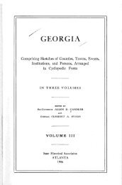
A STANDARD HISTORY OF ^ Georgia and
- Page 4 and 5:
PREFACE Georgia's history has heret
- Page 6:
TABLE OF CONTENTS VOLUME I PAGE Sec
- Page 9 and 10:
VI INDEX Barrett, Charles S., 3027
- Page 11 and 12:
Vlll INDEX Civil Rig-hts Act declar
- Page 13 and 14:
Episcopacy, 420, 660 Erskine, John,
- Page 15 and 16:
Great seal of the state, 1139 Great
- Page 17 and 18:
XIV Jeffries, Thomas H., 1924 Jeffe
- Page 19 and 20:
XVI INDEX McKenzie, William M., 249
- Page 21 and 22:
XV111 INDEX Polk county, 696, 1259
- Page 23 and 24:
XVI Mcl< McP Me! Me! Mcl Mcl Mcl Mc
- Page 25 and 26:
XX11 INDEX Wesleyan Female College,
- Page 28 and 29:
Georgia and Georgians CHAPTER I GEO
- Page 30 and 31:
GEORGIA AND GEORGIANS 5 oldest orga
- Page 32 and 33:
GEORGIA AND GEORGIANS . 7 almost in
- Page 34 and 35:
GEORGIA AND GEORGIANS 9 was Ogletho
- Page 36 and 37:
GEORGIA AND GEORGIANS 11 September
- Page 38 and 39:
GEORGIA AND GEORGIANS 13 ments at S
- Page 40 and 41:
CHAPTER II TJONCE DE LEON'S QUEST F
- Page 42 and 43:
GEORGIA AND GEORGIANS 17 country in
- Page 44 and 45:
GEORGIA AND GEORGIANS 19 the king r
- Page 46 and 47:
GEORGIA AND GEORGIANS 21 is now the
- Page 48 and 49:
0 March March March March March Mar
- Page 50 and 51:
CHAPTER III GEORGIA'S ORIGINAL DOMA
- Page 52 and 53:
GEORGIA AND GEORGIANS 27 the Town o
- Page 54 and 55:
GEORGIA AND GEORGIANS 29 must have
- Page 56 and 57:
GEORGIA AND GEORGIANS 31 tained. Wh
- Page 58 and 59:
GEORGIA AND GEORGIANS 33 known as P
- Page 60 and 61:
GEORGIA AND GEORGIANS 35 they catch
- Page 62 and 63:
GEOEGIA AND GEORGIANS 37 substantia
- Page 64 and 65:
GEORGIA AND GEORGIANS 39 They are f
- Page 66 and 67:
CHAPTER IV OGLETHOEPE'S HUMANE ENTE
- Page 68 and 69:
GEORGIA AND GEORGIANS 43 cultivate
- Page 70 and 71:
CHAPTER V ENGLAND DURING THE REIGN
- Page 72 and 73:
GEORGIA AND GEORGIANS 47 of gin hun
- Page 74 and 75:
GEORGIA AND GEORGIANS 49 Until this
- Page 76 and 77:
GEORGIA AND GEORGIANS 51 world? Sir
- Page 78 and 79:
CHAPTER VI GEORGIA'S EOYAL CHARTER
- Page 80 and 81:
GEORGIA AND GEORGIANS 55 soils, gro
- Page 82 and 83:
GEORGIA AND GEORGIANS 57 and receiv
- Page 84 and 85:
GEORGIA AND GEORGIANS 59 years gave
- Page 86 and 87:
GEORGIA AND GEORGIANS 61 removed fr
- Page 88 and 89:
GEORGIA AND GEORGIANS 63 Besides th
- Page 90 and 91:
GEORGIA AND GEORGIANS 65 There was
- Page 92 and 93:
GEORGIA AND GEORGIANS 67 Says a con
- Page 94 and 95:
GEORGIA AND GEORGIANS 69 was Coosa-
- Page 96 and 97:
GEORGIA AND GEORGIANS 71 still bear
- Page 98 and 99:
GEOEGIA AND GEORGIANS 73 Next morni
- Page 100 and 101:
GEORGIA AND GEORGIANS 75 sent over
- Page 102 and 103:
GEORGIA AND GEORGIANS 77 William Sc
- Page 104 and 105:
GEORGIA AND GEORGIANS 79 George He'
- Page 106 and 107:
GEORGIA AND GEOEGIANS 81 But Ogleth
- Page 108 and 109:
GEORGIA AND GEORGIANS 83 DECKER'S W
- Page 110 and 111:
GEORGIA AND GEORGIANS 85 for this a
- Page 112 and 113:
CHAPTER X OGLETHOEPE'S TREATY WITH
- Page 114 and 115:
GEORGIA AND GEORGIANS 89 had been a
- Page 116 and 117:
GEORGIA AND GEORGIANS 91 craw at a
- Page 118 and 119:
CHAPTER XI SAVANNAH HAVING BEEN SET
- Page 120 and 121:
GEORGIA AND GEORGIANS 95 told by Go
- Page 122 and 123:
GEORGIA AND GEORGIANS 97 six miles
- Page 124 and 125:
GEORGIA AND GEORGIANS 99 commenced
- Page 126 and 127:
GEORGIA AND GEORGIANS 101 But Oglet
- Page 128 and 129:
GEORGIA AND GEORGIANS 103 tocrat wh
- Page 130 and 131:
GEORGIA AND GEORGIANS 105 were not
- Page 132 and 133:
GEORGIA AND GEORGIANS volunteering
- Page 134 and 135:
CHAPTER XIII TOMO-CHI-CHI'S VISIT T
- Page 136 and 137:
GEORGIA AND GEORGIANS 111 Mr. Wesle
- Page 138 and 139:
GEOEGIA AND GEORGIANS 113 De Lacy,
- Page 140 and 141:
GEORGIA AND GEORGIANS 115 Frederiea
- Page 142 and 143:
GEOBGIA AND GEORGIANS 117 who visit
- Page 144 and 145:
I GEORGIA AND GEORGIANS 119 the tim
- Page 146 and 147:
GEORGIA AND GEORGIANS 121 his accep
- Page 148 and 149:
GEORGIA AND GEORGIANS 123 discomfor
- Page 150 and 151:
GEORGIA AND GEORGIANS 125 nizanees,
- Page 152 and 153:
GEORGIA AND GEORGIANS 127 which may
- Page 154 and 155:
GEORGIA AND GEORGIANS 129 field's i
- Page 156 and 157:
CHAPTER XV THE SPANIARDS PROVE TREA
- Page 158 and 159:
GEORGIA AND GEORGIANS 133 whose sup
- Page 160 and 161:
GEORGIA AND GEORGIANS 135 as such.
- Page 162 and 163:
GEOEGIA AND GEORGIANS 137 overtaken
- Page 164 and 165:
GEORGIA AND GEORGIANS 139 vagrants
- Page 166 and 167:
GEORGIA AND GEORGIANS 141 He theref
- Page 168 and 169:
CHAPTER XVII OGLETHORPE's TREATY WI
- Page 170 and 171:
GEORGIA AND GEORGIANS 145 the garri
- Page 172 and 173:
GEORGIA AND GEORGIANS 147 been one
- Page 174 and 175:
GEOEGIA AND GEOKGIANS 149 separated
- Page 176 and 177:
GEORGIA AND GEORGIANS 151 they had
- Page 178 and 179:
GEOEGIA AND GEORGIANS 153 ing Provi
- Page 180 and 181:
GEORGIA AND GEORGIANS 155 other Mer
- Page 182 and 183:
GEORGIA AND GEORGIANS 157 between O
- Page 184 and 185:
GEORGIA AND GEOBGIANS 159 FORCES EN
- Page 186 and 187:
GEORGIA AND GEORGIANS 161 which the
- Page 188 and 189:
GEORGIA AND GEORGIANS 163 lie willi
- Page 190 and 191:
GEORGIA AND GEORGIANS 165 William S
- Page 192 and 193:
GEORGIA AND GEORGIANS 167 that a co
- Page 194 and 195:
GEORGIA AND GEORGIANS 169 amazed to
- Page 196 and 197:
CHAPTER XIX BEFORE PRESIDENT STEPHE
- Page 198 and 199:
GEORGIA AND GEORGIANS 173 assembly
- Page 200 and 201:
GEORGIA AND GEORGIANS 175 these Pur
- Page 202 and 203:
GEORGIA AND GEORGIANS 177 Besides t
- Page 204 and 205:
GEORGIA AND GEORGIANS 179 names who
- Page 206 and 207:
CHAPTER XX RELATION 01 OGLETHORPE T
- Page 208 and 209:
GEORGIA AND GEORGIANS 183 reference
- Page 210 and 211:
GEORGIA AND GEORGIANS 185 It has fr
- Page 212 and 213:
GEORGIA AND GEORGIANS 187 thorpe tr
- Page 214 and 215:
GEORGIA AND GEORGIANS 189 necessary
- Page 216 and 217:
GEORGIA AND GEORGIANS 191 islands e
- Page 218 and 219:
GEORGIA AND GEORGIANS 193 Savannah
- Page 220 and 221:
GEOBGIA AND GEOEGIANS 195 Indian tr
- Page 222 and 223:
GEORGIA AND GEORGIANS 197 It may we
- Page 224 and 225:
GEORGIA AND GEORGIANS 199 ment from
- Page 226 and 227:
GEORGIA AND GEORGIANS 201 own expen
- Page 228 and 229:
GEORGIA AND GEORGIANS 203 above. If
- Page 230 and 231:
GEORGIA AND GEORGIANS 205 Of the se
- Page 232 and 233:
GEORGIA AND GEOEGIANS 207 Meetings
- Page 234 and 235:
Name Chosen *Bathurst ....... 1740
- Page 236 and 237:
GEORGIA AND GEORGIANS 211 THE LEADI
- Page 238 and 239:
GEORGIA AND GEORGIANS 213 pended up
- Page 240 and 241:
GEORGIA AND GEORGIANS 215 view of c
- Page 242 and 243:
GEORGIA AND GEORGIANS 217 the chari
- Page 244 and 245:
GEORGIA AND GEORGIANS 219 tliis gen
- Page 246 and 247:
CHAPTER XXII HAVING PASSED UNDER TH
- Page 248 and 249:
GEORGIA AND GEORGIANS 223 porters,
- Page 250 and 251:
GEORGIA AND GEORGIANS 225 these two
- Page 252 and 253:
GEORGIA AND GEORGIANS 227 such an e
- Page 254 and 255:
GEORGIA AND GEORGIANS 229 resolutio
- Page 256 and 257:
GEORGIA AND GEORGIANS 231 upon a pa
- Page 258 and 259:
GEORGIA AND GEORGIANS 233 of twenty
- Page 260 and 261:
GEORGIA AND GEORGIANS 235 1758, Gov
- Page 262 and 263:
GEORGIA AND GEORGIANS 237 coast tra
- Page 264 and 265:
GEORGIA AND GEORGIANS 239 natives o
- Page 266 and 267:
GEORGIA AND GEORGIANS 241 But Georg
- Page 268 and 269:
GEORGIA AND GEORGIANS 243 of suppli
- Page 270 and 271:
GEORGIA AND GEORGIANS 245 REPRESENT
- Page 272 and 273:
GEORGIA AND GEORGIANS 247 Sicily an
- Page 274 and 275:
GEORGIA AND GEORGIANS 249 quences.
- Page 276 and 277:
GEORGIA AND GEORGIANS 251 appointed
- Page 278 and 279:
GEORGIA AND GEORGIANS though he dec
- Page 280 and 281:
Bobert Gray Samuel Shepherd William
- Page 282:
John Jones Thomas Watson, Sen. Davi
- Page 286 and 287:
CHAPTER I FOLLOWING THE BATTLE OF L
- Page 288 and 289:
GEORGIA AND GEORGIANS 263 was born
- Page 290 and 291:
GEORGIA AND GEORGIANS 265 the eyes
- Page 292 and 293:
GEORGIA AND GEORGIANS 267 Notwithst
- Page 294 and 295:
GEORGIA AND GEORGIANS 269 facts and
- Page 296 and 297:
GEORGIA AND GEORGIANS 271 of time o
- Page 298 and 299:
GEORGIA AND GEORGIANS 273 Tories an
- Page 300 and 301:
GEORGIA AND GEORGIANS 275 Joseph Ha
- Page 302 and 303:
GEORGIA AND GEOEGIANS 277 participa
- Page 304 and 305:
CHAPTER II WHY GEORGIA WAS REPRESEN
- Page 306 and 307:
GEORGIA AND GEORGIANS 281 in justic
- Page 308 and 309:
GEOBGIA AND GEOEGIANS 283 preferenc
- Page 310 and 311:
GEORGIA AND GEORGIANS 285 on Yamacr
- Page 312 and 313:
GEORGIA AND GEORGIANS 287 troops un
- Page 314 and 315:
GEORGIA AND GEORGIANS 289 Bishop St
- Page 316 and 317:
GEORGIA AND GEORGIANS 291 from the
- Page 318 and 319:
GEORGIA AND GEORGIANS 293 the count
- Page 320 and 321:
GEORGIA AND GEORGIANS 295 Goose, re
- Page 322 and 323:
GEORGIA AND GEORGIANS 297 from the
- Page 324 and 325:
GEORGIA AND GEORGIANS 299 worth Jon
- Page 326 and 327:
GEORGIA AND GEORGIANS 301 judicial
- Page 328 and 329:
CHAPTER IV THE SIEGE OF SAVANNAH, C
- Page 330 and 331:
GEORGIA AND GEORGIANS 305 and eithe
- Page 332 and 333:
GEORGIA AND GEORGIANS 307 ley, Edwa
- Page 334 and 335:
GEOBGIA AND GEOBGIANS 309 the feeli
- Page 336 and 337:
GEOEGIA AND GEORGIANS 311 was sadly
- Page 338 and 339:
GEORGIA AND GEORGIANS 313 32. Eev.
- Page 340 and 341:
GEORGIA AND GEORGIANS 315 States Go
- Page 342 and 343:
GEORGIA AND GEORGIANS 317 place in
- Page 344 and 345:
CHAPTER V SAVANNAH'S REVOLUTIONARY
- Page 346 and 347:
GEORGIA AND GEORGIANS 321 which mar
- Page 348 and 349:
GEORGIA AND GEORGIANS 323 It is the
- Page 350 and 351:
CHAPTER VI GEORGIA'S TERRITORIAL DO
- Page 352 and 353:
GEORGIA AND GEORGIANS 327 carried o
- Page 354 and 355:
CHAPTER VII RICHMOND ACADEMY Is CHA
- Page 356 and 357:
GEORGIA AND GEORGIANS 331 avoid con
- Page 358 and 359:
GEORGIA AND GEORGIANS 333 ;> to the
- Page 360 and 361:
GEORGIA AND GEORGIANS 335 lution, w
- Page 362 and 363:
CHAPTER VIII THE OCONEE WAR—GROWS
- Page 364 and 365:
GEORGIA AND GEORGIANS 339 in log hu
- Page 366 and 367:
GEOBGIA AND GEORGIANS 341 But to be
- Page 368:
SECTION III THE EARLY COMMONWEALTH
- Page 371 and 372:
346 GEORGIA AND GEORGIANS the state
- Page 373 and 374:
348 GEOBGIA AND GEORGIANS any rate,
- Page 375 and 376:
350 GEORGIA AND GEORGIANS Britain a
- Page 377 and 378:
352 GEORGIA AND GEORGIANS importati
- Page 379 and 380:
CHAPTER II ORGANIZING THE NEW FEDER
- Page 381 and 382:
356 GEORGIA AND GEORGIANS , a firm
- Page 383 and 384:
358 GEORGIA AND GEORGIANS Town Hall
- Page 385 and 386:
360 GEORGIA AND GEORGIANS created a
- Page 387 and 388:
CHAPTER III DURING GOVERNOR TELF AI
- Page 389 and 390:
364 GEORGIA AND GEORGIANS to very g
- Page 391 and 392:
366 GEOEGIA AND GEORGIANS at a hous
- Page 393 and 394:
368 GEOKGIA AND GEORGIANS extending
- Page 395 and 396:
370 GEORGIA AND GEORGIANS Such an a
- Page 397 and 398:
CHAPTER V THE COTTON GIN—How THE
- Page 399 and 400:
374 GEORGIA AND GEORGIANS Andrews i
- Page 401 and 402:
376 GEORGIA AND GEORGIANS . 'Madam,
- Page 403 and 404:
378 GEORGIA AND GEORGIANS to $1,800
- Page 405 and 406:
380 GEORGIA AND GEORGIANS it must b
- Page 407 and 408:
382 GEORGIA AND GEORGIANS copy of t
- Page 409 and 410:
384 GEORGIA AND GEORGIANS ance with
- Page 411 and 412:
CHAPTER VII GEORGIA IN RATIFYING TH
- Page 413 and 414:
388 GEORGIA AND GEORGIANS On Decemb
- Page 415 and 416:
390 GEORGIA AND GEORGIANS were offe
- Page 417 and 418:
392 GEORGIA AND GEORGIANS nation me
- Page 419 and 420:
394 ' GEORGIA AND GEORGIANS of the
- Page 421 and 422:
396 GEORGIA AND GEORGIANS cited as
- Page 423 and 424:
CHAPTER VIII LOUISVILLE BECOMES THE
- Page 425 and 426: 400 GEORGIA AND GEORGIANS town lias
- Page 427 and 428: 402 GEORGIA AND GEORGIANS the Ogeec
- Page 429 and 430: 404 GEORGIA AND GEORGIANS of the Ya
- Page 431 and 432: CHAPTER IX THE GREAT CONSTITUTIONAL
- Page 433 and 434: 408 GEORGIA AND GEORGIANS Columbia
- Page 435 and 436: 410 GEORGIA AND GEORGIANS of the Fe
- Page 437 and 438: 412 GEOBGIA AND GEOEGIANS lodged in
- Page 439 and 440: CHAPTER X GOVERNOR JACKSON, ON RELI
- Page 441 and 442: 416 GEORGIA AND GEORGIANS lature, f
- Page 443 and 444: 418 GEORGIA AND GEORGIANS the prese
- Page 445 and 446: CHAPTER XI RELIGIOUS DENOMINATIONS
- Page 447 and 448: 422 GEORGIA AND GEORGIANS Darien ha
- Page 449 and 450: 424 GEORGIA AND GEORGIANS he also t
- Page 451 and 452: 426 GEORGIA AND GEORGIANS dressing
- Page 453 and 454: 428 GEORGIA AND GEORGIANS "The Act
- Page 455 and 456: CHAPTER XII SOCIAL CONDITIONS AT TH
- Page 457 and 458: 432 GEOEGIA AND GEOEGIANS people li
- Page 459 and 460: 434 GEOEGIA AND GEORGIANS they sat
- Page 461 and 462: 436 GEORGIA AND GEORGIANS There was
- Page 463 and 464: 438 GEORGIA AND GEORGIANS the war a
- Page 465 and 466: HOME OP JOSEPH EUCKEB AT OLD EUCKER
- Page 467 and 468: 442 GEORGIA AND GEORGIANS the offic
- Page 469 and 470: 444 GEOEGIA AND GEORGIANS I began m
- Page 472: SECTION IV THE PERIOD OP EXPANSION,
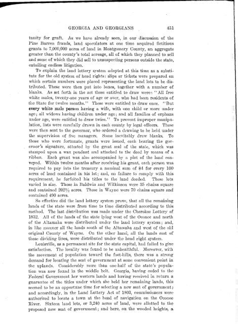
- Page 475: 450 GEORGIA AND GEORGIANS As we hav
- Page 479 and 480: CHAPTER II' THE GENERAL ASSEMBLY ME
- Page 481 and 482: 456 GEOEGIA AND GEOEGIANS famous Ir
- Page 483 and 484: 458 GEORGIA AND GEORGIANS cultural
- Page 485 and 486: CHAPTER III THE WAR OP 1812—To SE
- Page 487 and 488: 462 GEORGIA AND GEORGIANS join the
- Page 489 and 490: 464 GEORGIA AND GEORGIANS three in
- Page 491 and 492: CHAPTER IV THE HOSTILE CREEKS OR RE
- Page 493 and 494: 468 GEORGIA AND GEORGIANS However,
- Page 495 and 496: 470 GEORGIA AND GEORGIANS To the Am
- Page 497 and 498: 472 GEORGIA AND GEORGIANS was the a
- Page 499 and 500: 474 GEORGIA AND GEORGIANS often hea
- Page 501 and 502: 476 GEORGIA AND GEORGIANS of the ru
- Page 503 and 504: 478 GEORGIA AND GEORGIANS United St
- Page 505 and 506: CHAPTEE VI GOVERNOR MITCHELL APPOIN
- Page 507 and 508: 482 GEORGIA-AND GEORGIANS But Gener
- Page 509 and 510: 484 GEORGIA AND GEORGIANS Extract f
- Page 511 and 512: 486 GEORGIA AND GEORGIANS During th
- Page 513 and 514: 488 GEORGIA AND GEOEGIANS On the an
- Page 515 and 516: 490 GEORGIA AND GEORGIANS torians,
- Page 517 and 518: 492 GEORGIA AND GEORGIANS Leaving t
- Page 519 and 520: 494 GEORGIA AND GEORGIANS motive-po
- Page 521 and 522: CHAPTBE VIII THE CODE DUELLO—GEOR
- Page 523 and 524: 498 GEORGIA AND GEORGIANS of the ne
- Page 525 and 526: 500 GEORGIA AND GEORGIANS lature of
- Page 527 and 528:
502 GEORGIA AND GEORGIANS him." * I
- Page 529 and 530:
504 GEORGIA AND GEORGIANS of a mos.
- Page 531 and 532:
506 GEORGIA AND GEORGIANS prestige
- Page 533 and 534:
508 GEORGIA AND GEORGIANS himself w
- Page 535 and 536:
510 GEORGIA AND GEORGIANS High Shoa
- Page 537 and 538:
512 GEORGIA AND GEORGIANS "Tait," r
- Page 539 and 540:
514 GEORGIA AND GEORGIANS dead lett
- Page 541 and 542:
516 GEOBGIA AND GEORGIANS fleeted.
- Page 543 and 544:
518 GEORGIA AND GEORGIANS sensitive
- Page 545 and 546:
520 GEORGIA AND GEORGIANS According
- Page 547 and 548:
522 GEORGIA AND GEORGIANS in the fi
- Page 549 and 550:
524 GEORGIA AND GEORGIANS stands in
- Page 551 and 552:
526 GEORGIA AND GEORGIANS Four' new
- Page 553 and 554:
528 GEORGIA AND GEORGIANS clergyman
- Page 555 and 556:
530 GEORGIA AND GEORGIANS extinguis
- Page 557 and 558:
532 GEORGIA AND GEORGIANS these wer
- Page 559 and 560:
534 GEORGIA AND GEORGIANS toga to b
- Page 561 and 562:
536 GEORGIA AND GEORGIANS Judge Lum
- Page 563 and 564:
VAENEE HOUSE Where the Famous Treat
- Page 565 and 566:
540 GEORGIA AND GEORGIANS been adop
- Page 567 and 568:
CHAPTER XIII LA FAYETTE'S VISIT TO
- Page 569 and 570:
544 GEORGIA AND GEORGIANS volumes o
- Page 571 and 572:
546 GEORGIA AND GEORGIANS \ ter's h
- Page 573 and 574:
CHAPTEE XIV NEW LANDS ACQUIRED AT I
- Page 575 and 576:
550 GEOKGIA AND GEORGIANS supported
- Page 577 and 578:
552 GBOEGIA AND GEORGIANS Indians i
- Page 579 and 580:
554 GEORGIA AND GEORGIANS were call
- Page 581 and 582:
556 GEORGIA AND GEORGIANS not to go
- Page 583 and 584:
558 GEORGIA AND GEORGIANS the writ
- Page 585 and 586:
560 GEORGIA AND GEORGIANS leave for
- Page 587 and 588:
562 GEORGIA AND GEORGIANS complicat
- Page 589 and 590:
564 GEORGIA AND GEORGIANS Dahlonega
- Page 591 and 592:
566 GEORGIA • AND GEORGIANS suppo
- Page 593 and 594:
568 GEORGIA AND GEORGIANS Congress
- Page 595 and 596:
570 GEORGIA AND GEORGIANS ming, Cla
- Page 597 and 598:
572 GEORGIA AND GEORGIANS ties of p
- Page 599 and 600:
574 GEORGIA AND GEOEGIANS due to Mr
- Page 601 and 602:
576 GEORGIA AND GEORGIANS News of t
- Page 603 and 604:
578 GEORGIA AND GEORGIANS advantage
- Page 605 and 606:
580 GEORGIA AND GEORGIANS resigned
- Page 607 and 608:
582 GEORGIA AND GEORGIANS him to Ge
- Page 609 and 610:
584 GEORGIA AND GEORGIANS Later Pay
- Page 611 and 612:
586 GEORGIA AND GEORGIANS was so mo
- Page 613 and 614:
CHAPTER XX GEORGIANS SYMPATHIZE WIT
- Page 615 and 616:
590 GEORGIA AND GEORGIANS Santa Ann
- Page 617 and 618:
592 GEORGIA AND GEORGIANS were orde
- Page 619 and 620:
594 GEORGIA AND GEORGIANS dred and
- Page 621 and 622:
CHAPTER XXI SEQUOYA'S WONDERFUL INV
- Page 623:
598 GBOEGIA AND GEORGIANS accident
- Page 626 and 627:
GEOEGIA AND GEORGIANS 601 "But in a
- Page 628 and 629:
CHAPTER XXII THE DEPORTATION OF THE
- Page 630 and 631:
GEORGIA AND GEORGIANS 605 okees be
- Page 632:
GEOEGIA AND GEORGIANS 607 outlaws,


