facilities renewal master plan - National Zoo - Smithsonian Institution
facilities renewal master plan - National Zoo - Smithsonian Institution
facilities renewal master plan - National Zoo - Smithsonian Institution

You also want an ePaper? Increase the reach of your titles
YUMPU automatically turns print PDFs into web optimized ePapers that Google loves.
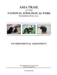
FACILITIES MASTER PLAN ENVIRONMENTAL ASSESSMENT<br />
At the end of each section when applicable, SI provides information on mitigation<br />
measures that would be employed to help avoid, minimize, or mitigate an adverse impact<br />
on a given resource.<br />
A. Natural and Biological Resources<br />
A.1 Soils, Geology, and Topography<br />
The soils of the <strong>National</strong> <strong>Zoo</strong> are classified as urban land soils, which are soils that have<br />
been previously excavated and filled with other soil materials. Some of the site soils<br />
have been historically disturbed for construction, and covered with impervious materials<br />
such as asphalt, concrete, and building materials. In steeply sloped areas of the site, soils<br />
may be mixed with bluestone for stabilization. In other areas, extensive fill may have<br />
been used to create level surface areas for construction of structures. Therefore, the depth<br />
to undisturbed soils on the site varies; the natural soils overlie bedrock at depths of 12 to<br />
15 feet below the natural soil surface. The source of historical fill material has not been<br />
documented in most instances; however, previous excavations in fill materials at the<br />
<strong>National</strong> <strong>Zoo</strong> have not detected any signs of contamination.<br />
The <strong>National</strong> <strong>Zoo</strong> lies within the physiographic province of the Eastern Piedmont Region.<br />
The underlying rocks in this province consist primarily of granite, gneiess and schist.<br />
The depth to bedrock on the site is approximately 12 to 15 feet below the natural soil<br />
surface (USGS, 2008).<br />
The topography of the <strong>National</strong> <strong>Zoo</strong> consists of a moderate to steeply sloping basin<br />
descending eastward from the Connecticut Avenue entrance, at approximately 210 feet in<br />
elevation to mean sea level, to the eastern boundary at Rock Creek, at approximately 55<br />
feet in elevation. The natural topography of the site has been modified over time by the<br />
introduction of fill material to create level surfaces areas for built structures. One unique<br />
aspect of the topography on site is that Olmsted’s design utilized the natural ridge line<br />
affecting the placement of many of the exhibits and circulation.<br />
Impacts to Soils, Topography, and Geology<br />
No-Action Alternative<br />
Additional exhibit <strong>plan</strong>ning outside of the on-going Elephant Trails project would<br />
continue on a site-by-site basis without the availability of large land tracts, preferable for<br />
new exhibits. Other small scale site improvements would continue for site<br />
improvements, building rehabilitation, and <strong>facilities</strong> updates related to safety, health, and<br />
maintenance. The impacts to soils, topography, and geology from exhibit <strong>renewal</strong> and<br />
other improvements would be localized to small areas. With erosion and sediment control<br />
measures to minimize soil runoff and loss, impacts to soils would be minor and shortterm.<br />
There would be no impact to topography or geology because construction activities<br />
such as surface grading, drilling, pile driving, etc. would not occur; therefore, there would<br />
be no change to existing topography or geology.<br />
SMITHSONIAN INSTITUTION – NATIONAL ZOOLOGICAL PARK 40 | P a g e