JLR-10 Instruction Manual.pdf - Echomaster Marine Ltd.
JLR-10 Instruction Manual.pdf - Echomaster Marine Ltd.
JLR-10 Instruction Manual.pdf - Echomaster Marine Ltd.
SHOW LESS

You also want an ePaper? Increase the reach of your titles
YUMPU automatically turns print PDFs into web optimized ePapers that Google loves.
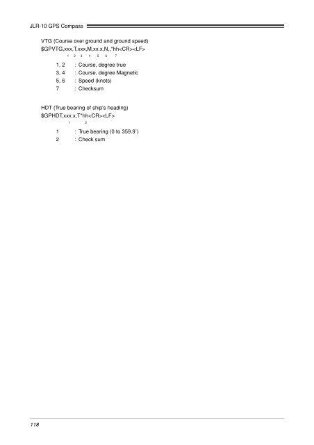
<strong>JLR</strong>-<strong>10</strong> GPS Compass<br />
VTG (Course over ground and ground speed)<br />
$GPVTG,xxx,T,xxx,M,xx.x,N,,*hh<br />
1 2 3 4 5 6 7<br />
1, 2 : Course, degree true<br />
3, 4 : Course, degree Magnetic<br />
5, 6 : Speed (knots)<br />
7 : Checksum<br />
HDT (True bearing of ship's heading)<br />
$GPHDT,xxx.x,T*hh<br />
1 2<br />
1 : True bearing (0 to 359.9˚)<br />
2 : Check sum<br />
118