mededelingen der zittingen bulletin des seances - Royal Academy ...
mededelingen der zittingen bulletin des seances - Royal Academy ...
mededelingen der zittingen bulletin des seances - Royal Academy ...
You also want an ePaper? Increase the reach of your titles
YUMPU automatically turns print PDFs into web optimized ePapers that Google loves.
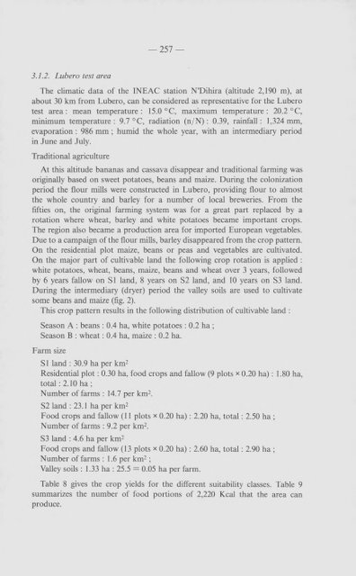
3.1.2. Lubero test area<br />
— 257 —<br />
The climatic data of the 1NEAC station N ’Dihira (altitude 2,190 m), at<br />
about 30 km from Lubero, can be consi<strong>der</strong>ed as representative for the Lubero<br />
test area : mean temperature : 15.0 °C, maximum temperature : 20.2 °C,<br />
minimum temperature: 9.7 °C, radiation (n/N) : 0.39, rainfall: 1,324 mm,<br />
evaporation : 986 mm ; humid the whole year, with an intermediary period<br />
in June and July.<br />
Traditional agriculture<br />
At this altitude bananas and cassava disappear and traditional farming was<br />
originally based on sweet potatoes, beans and maize. During the colonization<br />
period the flour mills were constructed in Lubero, providing flour to almost<br />
the whole country and barley for a number of local breweries. From the<br />
fifties on, the original farming system was for a great part replaced by a<br />
rotation where wheat, barley and white potatoes became important crops.<br />
The region also became a production area for imported European vegetables.<br />
Due to a campaign of the flour mills, barley disappeared from the crop pattern.<br />
On the residential plot maize, beans or peas and vegetables are cultivated.<br />
On the major part of cultivable land the following crop rotation is applied :<br />
white potatoes, wheat, beans, maize, beans and wheat over 3 years, followed<br />
by 6 years fallow on SI land, 8 years on S2 land, and 10 years on S3 land.<br />
During the intermediary (dryer) period the valley soils are used to cultivate<br />
some beans and maize (fig. 2).<br />
This crop pattern results in the following distribution of cultivable land :<br />
Season A : beans : 0.4 ha, white potatoes : 0.2 ha ;<br />
Season B : wheat : 0.4 ha, maize : 0.2 ha.<br />
Farm size<br />
51 land : 30.9 ha per km2<br />
Residential plot : 0.30 ha, food crops and fallow (9 plots x 0.20 ha) : 1.80 ha,<br />
total : 2.10 ha ;<br />
Number of farms : 14.7 per km2.<br />
52 land : 23.1 ha per km2<br />
Food crops and fallow (11 plots * 0.20 ha) : 2.20 ha, total : 2.50 ha ;<br />
Number of farms : 9.2 per km2.<br />
53 land : 4.6 ha per km2<br />
Food crops and fallow (13 plots x 0.20 ha) : 2.60 ha, total : 2.90 ha ;<br />
Number of farms : 1.6 per km2 ;<br />
Valley soils : 1.33 ha : 25.5 = 0.05 ha per farm.<br />
Table 8 gives the crop yields for the different suitability classes. Table 9<br />
summarizes the number of food portions of 2,220 Kcal that the area can<br />
produce.


