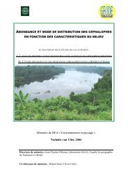
Fisheries in the Southern Border Zone of Takamanda - Impact ...
Fisheries in the Southern Border Zone of Takamanda - Impact ...
Fisheries in the Southern Border Zone of Takamanda - Impact ...

You also want an ePaper? Increase the reach of your titles
YUMPU automatically turns print PDFs into web optimized ePapers that Google loves.
Landcover change <strong>in</strong> <strong>the</strong> <strong>Takamanda</strong> Forest Reserve, Cameroon:<br />
1986-2000<br />
1 Introduction<br />
As with many areas <strong>of</strong> conservation <strong>in</strong>terest, <strong>the</strong><br />
<strong>Takamanda</strong> Forest Reserve (TFR) is part <strong>of</strong> a dynamic,<br />
human-<strong>in</strong>fluenced landscape. Although located <strong>in</strong> a fairly<br />
remote region along <strong>the</strong> Nigerian border, <strong>the</strong> reserve is<br />
surrounded by numerous small villages on its eastern and<br />
sou<strong>the</strong>rn sides, with three villages enclaved with<strong>in</strong> <strong>the</strong><br />
reserve itself (see figure 2 <strong>in</strong> Chapter 1). Figure 1<br />
graphically <strong>in</strong>dicates <strong>the</strong> relative proximity <strong>of</strong> much <strong>of</strong><br />
<strong>the</strong> reserve to human settlements and movement.<br />
Additionally, numerous old village sites scattered<br />
throughout parts <strong>of</strong> <strong>the</strong> reserve <strong>in</strong>dicate <strong>the</strong> extent and<br />
fluidity <strong>of</strong> previous human settlements.<br />
Until recently, access to <strong>the</strong> reserve was relatively<br />
difficult, <strong>of</strong>ten requir<strong>in</strong>g a day’s journey on foot to reach<br />
ei<strong>the</strong>r <strong>the</strong> sou<strong>the</strong>rn boundary (from Mamfe) or <strong>the</strong><br />
nor<strong>the</strong>rn boundary (from <strong>the</strong> Obudu Cattle Ranch <strong>in</strong><br />
Nigeria). S<strong>in</strong>ce <strong>the</strong> late 1980s, however, access to <strong>the</strong><br />
area has been improved with <strong>the</strong> completion <strong>of</strong> a largespan<br />
bridge over <strong>the</strong> Manyu river at Mamfe. With this<br />
bridge <strong>in</strong> place, both logg<strong>in</strong>g companies and <strong>the</strong><br />
government have constructed unpaved roads <strong>in</strong>to <strong>the</strong><br />
region. The government has also made significant<br />
progress on <strong>the</strong> long-awaited Mamfe-to-Akwaya road,<br />
which may be completed with<strong>in</strong> <strong>the</strong> next few years at<br />
current rates <strong>of</strong> progress. A network <strong>of</strong> footpaths<br />
currently connects most villages <strong>in</strong> <strong>the</strong> region to one<br />
ano<strong>the</strong>r.<br />
Given <strong>the</strong> exist<strong>in</strong>g pattern <strong>of</strong> settlements and <strong>the</strong><br />
recently improved access to <strong>the</strong> region, we wanted to<br />
exam<strong>in</strong>e recent landcover change <strong>in</strong> and around TFR.<br />
Fortunately, <strong>the</strong> archive <strong>of</strong> high-resolution satellite<br />
imagery for <strong>the</strong> region <strong>in</strong>cludes clear images from 1986<br />
Dan Slayback<br />
and 2000, allow<strong>in</strong>g a study <strong>of</strong> landcover changes over<br />
that 14-year period.<br />
2 Methods<br />
2.1 Data<br />
Chapter 12<br />
NASA’s Landsat series <strong>of</strong> earth-observ<strong>in</strong>g satellites have<br />
been acquir<strong>in</strong>g medium to high-resolution multispectral<br />
earth imagery s<strong>in</strong>ce 1972. Start<strong>in</strong>g with <strong>the</strong> launch <strong>of</strong><br />
Landsat 4 <strong>in</strong> 1982, <strong>the</strong> satellites began carry<strong>in</strong>g <strong>the</strong> 30meter<br />
resolution Thematic Mapper (TM) <strong>in</strong>strument. The<br />
result<strong>in</strong>g TM data archive, from 1982 to present, is <strong>the</strong><br />
most extensive global collection <strong>of</strong> high-resolution<br />
imagery.<br />
However, <strong>the</strong> archive conta<strong>in</strong>s relatively few cloudfree<br />
images from <strong>the</strong> coastal areas <strong>of</strong> central Africa,<br />
<strong>in</strong>clud<strong>in</strong>g <strong>the</strong> scene cover<strong>in</strong>g <strong>the</strong> TFR (identified as WRS<br />
path 187 row 56). This is <strong>in</strong> part due to <strong>the</strong> extreme<br />
cloud<strong>in</strong>ess <strong>of</strong> <strong>the</strong> region and <strong>the</strong> satellite’s 16-day repeat<br />
coverage (any scene is observed only once every 16<br />
days). Also, previous data acquisition policies and<br />
technical difficulties h<strong>in</strong>dered <strong>the</strong> acquisition <strong>of</strong> imagery<br />
over central Africa until <strong>the</strong> launch <strong>of</strong> Landsat 7 <strong>in</strong> 1999.<br />
Fortunately, one relatively clear Landsat 5 image is<br />
available from December 12, 1986. This image and a<br />
clear Landsat 7 image from December 10, 2000 were<br />
acquired for this analysis.<br />
To ensure <strong>the</strong> precise image-to-image registration<br />
required for detect<strong>in</strong>g changes between an image pair,<br />
both scenes were orthorectified (by <strong>the</strong> EarthSat<br />
corporation). Orthorectification uses <strong>the</strong> known locations<br />
<strong>of</strong> many ground reference po<strong>in</strong>ts to remove <strong>the</strong> artificial<br />
curvature <strong>of</strong> satellite-acquired imagery, which is an<br />
artifact <strong>of</strong> <strong>the</strong> satellite’s view<strong>in</strong>g geometry. Fur<strong>the</strong>r<br />
preprocess<strong>in</strong>g <strong>of</strong> <strong>the</strong> imagery was unnecessary; due to <strong>the</strong><br />
SI/MAB Series #8, 2003, Pages 173 to 179