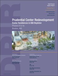
- Page 1:
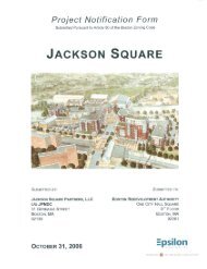
Expanded Project Notication Form Su
- Page 5 and 6:
Vanasse Hangen Brustlin, Inc. The P
- Page 7 and 8:
Vanasse Hangen Brustlin, Inc. The P
- Page 9 and 10:
Vanasse Hangen Brustlin, Inc. The P
- Page 11 and 12:
Vanasse Hangen Brustlin, Inc. The P
- Page 13 and 14:
Vanasse Hangen Brustlin, Inc. The P
- Page 15 and 16:
Vanasse Hangen Brustlin, Inc. The P
- Page 17 and 18:
Vanasse Hangen Brustlin, Inc. The P
- Page 19 and 20:
Commonwealth of Massachusetts Vanas
- Page 21 and 22:
Vanasse Hangen Brustlin, Inc. The P
- Page 23 and 24:
Summary of Project Impacts Vanasse
- Page 25 and 26:
Daylight Vanasse Hangen Brustlin, I
- Page 27 and 28:
Construction Vanasse Hangen Brustli
- Page 29 and 30:
Vanasse Hangen Brustlin, Inc. The P
- Page 31 and 32:
\\MABOS\projects\11381.00\graphics\
- Page 33 and 34:
\\vhb\proj\Boston\11381.00\graphics
- Page 35 and 36:
\\vhb\proj\Boston\11381.00\graphics
- Page 37 and 38:
\\vhb\proj\Boston\11381.00\graphics
- Page 39 and 40:
\\vhb\proj\Boston\11381.00\graphics
- Page 41 and 42:
\\vhb\proj\Boston\11381.00\graphics
- Page 43 and 44:
Legal Counsel Goulston & Storrs, P.
- Page 45 and 46:
Vanasse Hangen Brustlin, Inc. The P
- Page 47 and 48:
Vanasse Hangen Brustlin, Inc. The P
- Page 49 and 50:
Vanasse Hangen Brustlin, Inc. The P
- Page 51 and 52:
Vanasse Hangen Brustlin, Inc. The P
- Page 53 and 54:
Character and Materials Vanasse Han
- Page 55 and 56:
\\MABOS\projects\11381.00\graphics\
- Page 57 and 58:
\\MABOS\projects\11381.00\graphics\
- Page 59 and 60:
\\MABOS\projects\11381.00\graphics\
- Page 61 and 62:
AMENITY CORE RESIDENTIAL \\MABOS\pr
- Page 63 and 64:
Introduction Vanasse Hangen Brustli
- Page 65 and 66:
Vanasse Hangen Brustlin, Inc. The P
- Page 67 and 68:
Vanasse Hangen Brustlin, Inc. The P
- Page 69 and 70:
Vanasse Hangen Brustlin, Inc. The P
- Page 71 and 72:
Vanasse Hangen Brustlin, Inc. The P
- Page 73 and 74:
Build Condition \\MABOS\projects\11
- Page 75 and 76:
\\MABOS\projects\11381.00\reports\A
- Page 77 and 78:
\\MABOS\projects\11381.00\reports\A
- Page 79 and 80:
\\MABOS\projects\11381.00\reports\A
- Page 81 and 82:
\\vhb\proj\Boston\11381.00\graphics
- Page 83 and 84:
\\MABOS\projects\11381.00\graphics\
- Page 85 and 86:
\\MABOS\projects\11381.00\graphics\
- Page 87 and 88:
\\MABOS\projects\11381.00\graphics\
- Page 89 and 90:
\\MABOS\projects\11381.00\graphics\
- Page 91 and 92:
\\MABOS\projects\11381.00\graphics\
- Page 93 and 94:
\\MABOS\projects\11381.00\graphics\
- Page 95 and 96:
\\MABOS\projects\11381.00\graphics\
- Page 97 and 98:
\\MABOS\projects\11381.00\graphics\
- Page 99 and 100:
Introduction \\MABOS\projects\11381
- Page 101 and 102: Overview \\MABOS\projects\11381.00\
- Page 103 and 104: \\MABOS\projects\11381.00\reports\A
- Page 105 and 106: Shadow \\MABOS\projects\11381.00\re
- Page 107 and 108: \\MABOS\projects\11381.00\reports\A
- Page 109 and 110: Summary of Key Findings \\MABOS\pro
- Page 111 and 112: Summary of Key Findings \\MABOS\pro
- Page 113 and 114: \\MABOS\projects\11381.00\reports\A
- Page 115 and 116: \\MABOS\projects\11381.00\reports\A
- Page 117 and 118: Emission Rates \\MABOS\projects\113
- Page 119 and 120: \\MABOS\projects\11381.00\reports\A
- Page 121 and 122: \\MABOS\projects\11381.00\reports\A
- Page 123 and 124: \\MABOS\projects\11381.00\reports\A
- Page 125 and 126: Groundwater \\MABOS\projects\11381.
- Page 127 and 128: \\MABOS\projects\11381.00\reports\A
- Page 129 and 130: \\MABOS\projects\11381.00\reports\A
- Page 131 and 132: \\MABOS\projects\11381.00\reports\A
- Page 133 and 134: \\MABOS\projects\11381.00\reports\A
- Page 135 and 136: \\MABOS\projects\11381.00\reports\A
- Page 137 and 138: \\MABOS\projects\11381.00\reports\A
- Page 139 and 140: \\MABOS\projects\11381.00\reports\A
- Page 141 and 142: \\MABOS\projects\11381.00\reports\A
- Page 143 and 144: \\MABOS\projects\11381.00\reports\A
- Page 145 and 146: \\vhb\proj\Boston\11381.00\graphics
- Page 147 and 148: \\vhb\proj\Boston\11381.00\graphics
- Page 149 and 150: \\vhb\proj\Boston\11381.00\graphics
- Page 151: Boylston Street Brookline Avenue Fi
- Page 155 and 156: Introduction \\MABOS\projects\11381
- Page 157 and 158: progresses, updated information on
- Page 159 and 160: Domestic Water and Fire Protection
- Page 161 and 162: Protection of Utilities Existing pu
- Page 163 and 164: Introduction Vanasse Hangen Brustli
- Page 165 and 166: Vanasse Hangen Brustlin, Inc. The P
- Page 167 and 168: Audubon Circle Area Vanasse Hangen
- Page 169 and 170: \\MABOS\projects\11381.00\graphics\
- Page 171 and 172: \\MABOS\projects\11381.00\graphics\
- Page 173 and 174: \\MABOS\projects\11381.00\graphics\
- Page 175 and 176: \\MABOS\projects\11381.00\graphics\
- Page 177: \\MABOS\projects\11381.00\graphics\