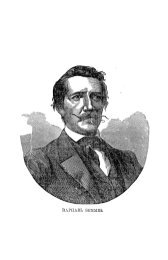
EXPLORATIONS IN TURKESTAN
EXPLORATIONS IN TURKESTAN
EXPLORATIONS IN TURKESTAN

Create successful ePaper yourself
Turn your PDF publications into a flip-book with our unique Google optimized e-Paper software.
284<br />
PIHYSIOGRAPHY<br />
OF CENTRAL-ASIAN DESERTS AND OASES.<br />
exposing red layers of laminated sandy clay, and doubtless range across the direction<br />
of prevalent wind, as there is a constancy of leeward overhanging sides.<br />
Everywhere they are associated with heaps of sand derived from the silt, of which<br />
all finer material has been drifted away, doubtless to settle as loess in grassy<br />
mountain valleys. Anyhow, wherever the finer material is now, it has been<br />
totally removed by the wind that excavated the trenches and left their sand<br />
constituent behind. Another interesting feature is the frequency of large masses<br />
of sand piled on top of these ridges, to occupy spaces of calm in the eddies of<br />
windwork.<br />
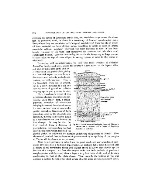
Proceeding still mountainwards, we soon find these trenches of deflation<br />
floored by hard gravel-beds, and in the course of a few miles the silt deposit thins<br />
out and dwindles into spits and isolated<br />
areas on the gravel-plain, giving Feet<br />
it a mottled aspect as seen from a<br />
Loess<br />
distance-mottled only in shade and<br />
.es<br />
texture'. as both isFine gravel<br />
texture. as both are red. This .-.- '..-.v--.....<br />
the transition from silt to gravel,<br />
for in a short distance it is all one<br />
vast expanse of gravel or cobbles<br />
varying up to 4 or 5 inches in size.<br />
Here, therefore, is record of two<br />
significant changes of conditions succeeding<br />
each other-first, a mountainward<br />
recession of alluviation<br />
bringing its zone of fine deposits over<br />
its more ancient zone of coarse deposits;<br />
second, a dissection of both<br />
grit<br />
preceding zones by the channels now<br />
nocunied. moving alluviation aoain<br />
: .... ... .. '.-.r..' '<br />
to a zone farther out than before the j' :f...;.:. Loess<br />
first change. It may be that the Canal water level<br />
first resulted from a decrease of Fig. 462.-Vertical Section of Interlapping Loess and Alluvium in<br />
100-foot Cliff of Obu-siob Canal at Crossing of Road from<br />
precipitation corresponding to that Samarkand to Kudu Sufi.<br />
extreme reaction which followed the<br />
glacial period, as evidenced by moraine underlying the glaciers of Pamir. That<br />
the second resulted from an increase of grade caused by an uptilting of the margins<br />
of Tarim will be shown as we proceed.<br />
Now we are perhaps 25 miles from the great sand, and our abandoned piedmont<br />
develops into a bad-land topography, an inclined table-land dissected into<br />
a desert of red mountains rising ever higher above us as we ride slowly up the<br />
bottom of a canyon. At first the canyon walls are built entirely of piedmont<br />
conglomerates with here and there a layer i to 3 feet thick of silt, and all in slope<br />
conforming to that of the plain above. Then towards the bottom of the wall<br />
appears a surface beveling the tilted strata of a still more ancient piedmont series,